

")
Happy Tuesday to everyone out there across WABBLES and an especially happy Tuesday to the WKU students taking finals today. The weather overall today will be very quiet, and that will be the trend for the remainder of the work and finals week.

As things stay quiet this work week, temperatures will also be on the rise every day until this weekend. The warmest day looks to be this Saturday before a cold front comes in and brings temperatures back closer to average.
A dominant high pressure pattern will be what keeps us quiet and free from weather during the work week. So, enjoy the quiet during this otherwise busy week for most college students.
Long Range
The biggest noteworthy topic in the long range will be a potentially strong system to move through WABBLES sometime this upcoming weekend. This is something to watch very closely as it becomes closer, so say goodbye to the quiet part of the week here.
Models are obviously still disagreeing on aspects of this and likely will continue to do this for a few more days. However, models have been consistent with this overall being on the stronger side with whatever impacts it could bring.
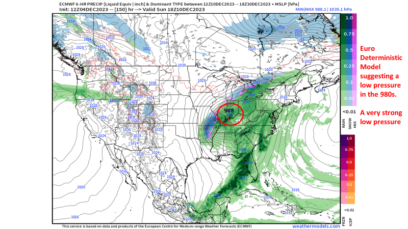
This system will likely have about every hazard we see in it including wintry, severe, and heavy rain hazards. Where each of these hazards set up will be the key.
Starting off with the wintry weather side, I have some bad news for the snow lovers around WABBLES. Snow chances for us are very low right now, but not impossible, as I have some serious concerns with the cold air supply fueling it.

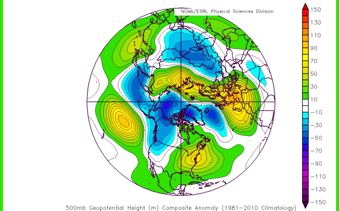
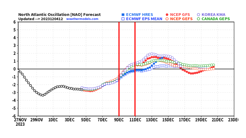
Deterministic models are going to naturally struggle with how much cold air we get with this system and thus who gets snow/no snow. So, we turn to our good friends, teleconnections, to get a more accurate picture of what we could see.
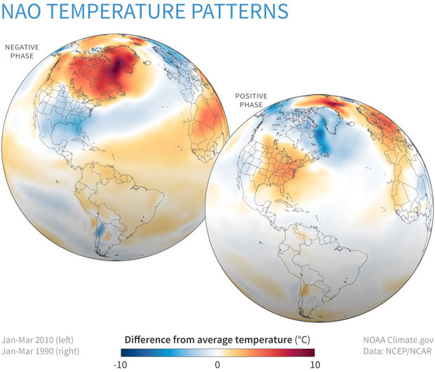
Starting with the NAO, we will be in a negative-turning-positive pattern at the time of the storm. This isn’t the worst pattern to be in to get cold air, but the fact that it is turning into its warmer phase around the time of the storm concerns me and is a red flag.
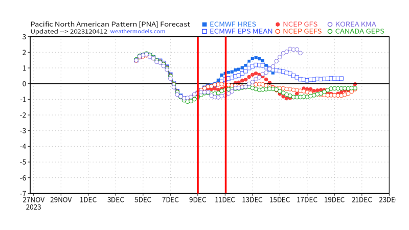
The PNA is also in a negative-turning-positive pattern during the storm which means it is the warmer phase going into the colder phase. Originating in the warmer phase until after the system passes doesn’t grant me a lot of confidence in the cold air being strong enough to reach this far south.
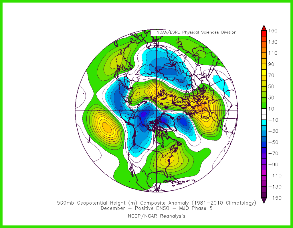
Looking at the MJO, we will be in a weak phase 5 during the storm which puts blocking and generally warmer conditions over the WABBLES region during an El Nino.
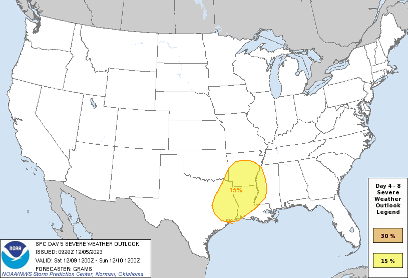
As for a severe weather threat, it is certainly a technical possibility since we will likely be on the warm side of the storm. However, it looks like we will struggle to sufficient moisture into the region to build instability and thus a more ideal severe weather threat.
In Conclusion:
- Teleconnections do not support a snowy scenario for WABBLES – Cold air will likely not reach far enough south
- Concerns over quantity of moisture results in a questionable severe weather threat.
- Most likely hazard, if any, for WABBLES still unclear at this point.
That will be all for now folks! I hope everyone out there has a great rest of the week, for the latest on the upcoming weather this weekend follow us on our social media accounts @wxornotBG.
Have a blessed day!