

")
Greetings, WABBLES! Let’s take a look at your weather forecast for the next few days, that’ll come complete with comfortable temps, along with increasing clouds on the horizon.
Today into Tomorrow: Increasing Clouds, Pleasant Temperatures
As we move into today and tomorrow, expect to see some changes in the skies. Clouds will be on the increase, and you might notice a bit more shade than usual. This will be in response to cloud debris trekking into our region from ongoing showers and storms in the Mississippi Valley.
Despite these increasing clouds, temperatures are set to rise to the low/mid-80s each afternoon. It’ll be like having a cozy blanket of clouds keeping the heat in check. With dry low levels of the atmosphere present, we may be in for a treat, in the form of “Jellyfish Clouds”. This is produced by virga, which conditions will be primed for across the WABBLES community. Don’t worry…we’ve had it before:
Two Disturbances on our Radar
Behind the scenes, we’re keeping a close eye on two weather disturbances that could potentially affect our region in the coming days.

1. An Upper Disturbance off the Coast of the Carolinas
First, there’s an upper disturbance lurking off the coast of the Carolinas. This system is like a mysterious guest at a party, and we’re not entirely sure if it will crash our weather plans. Models hint at the moisture from this staying well to our east… we’ll keep a close eye on the forecast as this disturbance evolves. Overall, it shouldn’t bring much, if any fuss…perhaps some more clouds on the horizon.
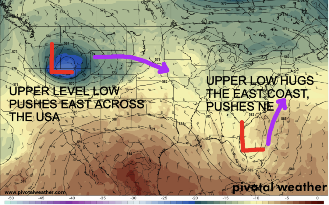
2. An Upper Level Low in the Pacific Northwest
The second disturbance is an upper-level low currently trekking into the Pacific Northwest. Now, what’s an upper-level low, you ask? Think of it as a weather system that’s like a puzzle piece in the upper atmosphere. These are notoriously difficult to forecast, but they can lead to significant changes in our weather.
Potential for Deteriorating Weather Conditions Late in the Weekend
As this upper-level low in the Pacific Northwest pushes southeast over the upcoming days, it has the potential to bring some less-than-ideal weather conditions to our region late in the weekend and into a large chunk of next week.
What to Expect: Colder Temps, Gusty Winds, Pesky Rain & Storm Chances
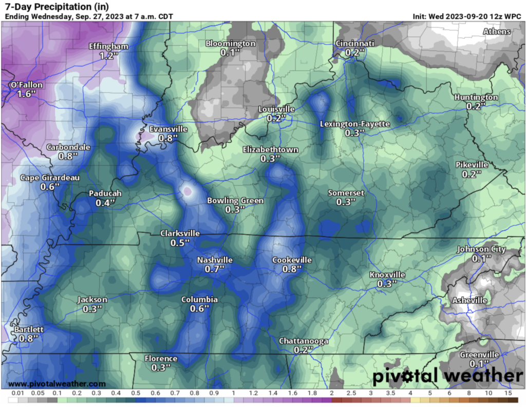
When dealing with an upper-level low, things can get a bit tricky. These systems are like the wildcard of weather, and their effects can be hard to pin down. However, we’re looking at the possibility of a prolonged period of colder temperatures, gusty winds that could ruffle your hair, and the chance for pesky rain and storms. The rain totals from this could have a wide range. The latest only calls for ~0.25″ Monday through Wednesday of next week:
So, while it might not be a guaranteed washout, it’s wise to keep an umbrella and a light jacket handy as we keep an eye on how this weather-maker develops. Remember, weather can be unpredictable, but that’s what keeps it interesting! Stay tuned for updates, and we’ll keep you posted on any changes in the forecast. As always, keep up with us here —-> @wxornotBG.