

")
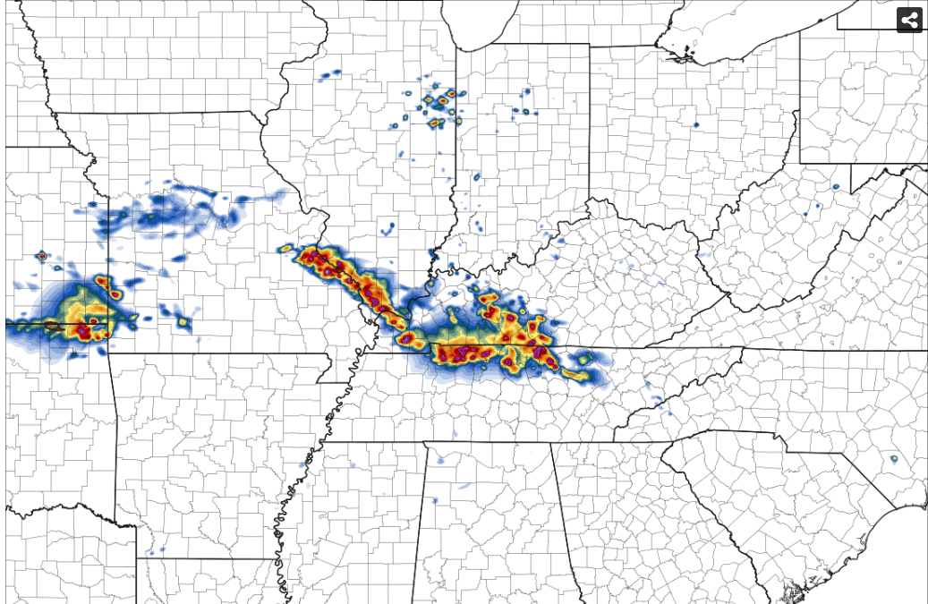
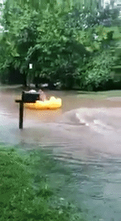
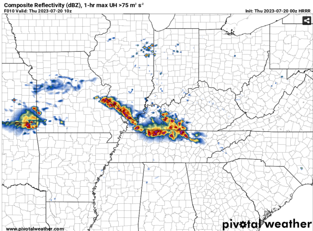
Good morning WABBLES, and Happy Thursday! As most of us know, there has been some intense flooding in parts of Western Kentucky due to these severe storms recently. Well much like the past few days, we can expect more precipitation to occur in the day, accompanied by a flood watch currently in effect until noon.
Stationary Boundary Brings Storms
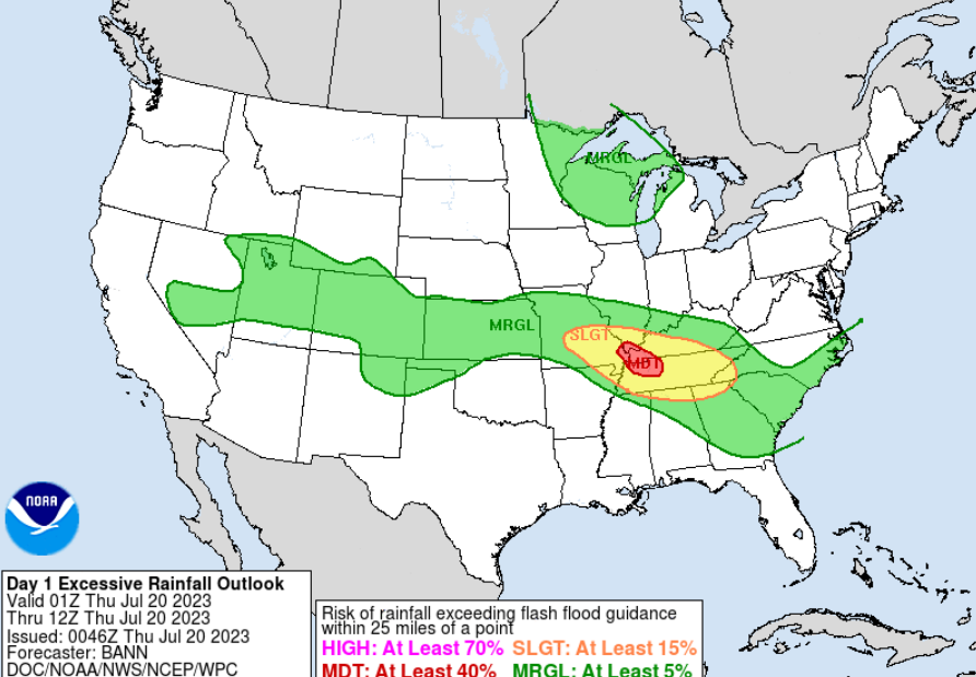
The stationary responsible for bringing a surplus of storms and rain to WABBLES and most of Western Kentucky will remain longer for a shorter period this morning, and end mostly before noon. However, the chances for localized flooding will be significantly higher, with the WPC having WABBLES in a slight risk for excessive rain probabailities, and a QPF of over an inch expected.
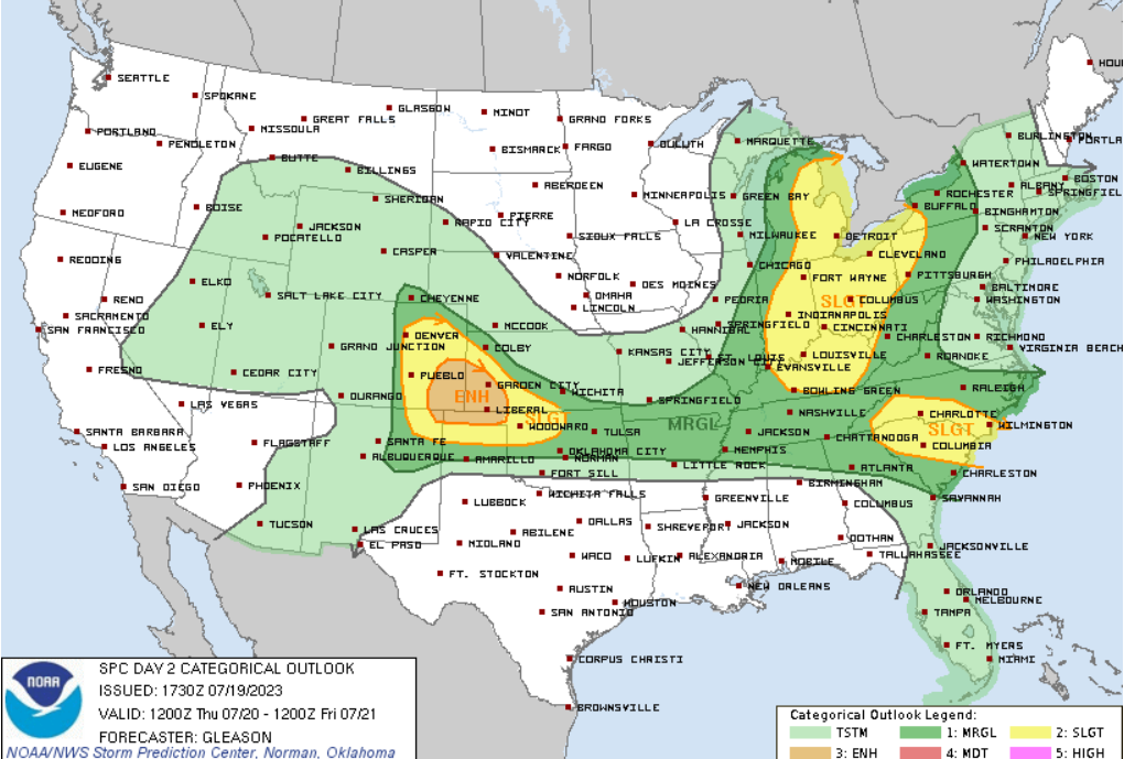
It is also important to note that aside from just rain, there are other severe risks for today aside from flooding. The Storm Predicition Center has most of WABBLES in a marginal risk, parts of Warren and Edmonson in slight risks for wind (15%), hail (5%), and tornado (2%). Most of these storms will be in the early morning.
Developing Cold Front Brings Familiar Conditions
The previous stationary boundary will undergo a strengthening, developing into a cold front and push its way through on Friday, yet again bringing more rain to our area! As of now, WABBLES is not in any sort of severe categorical outlook for Friday.
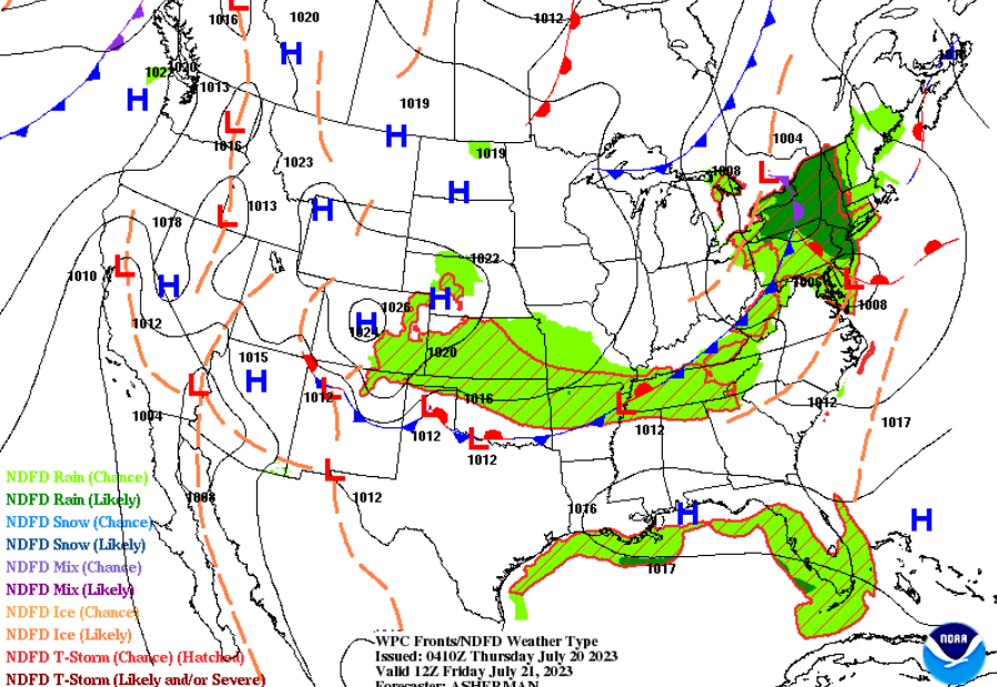
Models are expecting most of the showers to begin taking place around noon, and lasting for a few hours, then clearing out as the storm passes through the area. While this “cold front” is heading towards us, do not be misled as the daily temperatures will still be within the upper 80’s. And VERY humid!
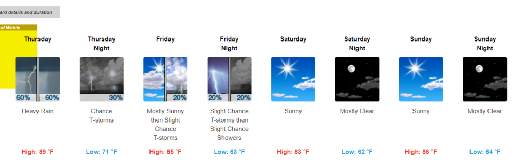
Here is a multi-day outlook for Bowling Green (NWS):
That’s all for today’s blog everyone! Make sure to stay weather aware in case of potential flooding. This includes having multiple ways to receive watches and warnings, one including our very own social media pages. Don’t forget to follow our facebook, twitter, and instagram for weather updates.