")
Good Monday morning, WABBLES! It’s been an exceedingly busy weekend of local weather across the region, and it’s not quite over yet. After the widespread flooding our community saw after the torrential rains on Saturday, we’re now eyeing a potent winter storm likely to drop several inches of snow in WABBLES this week. Between torrential rains, severe weather, and now a snowstorm on the way, we’re going to do everything in our power to make sure you’re staying up-to-date and weather-aware. Let’s dive into all the news together, in today’s weather blog!

Today’s Forecast
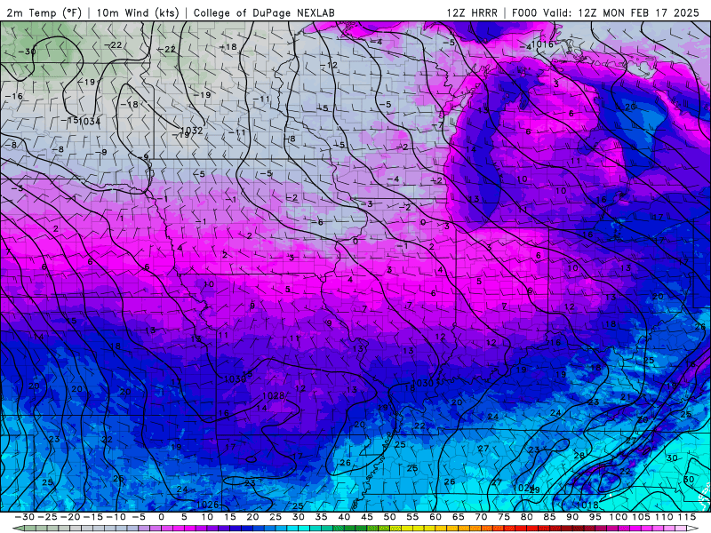
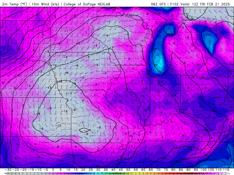
The good news is that our Monday forecast is quite calm compared to what we have coming up closer to midweek. We’re keeping things quite chilly, however, with our high temperatures only expected to top out around the low-to-mid 30s this afternoon in the wake of the cold front that pushed through over the weekend. Light winds will make temperatures feel a bit closer to the mid-20s instead, though, so make absolutely sure you’re bundling up today if you’re headed outside to brave the messy roads. Clouds increase overnight, with a small chance for some light non-accumulating flurries before dawn tomorrow, but the real snow-maker moves in overnight Tuesday into Wednesday morning.
Okay, so what about the snowstorm?
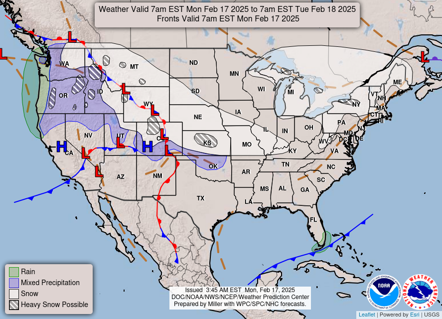
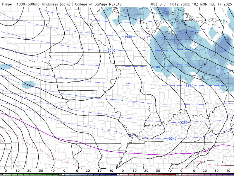
Here’s what we know about the snow so far. A relatively weaker low pressure system will form over the Central US Tuesday morning, and as it does, it will slide east along a strong temperature gradient. Because we’ve got all this potent cold air in place after this weekend’s wet weather, WABBLES will be in the perfect position to receive a quick several inches of snowfall overnight Tuesday night into early Wednesday morning.
Because this is such a quick-moving system, and it’s a bit weaker than other typical snowstorms, we aren’t expecting to see any double-digit snow totals by the time everyone wakes Wednesday morning. Locations closer to the west side of WABBLES are likely to see locally higher amounts, but everyone across the region can expect anywhere from 3-5 inches by noon on Wednesday at this time.
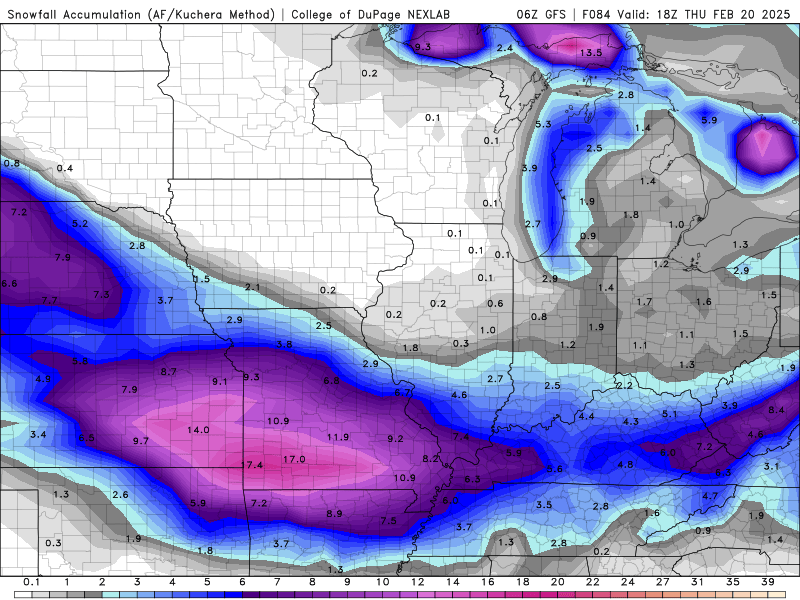
Five inches, however, is still a lot! And when in conjunction with some bone-chilling temperatures and already messy roadways due to the flooding we’ve seen, it’s not going to be easy getting around this week, WABBLES. In fact, if you can, try to stay inside as much as possible! Temperatures drop off a cliff going into Wednesday night as a result of this system, bringing our overnight lows into the single digits to close out the week. Combined with some blustery winds, it’ll feel like temperatures are in the negatives for some before a much-needed warmup this coming weekend!
It’s safe to say you’re going to want to stay weather-aware this week, y’all. We’re still under a Flood Warning until tomorrow around 10:30 AM, on top of the Winter Storm Watch that’s now been issued for our area through Wednesday at 6:00 PM! Be smart and stay safe out there, and whatever you do, do not attempt to drive through flooded roads. Turn around, don’t drown! With how cold temperatures are right now, you do not want to risk a water rescue!

That’s about all we’ve got for you today, WABBLES. The good news is that once this winter system is out of the way, we’re looking much calmer (if not much colder) through the end of the work week and into the weekend. We can see the light at the end of the tunnel, we’ve just got to get there together!
In related news, our Twitter page just hit 20,000 followers over the weekend, and we couldn’t be more overwhelmed with gratitude at all the amazing Wabblers who have joined our little community since we started this operation so many years ago. If you don’t already follow us, pop on over for all the latest updates to your forecast and some live on-the-ground snow reports across the region as the winter weather arrives this week!
Take care out there, folks! Stay bundled up, stay safe, and check back later this week for more forecast info!