")
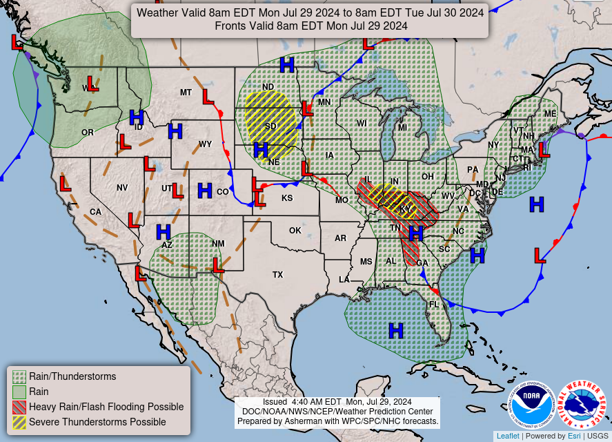
Good Monday morning, WABBLES! We’re diving headfirst back into our active summer pattern as scattered showers and thunderstorms carry us through the last few days of the month. After the wet weekend many of us across the region have seen, flooding could become a concern the closer we get to the start of August, as precipitation chances will be possible here in our area through the end of the work week. How strong will these storms be? And will we see an end to this scattered summer pattern anytime soon? We’re going through it all together in today’s weather blog!

Today’s Forecast
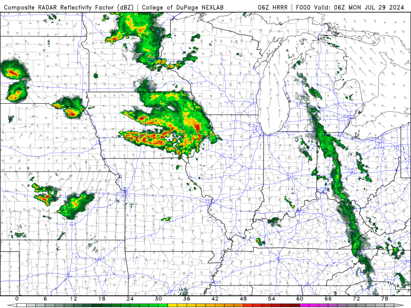
Things are looking slightly calmer this morning when compared to yesterday, as most of our precipitation opportunities today will largely hold off until closer to noon. Showers and storms will once again become possible here in WABBLES by lunchtime, when temperatures will reach the upper 80s and pop-up cells may begin to take root anywhere in our lovely area. Each cell will provide some strong downpours, some lightning, and possibly some gusty winds as they make their way off to the east during the evening hours tonight.
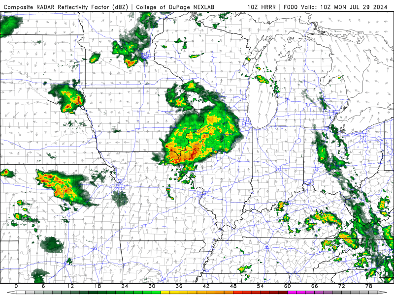
However, as the sun goes down and our scattered afternoon convection dissipates, a much larger conglomeration of storms is expected to take shape to our north in Illinois and Indiana. That long line of storms is currently forecast to head south shortly after its development, lining up WABBLES in its sights, and pushing into our region shortly after midnight Tuesday morning. This will likely be a stronger round of storms than the scattered individual cells we’re expecting to see during the daytime today, as this convective complex has taken on a distinct bowing shape in our forecast models, which indicates that severe strength winds could be associated with the storm system itself.
Scattered Storms for the Rest of the Week?
Bingo! You got it in one. Well, or at least that’s what we’re expecting. The active pattern we’ve found ourselves in isn’t expected to let up anytime soon, so at the very least, it will be possible for some of us in the WABBLES region to see precipitation every day this week. Is that exactly what’s going to happen? Probably not.
A lot of these summertime storms are very hit-and-miss in nature due to their small size and short lifespans. But all it takes is one cell to put down a good amount of rain in a short time, and if it happens to track over an area that’s already seen a bit of rain, we could have some localized flooding issues.
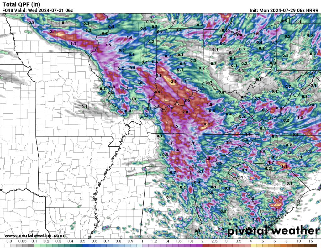
In fact, the HRRR model’s QPF seems to think that most of us across the region could see more than two inches of rainfall through Wednesday! While I personally believe that this is likely a significant exaggeration on what totals could actually look like, it could very well be a possibility depending on where and when we see storms this week.
To wrap things up, we’d like you to stay weather aware this week, if only to make sure that you aren’t caught under one of the many scattered showers we could see before the start of August. Keep that umbrella and rain jacket handy, and make sure you’re following us on our Twitter page, where we give consistent updates on the daily forecast in real time so that no one goes unnotified! We’ll have another blog up later this week, but until then, take care out there y’all, and stay dry!