

")

I mean, technically this weekend will be the first of astronomical summer for WABBLES and the world…but we’ve been parked in a summer pattern for quite some time. And it shows no signs of letting up anytime soon.
Into the Weekend: Friday and Friday Night
Not much change expected in the forecast as we remain under the influence of a big old ridge across the eastern part of the nation.

This means we’ll continue to see sunshine as the airmass remains hot, humid, and altogether unpleasant to stand out in for long periods of time. Highs will continue their trek into the middle and upper 90s, with heat indices possibly making it to around 100º or so. Definitely a pool day, just don’t forget the sunscreen.
We’ll continue to stay stuffy as we head into the overnight as lows only fall back into the lower to middle 70s.
Weekend Sizzle: Saturday and Sunday
Our ridge of high pressure continues to dominate the weather forecast for the weekend. Hot, humid, and sunny conditions look to continue across the region.
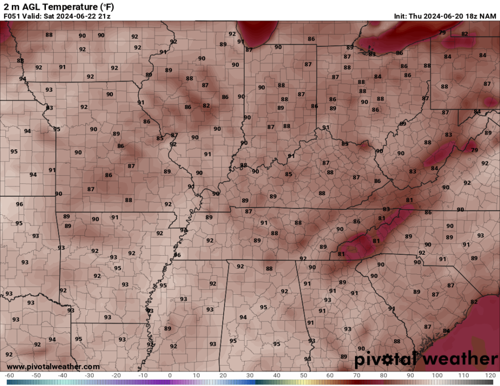
The sunshine on Saturday will keep highs in the middle and upper 90s as we head through the afternoon and into the evening hours, with that typical summertime humidity making it feel closer to 100º. Similarly to the past few nights, there won’t be much evening relief. Even under partly cloudy skies, lows only make it down into the mid 70s.
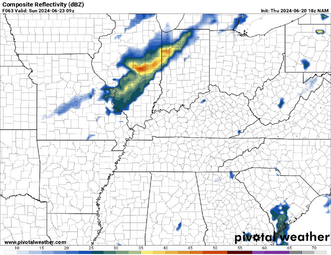
More of the same on Sunday as we watch highs climb back into the middle 90s with heat indices flirting with 100º. We may see a few more clouds as a weak system will try to make a run at us. Only a small chance for a small pop-up storm exists as we head into Sunday night with this front washing out over us. Lows are still only in the middle 70s.
Into Next Week
This particularly stubborn pattern continues as we head into next week. I know, I know….

We’ll try to sneak some slightly lower humidity in here as we head into the day on Monday, but the heat will continue rather unabated. Highs still make it into the middle 90s, but slightly lower dew points will make the heat index peak “only” in the upper 90s.
Heading toward the middle of next week, we’ll continue to watch another disturbance try to sneak in here from the north and west. That won’t do much to ease the heat we’re seeing out there now, but we may see a few cooler spots in the afternoon with some pop-up showers and storms developing.
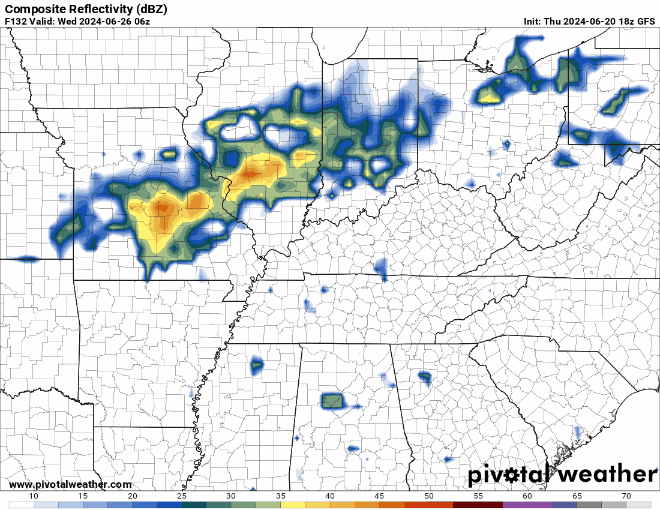
Highs still make it into the middle 90s, though, on Tuesday and Wednesday as this airmass doesn’t look to let up any time soon.
Looking beyond, it’s possible we’ll see an uptick in rain chances as we head toward the beginning of July, but the heat doesn’t look to let up any time soon. Such is life in the heart of summer!
That’s it for me for now! You can always keep up with the latest on all of our social media platforms. Have a tremendous day and a great weekend!