")
Good Monday morning, WABBLES! The first real heatwave of our summer season has finally arrived in our area, as we’re shaping up to have a very hot and very dry next several days. With no big weather-making systems in our immediate future, the only relief we’ll have from the bright sun will be a few pop-up summer showers, which may be possible tonight and tomorrow, though they won’t last all week. How toasty will things get here in WABBLES? And when will this blasted heatwave begin to wind down? We’re going over it all together in today’s weather blog!
Today’s Forecast
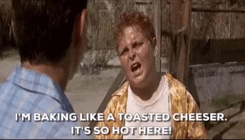
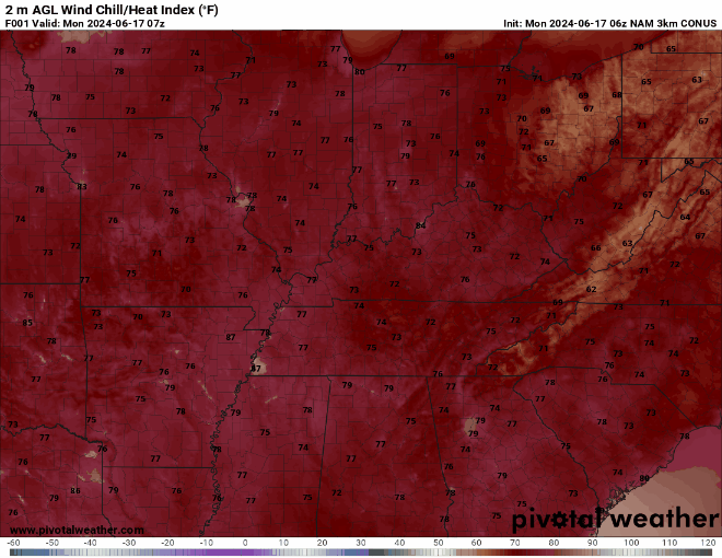
Outside conditions today will be very similar to what they were yesterday, but just in case you can’t remember, a very light breeze and relatively cloudless skies will give rise to some nasty heat as we get closer to the afternoon hours. Our high temperatures today are expected to linger in the low to mid-90s, with heat index values nearing and even surpassing 100 by midafternoon.
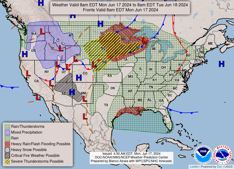
A very small chance exists for some summer bubbler-type storms to occur throughout the WABBLES region after 5 PM tonight, but as they’ll likely miss the window of our warmest temperature values, we’re gonna have to count on something else to cool us off today. Freeze those water bottles and break the sunhats out; this heatwave isn’t here to play around, and it’s only getting started!
SO… How Long Will the Heatwave Last?
That’s a very good question that we don’t quite have the perfect answer for just yet. It’s very common in the summertime for our region to get “locked” under an area of high atmospheric pressure that will work very hard to ward off any big weather systems while also letting serious summer heat build up underneath the high pressure bubble. That’s exactly what’s beginning to occur here in WABBLES and also across the country, as the Climate Prediction Center believes nearly the entire CONUS will see above-average temperatures over the next 6 to 10 days.
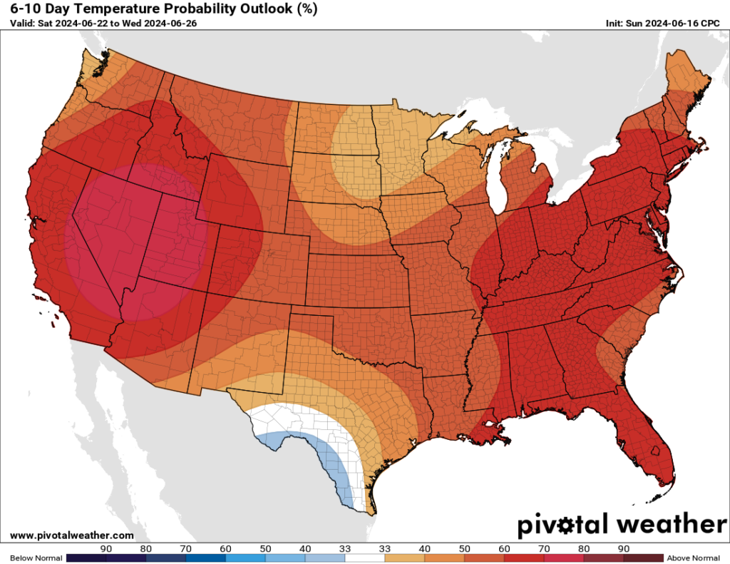
We’ll be watching here over the next several days to monitor how the high pressure over our area will begin to change. When that high pressure starts to erode and the upper-level winds shift to bring us more likely weather systems, we’ll be the first to let you know. But for now, most models have this potent ridging and high pressure dome sitting in place for at least the next week, if not through the end of June entirely.
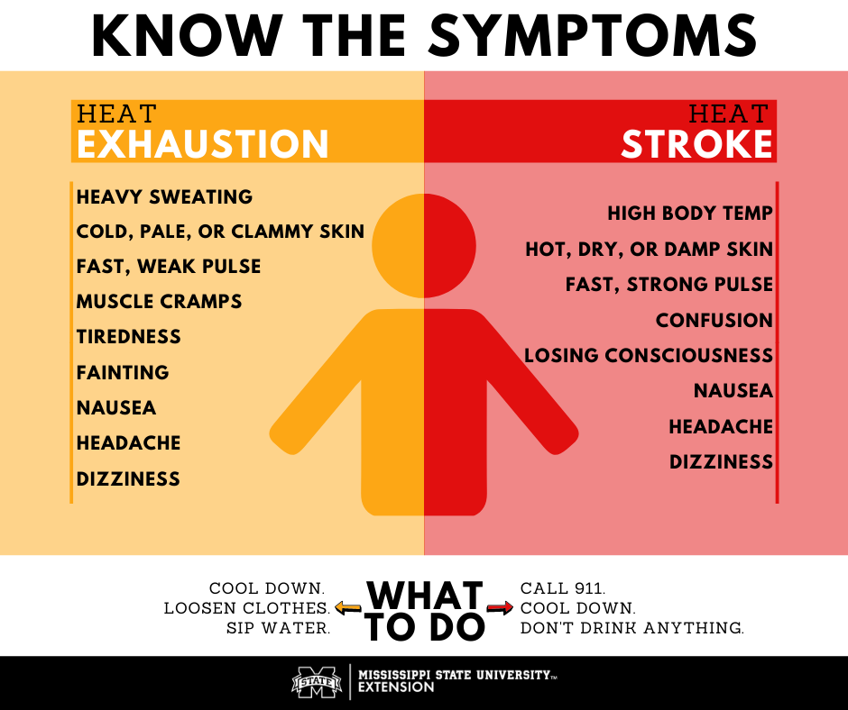
You and your family must be taking this heat and bright sunshine seriously if you have plans to spend any large amounts of time outdoors over the next several days. Sunburn and heatstroke are dangerous, especially to children, and we would hate for any of our sweet WABBLES family to fall ill or injured during this incoming heatwave. We love you and we care about you, so take a look at the graphic below and remember what to do in case you or someone you know begins to exhibit symptoms of heat sickness!
That’s about all we’ve got for you today, folks! Please make sure you and your loved ones are staying safe this week as we get really into summer’s hottest days. Of course, we do this every year, but it’s still important to practice weather awareness not just with severe weather, but with severe temperatures as well. We’ll keep you as updated as possible on the heatwave both on our Twitter page and here on the blog, so make sure to check in with both as we go throughout the week!
Until next time, take care and stay cool out there, y’all!