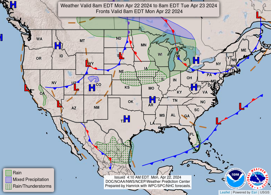
Good Monday morning, WABBLES! It’s all blue skies and sunshine here in Southern Kentucky today, but despite it, we’re still quite chilly outside to start the week. After an extended period of warmer conditions and then frequent rain, our incoming stretch of calmer, cooler conditions might come as a shock to some; but both shower chances and more average late April temperatures return to our area by late in the week, so they won’t be gone for very long. How warm will it get? And when will precipitation spoil all our fun once more? We’re going over it together, in today’s weather blog!

Today’s Forecast
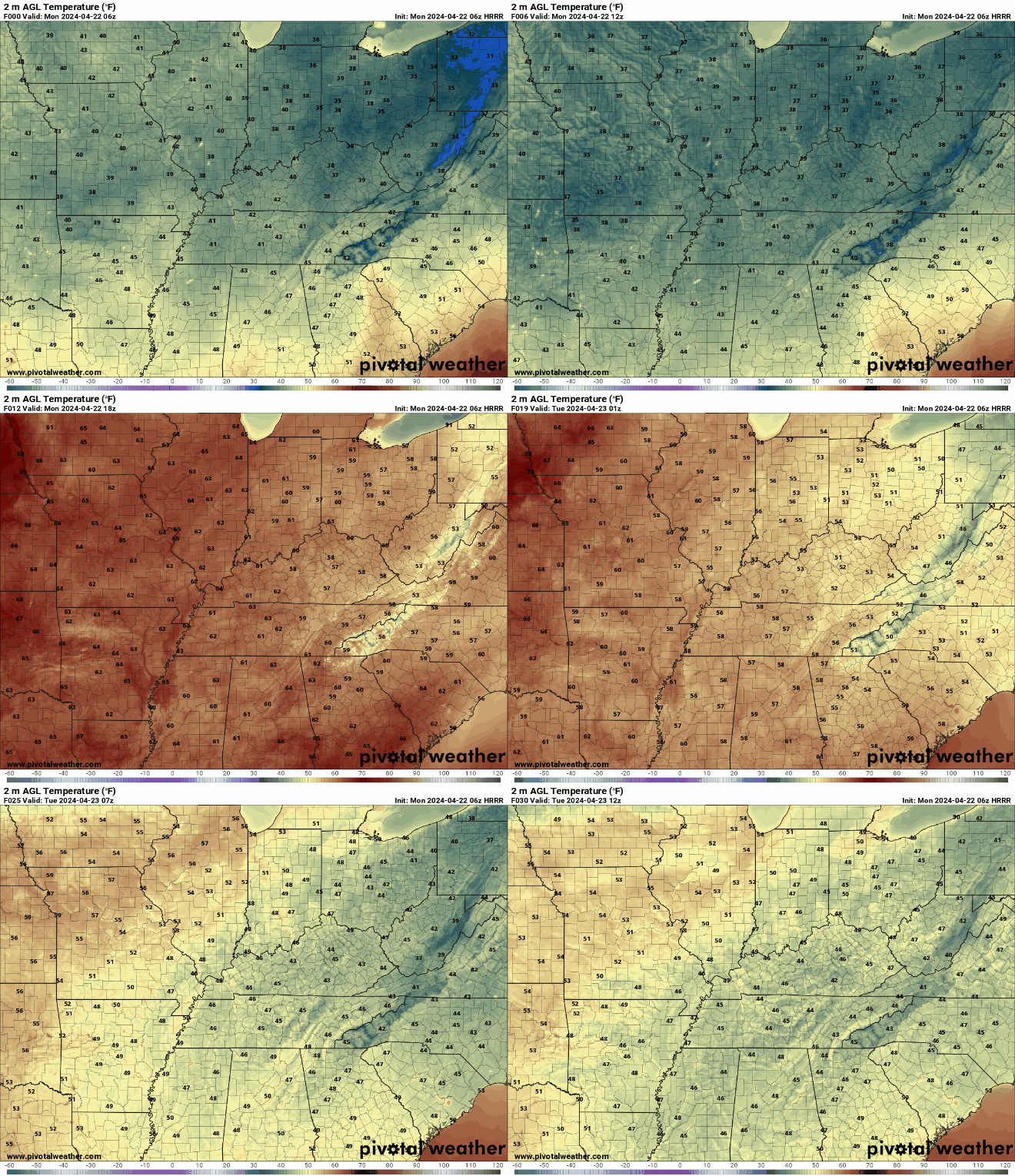
As mentioned earlier, us folks down here in WABBLES are currently riding out a wave of chillier temperatures than we’re used to seeing this late in the month. In fact, we’re under a Frost Advisory until 8:00 AM this morning just to make sure everyone’s got their sensitive outdoor vegetation taken care of due to the unprecedented cold snap.
We’ll only get up into the mid-60s for a high today here in the area despite bright, cloudless sunny skies dominating the forecast, just because the chillier air mass lingering over the region is so potent. Temperatures will drop back down into the low-40s after sundown this evening, so don’t pack away those thicker blankets until later this week. You’re gonna need ’em for a little while longer!
When do we Lose the Chill?
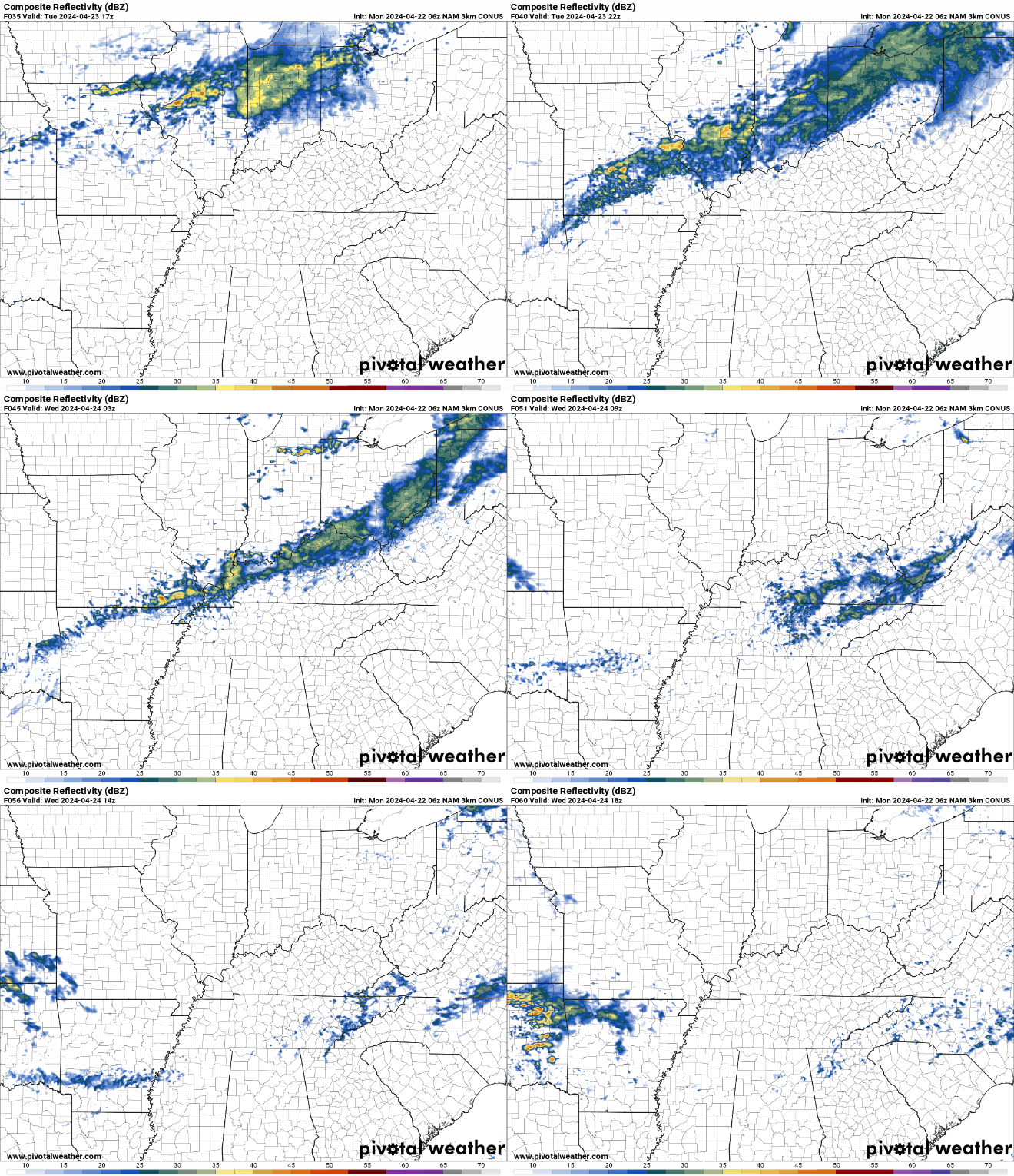
Good question! Luckily, we’ll be back into the lower-70s by Thursday, though that isn’t very much of an improvement on our mid-60s highs already. This is mostly due to another, much smaller cold front that will bring precipitation chances to the WABBLES area Tuesday night and prolong our chillier-feeling temperatures for another 24 hours or so. By Friday, our opportunities to see a spotty shower or thunderstorm once again increase, but we’ll be back in the mid-80s for highs. It’s a little bit of a trade-off: we’re colder now but dry, and by the end of the week we’ll be much warmer but plagued by the occasional rain shower. That’s the joy of late spring weather, y’all!
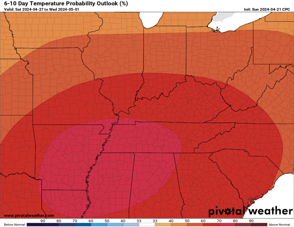
Despite our current temperature roadblock, the Climate Prediction Center is still convinced that we’ll be seeing much higher than average temperatures over the next 6 to 10 days. Their temperature probability outlook for the next week and change has us sat squarely in an area of much warmer conditions, so it’s just a waiting game, everybody! Have patience this week as we tough out the chillier, breezier days and the light at the end of the tunnel will come soon enough!
That’s about all we have for you today, WABBLES! Be prepared to handle some light showers tomorrow night, but other than that, we’re waiting out the chill in the air until late this week, when we warm right back up into mid-80s temperatures. Take care of your outdoor plants if you’ve got any sensitive foliage that might take issue with the colder weather, and if you’ve already switched over to AC (as so many of our on-campus residents have) make sure to leave the thick blankets out for just a few more nights. Until the warmth returns, enjoy those bright sunny skies and get outside for some activities before we’re back to dodging rainstorms, if you can!
As always, you can keep up with us on Twitter for all the latest forecast updates as you go throughout your day; if anything changes at all until our next blog comes out on Wednesday, right there is where you’ll hear about it! Until next time, take care out there y’all, and we’ll see you later!


