

")
Good Tuesday morning, WABBLES! After a calmer start to the week, we are back at it with rounds of severe weather. The low-pressure system that was over the Great Plains yesterday has made its way to the WABBLES region and is causing all sorts of ruckus. Thankfully, once this moves out of the area, we will catch a break from the active weather for the rest of the week. But without further ado, let’s dive into the details of today and this week.

TODAYS FORECAST
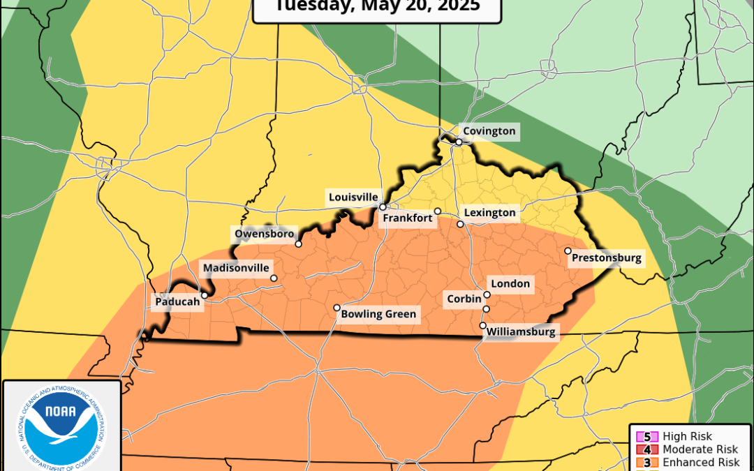
The WABBLES region is currently under an enhanced risk (3/5) for severe weather, with all hazards considered. The scattered rainstorms moving through this morning are only the first round, while a couple more rounds of strong storms can be expected this afternoon. Depending on how long the morning and afternoon storms take to move out, contributes to how much sun we will get in between these rounds. With some sun and temperatures warming back up into the mid-70s after the first couple of waves, this will prompt some instability for the next round of storms.
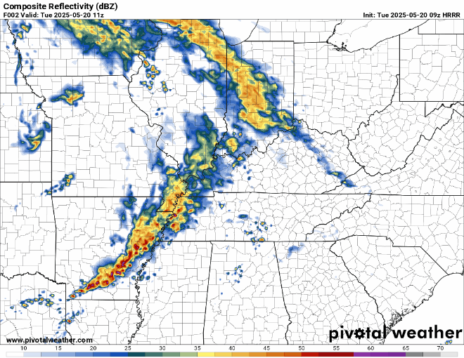
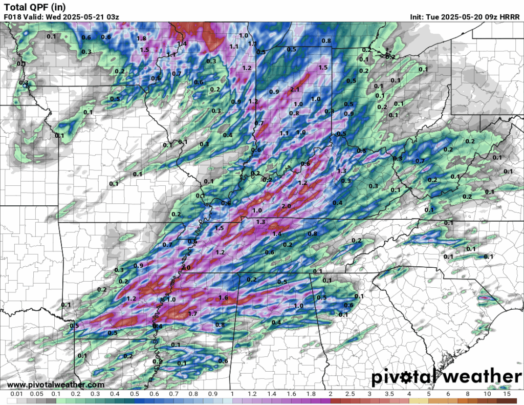
A second wave of storms will move in from mid-morning to around noon, while the last wave will move in this evening. With these waves of storms moving over the same area, localized flooding poses a threat to the WABBLES region. A flood watch is in place for the region from this afternoon until tonight as multiple bouts of heavy rain move in throughout the day.
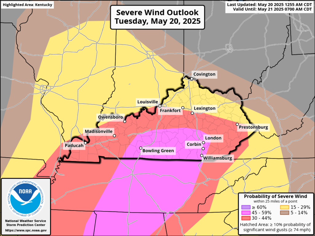
Even with all hazards on the table for today, the biggest threat is the strong winds associated with these storms. Parts of WABBLES are under a 45-59% risk for very high winds.
CALMER WEATHER AHEAD
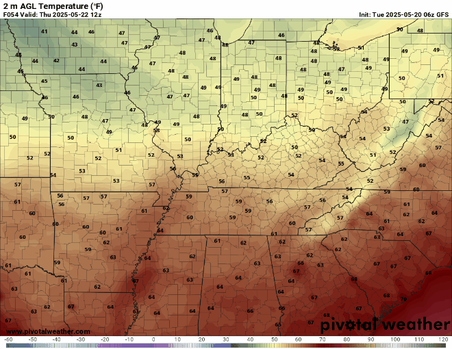
Once this system moves out of the region and is replaced with some high pressure, we will be left with a drier, cooler, northwesterly flow. Light rain is possible Thursday afternoon, but it will be nothing compared to the recent activity. High temperatures for the end of the week will stay between 60-70 degrees, with lows even dipping into the upper 40s. Gotta love the spring swings!
Since NOAA weather radios are down for required maintenance and today is an especially active day, it is important to remain weather-aware and know how to get information about current hazards. You can follow our social media to view live updates and to tune into our livestream on Twitter or YouTube when things start to get messy. That is about all from me for now, so stay safe, WABBLES!

Lord I Thank God for our weather team Landon, Davis , David and Audrey you all keep us up to date and on point at all times . I Pray that Good keep you and your families safe and unharmed. God Bless you All . Thank You For All You Do