")
Good Monday morning, WABBLES! As we approach the final few days of April, the showery spring pattern we’ve grown so accustomed to this month continues. Though we start the week off warm and dry, daily rain chances return to the region beginning Tuesday, and these opportunities for precipitation will last through Friday, kicking things off for the month of May! But how problematic will some of these rainy systems be? Could we see any severe weather? We’re going through all the details together in today’s weather blog!

Today’s Forecast
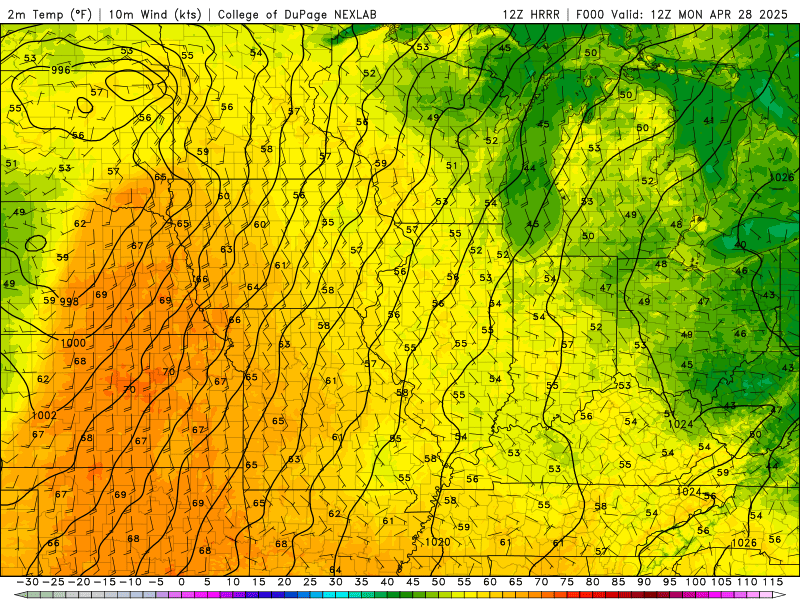
Monday will be our warmest and driest day of the week by a landslide! Though most of us will see high temperatures lingering in the low-to-mid 80s through Friday, some of us could see conditions warm into the upper-80s through this afternoon, as light winds and relatively cloudless skies will help us see some of that strong daytime heating. The showers and storms will hold off long enough for us to enjoy the day, which is a true blessing, because more consistent rainfall chances return to WABBLES bright and early Tuesday.
Show us the Rain!
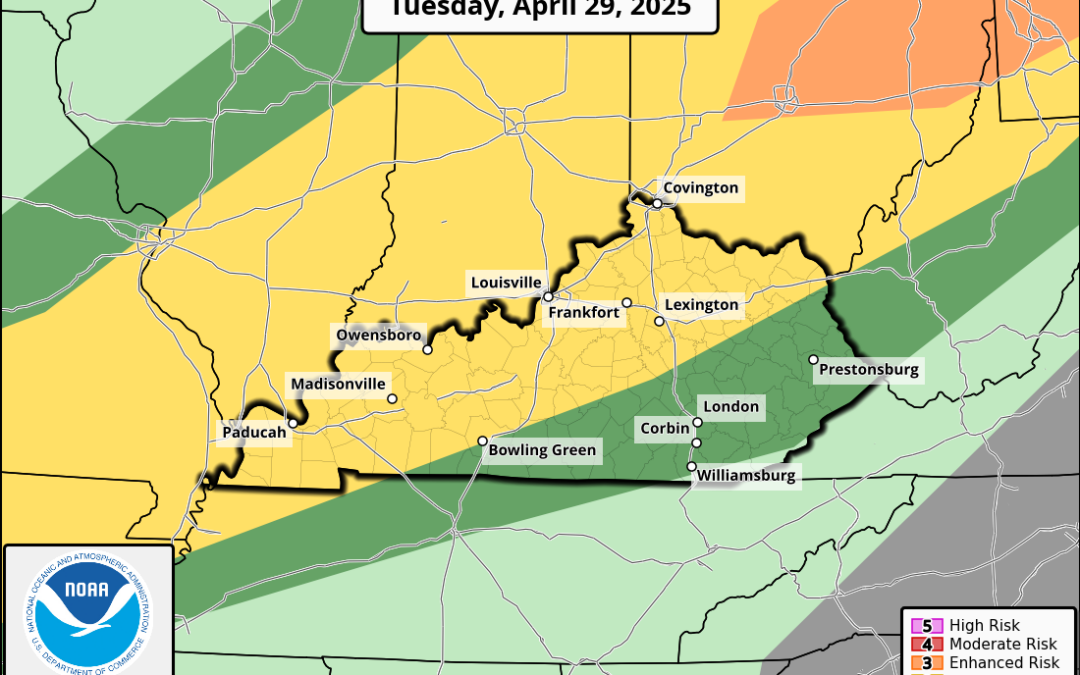
Alright, you got it! The Storm Prediction Center currently has the northwestern portion of WABBLES under a Slight Risk (2/5) for severe weather on Tuesday, largely as a result of that cold front you can see sweeping through the Upper Midwest today.
There’s good news and bad news with this system, however: the good news is that the cold front is very shallow, and won’t fully reach us on Tuesday, so our severe chances are a bit limited. The bad news is that because this cold front is so shallow and won’t completely push through the region, we’re expecting it to stall out a ways to our north, which will be the catalyst for all the other showers and storms we may see this week.
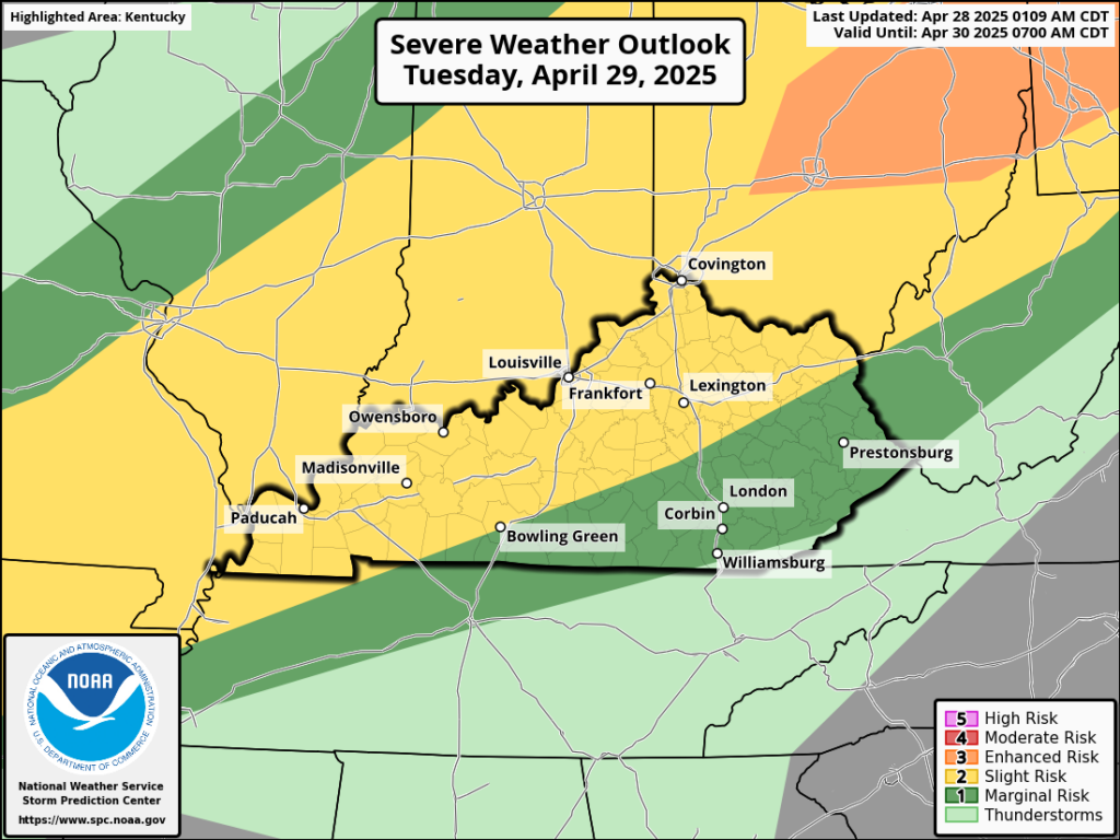
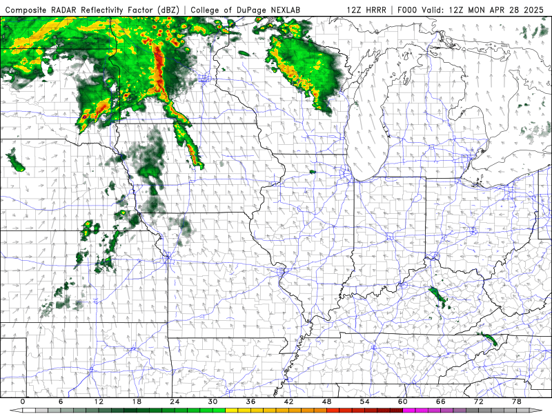
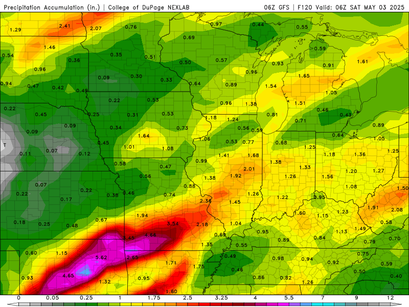
See how the line of storms moving east begins to flatten out and become more horizontal as it reaches Western Kentucky? That boundary-layer atmospheric feature will stay in place for the rest of the work week, and as more moisture from the south is pushed up against it like a wall, we’ll continue to see opportunities for rain and a few isolated storms through Friday afternoon. Skies clear up just in time for the weekend, thank goodness, but we’ll need a few days of dry time to really savor the break!
Of course, as always, we’ll be keeping an eye on all the latest details so that you stay up-to-date with the new forecast information as it comes out. April showers bring May flowers, and we’ll certainly see enough showers to test that saying as we close out the month this week. We’ll have more details on specific threats and timing day by day, so if you don’t already, make sure to follow us over on our Twitter page, which is where we’re most actively posting updates about our beloved WABBLES forecast!
Keep an eye out here for more blogs this week, but until then, take care out there, y’all, and stay dry!