")
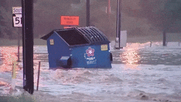
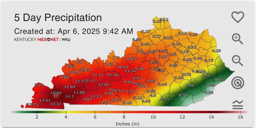
Good Monday morning, WABBLES! After an exhausting stretch of active weather, dry conditions have returned to the region, if only temporarily. Flooding has been a significant issue across WABBLES over the last several days, as nearly all of the area saw rain amounts near or over 9.00″ since the rain began late last week. The good news is that this rain is finally over, and dry weather has returned once more to WABBLES to kick off the work week! But how long does it last? We’re going through it together in today’s weather blog!
Today’s Forecast
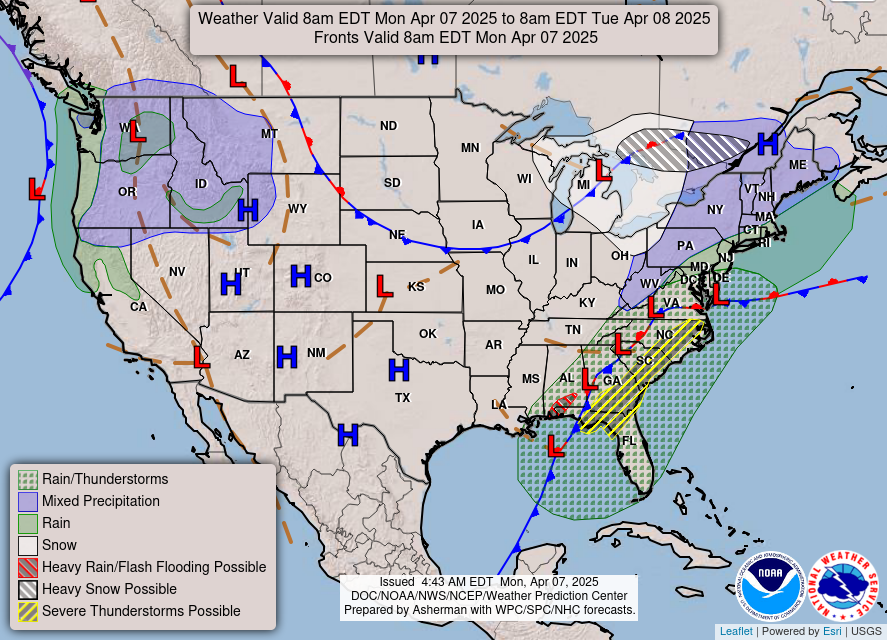
Just like that, it’s finally over! Though a bit cloudy and grey, rainfall in WABBLES has come to an end after what feels like an entire week of storms and severe weather. High temperatures in the upper-50s will be prevalent today as sunnier skies attempt to burn off most of that lingering cloud cover, but a few more weather warnings still remain in effect through the day.
Drakes Creek and the Barren River are both still under flood warnings, as we will continue to see flood waters increase for the next several days in response to the massive amount of rainfall we’ve received. Those who are in flood-prone areas definitely should be aware by now, so continue practicing those flood safety habits until we’re finally able to give the all-clear, hopefully sometime soon!
SO… How Long are we Dry?
Very good question, and I wish I could say it’ll be a bit longer. But right now we’re expecting to stay calm, dry, and just a bit cooler than average through Wednesday morning… and then the rain arrives once more late that evening. But don’t panic! This system will look much, much different than what we experienced last week and over the weekend.
Instead of rain that moves in and stays in for several days, we’re expecting a rather quick-moving clipper system of scattered rain showers to press in from the northwest and give us the opportunity for some additional rainfall throughout the day on Thursday. No matter what, these showers exit the region by early Friday morning, and then we’re dry once again for the weekend!
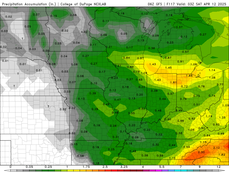
The additional rainfall may be a detriment to a lot of our regions that have been battling high flood waters, but the good news is that we aren’t expecting any more extreme amounts. Our rainfall has been nothing short of historic recently, and while we’re already close to smashing an April precipitation record (in just the first week!), it’s likely many of us will never see the same type of excessive rainfall setup in WABBLES again for several decades.
Regardless, storm season is still in session, and we here at wxornotBG know beyond a shadow of a doubt that there will be more severe systems moving down the pipeline in the coming months. But that’s why we’re here for you, WABBLES! You showed us amazing, immense support these last several days, every single time we went live, providing photos and details from out in the field, and we are so unbelievably grateful to you for that. WABBLES is a community, and by working together, we can ALL be more weather-aware. So, if you don’t already, make sure you’re following us on Twitter so that you get all our latest real-time updates as they come in!
We’ll have another blog out tomorrow to cover the latest details on our Thursday-Friday system, so make sure you check back here for more info in the morning. Other than that, stay safe, stay dry, and stay weather-aware, y’all!