

")

Good morning, WABBLES! I hope you’re in the mood for some rainy spring weather because you’re in for a treat this week. After a calm start to the month of March, a storm is brewing in the Great Plains as we speak that will interrupt those sunny skies we’ve been enjoying. But without further ado, let’s dive into the details of this week’s forecast!

Get ready for a show! (tenor)
TODAY’S FORECAST
With some gusty, warm winds from the south, the WABBLES region will begin to warm up, with high temperatures reaching into the mid- to upper 60s today. We’ll see some partly cloudy skies for most of the day. As mentioned before, the low-pressure system located over the plains will push eastward and bring a line of heavy rain and thunderstorms into the region this evening. As this pressure gradient tightens over us, we can expect to see some gusty winds throughout the day.
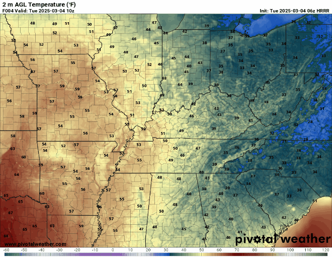
WABBLES will soon be warming up! (Pivotal Weather)
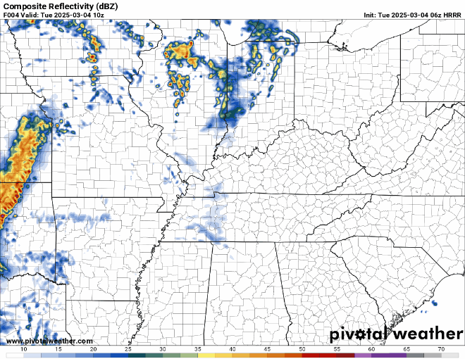
This line of rain and storms will begin to push into the area this evening. (Pivotal Weather)
With an influx of moisture from the Gulf fueling this storm system, the majority of the severe weather will remain to the south of Kentucky. However, the Storm Prediction Center has now put our region under a marginal risk (1/5) for severe weather. As some of the warmer air and moisture creeps into our area, we can expect to see a few strong thunderstorms with strong winds, heavy rain, and possibly small hail.
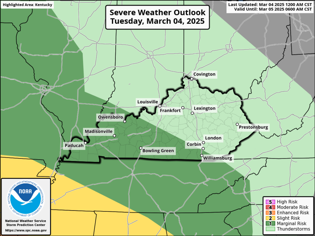
The WABBLES region is under a marginal risk for severe weather. (SPC)
COOLER AIR FOLLOWING The STORM
Behind this system is another batch of cooler air that will trail a cold front moving in during the early hours of Wednesday morning. This will keep temperatures in the upper 40s and lower 50s for the rest of the week. If that wasn’t enough activity for you, some of the WABBLES area could receive some late night flurries Wednesday night as the back end of this system precipitates out into the now cooler air. It won’t be much, nor will much stick due to the warm ground temperatures, but it will still be a pretty sight before you head to bed!
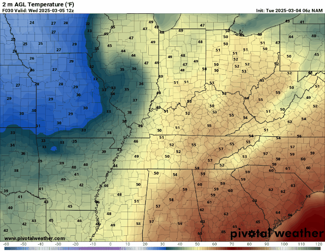
See you next time, warm air! (Pivotal Weather)
Although, don’t let those flurries deceive you; we will be seeing some warmer temperatures these next couple of weeks as spring gradually moves in. The Climate Prediction Center is adamant about WABBLES being above the average March temperatures within the upcoming weeks. As we progress through the month and endure more storm systems and warmer temperatures, it will soon begin to feel more and more like spring!
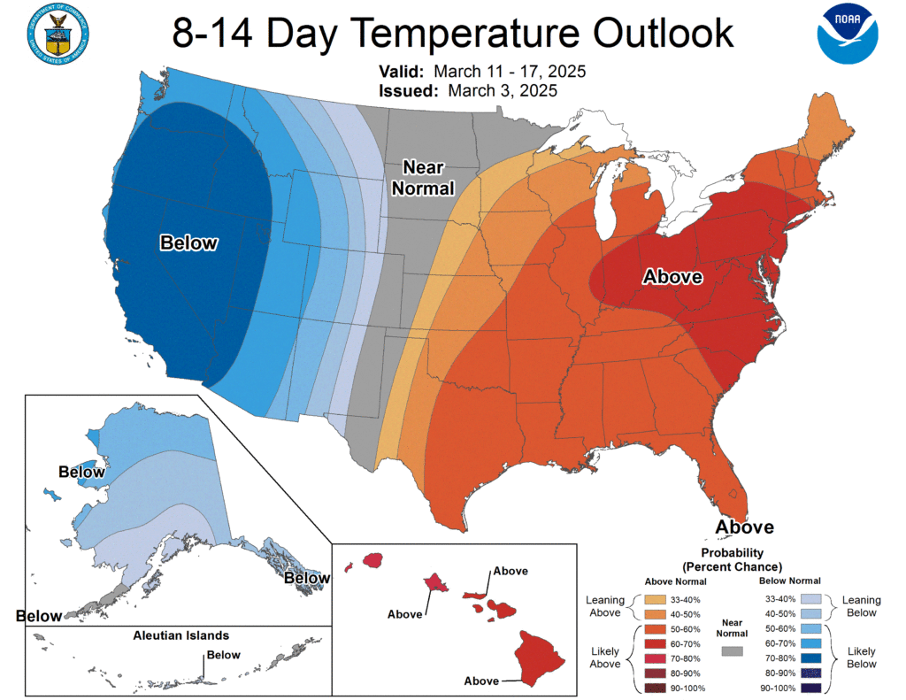
We will be quite above the normal temperatures in the upcoming weeks. (CPC)
So enjoy this terrific Tuesday while you can, WABBLES, and hold on to your umbrellas because it is going to be a windy, rainy evening! And remember, as we are approaching the active severe weather season, wxornotBG will be there to provide updated weather information and help you stay weather aware! Don’t forget to follow us on our social media, where you can find these updates. Stay safe, WABBLES!

Until next time… (tenor)
Can’t wait for that spring weather, great blog!
We love the bipolar Kentucky weather 👏👏