")
Good Monday morning, WABBLES! As we kick off the last week of February, I’m sure it’ll come as a relief to know we return to much calmer weather in the wake of all the recent activity we’ve seen. We’re closing out the month with some much tamer conditions, as well as a return to warm weather that’ll have us questioning how we saw any snow at all last week! Despite the relaxed nature of our upcoming work week, however, we’re still watching a passing weather system Wednesday night to break up some of the monotony; we’ll go through all the details together in today’s forecast blog!

Today’s Forecast
We are looking at a beautiful Monday ahead across our WABBLES community! With high temperatures in the upper 50s and bright sunny skies, any leftover snow or ice still lingering in our shady spots will be taken care of by the end of the day. A warm wind out of the southwest will keep things perfectly calm and comfortable, making it feel a lot more like spring outside than the last few weeks of winter. Overnight lows will still dip down close to freezing, but compared to the single-digit temperatures we were seeing this time last week, I’d say mid-30s are much more appreciated!
How Long Does Calm LasT?
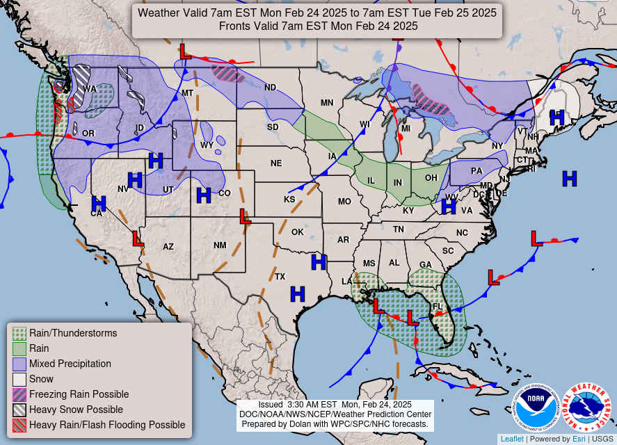
Good question! I mentioned a little midweek disturbance earlier, and I’d like to keep y’all in the loop on exactly what we’re watching. Currently, we’re keeping an eye on a low pressure system with a long, trailing cold front that’ll pass to our north overnight Wednesday night into Thursday morning. While this system isn’t very strong and also isn’t in a great position to bring us a lot of heavy rainfall, we’ll still see some scattered showers during the overnight hours before some cooler temperatures return Thursday morning.
As you can see, the bulk of the heavy precipitation associated with this low pressure system is far off to our north, near the Great Lakes, where they’re likely to see a bit of snowfall with this storm. But since we’re much farther off to the south, it’s much more likely that we’ll just end up with some light to moderate rain showers before temperatures dip down into the 40s for our Thursday morning. But with no real instability to speak of, that’s all it’ll be!
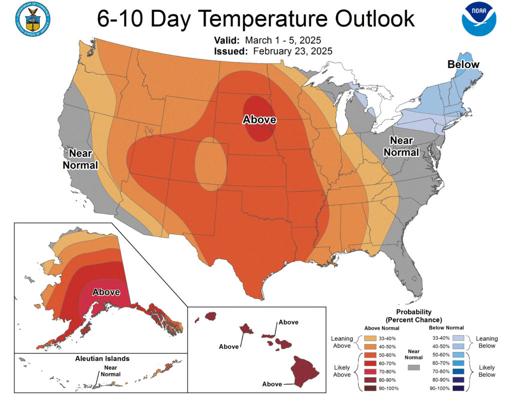
After our midweek rainy weather, we’ll go right back to calm conditions with clear skies & highs in the upper 50s and low 60s- which is great for those of us who are chomping at the bit to see the end of winter. We’ve definitely had an active one here across the region, so there’s no shame in it whatsoever! The Climate Prediction Center is pretty adamant that we’ll stay warm over the next week or so, just long enough to ring in the month of March, which will help us shift our focus from winter systems to more severe weather environments.
Remember, folks: as we start heading into severe weather season proper, WXornotBG will be here to walk you through every single event just to make sure our community is staying weather-aware and informed. If you don’t already, make sure to give us a follow over on Twitter, where we post daily forecast updates for the entire WABBLES community! Calm weather or chaotic weather, we’ll always be here for you.
That’s all we’ve got for you today! Go out there and enjoy some of that beautiful sunshine and nice warm weather, and we’ll see you again tomorrow for another forecast blog!