")
Good Monday morning, WABBLES! We’ve got a hectic week of weather ahead, with multiple systems lined up to bring us some flooding concerns alongside torrential rains. With Winter Storm Watches just to the north of our area and a Flood Watch for WABBLES through late Tuesday night, it’s safe to say that the incoming weather is expected to cause some issues as we get into the week. We’ll dive into all the latest forecast updates here in today’s blog!
Today’s Forecast
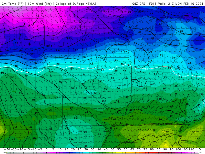
Enjoy your dry Monday, y’all, because it’ll be the last time we’re dry before the end of the week! Temperatures top out around the mid-to-high 40s this afternoon, with a gentle breeze out of the northeast keeping things comfortable, if not a tad chilly. Cloud cover increases during the day today into the night as our first big rain-making system of the week approaches, and shortly after midnight we’ll start to see the first bits of precipitation make their way into the region. And once the rain starts… it’s going to be a while before we see the sun again.
Flooding Concerns?
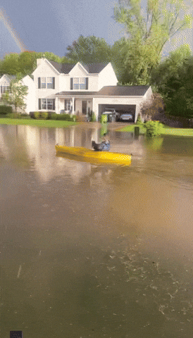
Unfortunately, we do have a few. As mentioned earlier, the entirety of WABBLES is under a Flood Watch through 6:00 AM on Wednesday. But the risk for torrential rains will continue throughout the week, which may inspire a second Flood Watch to be issued depending on just how much rain we end up seeing on Tuesday. And folks? It’s gonna be a pretty large amount.
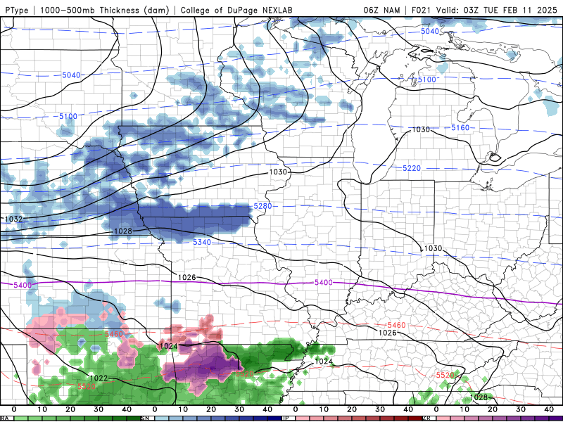
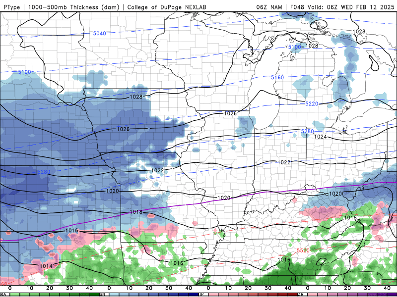
With the freezing line staying just to our north by a few counties overnight, WABBLES will largely be missed by any wintry precipitation in favor of seeing some really significant rainfall beginning just after midnight on Tuesday. But make no mistake; we will be COLD on Tuesday, with temperatures staying just barely above freezing for most of the day as moderate to heavy rainfall goes on. After the rainfall we experienced last week, our ground is fairly well saturated across the region; this means it’ll be much easier for any additional rain to overwhelm grassy surfaces and pavements, which is where our flooding concerns come in.
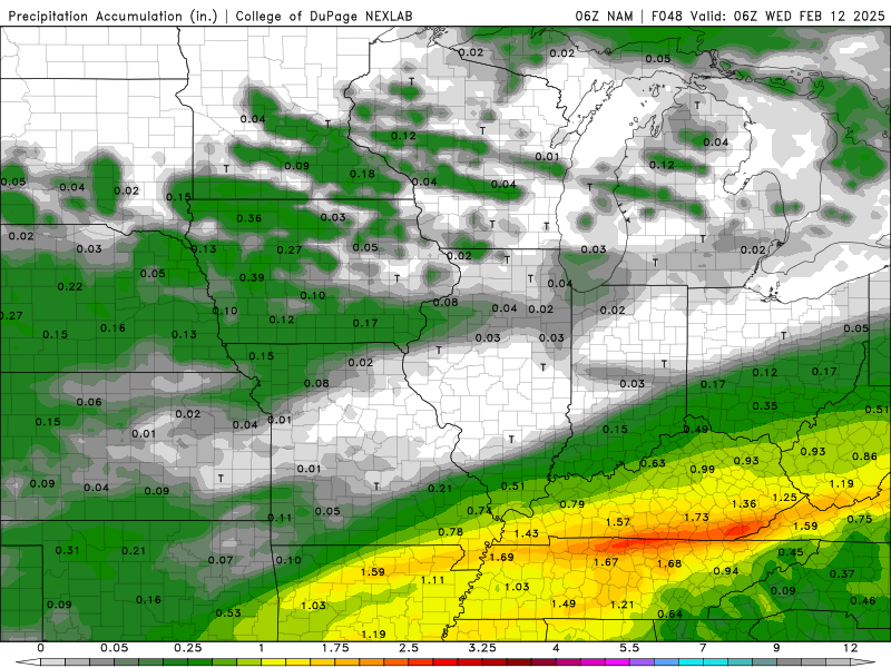
Through Tuesday night alone, WABBLES residents can expect to see anywhere from one to nearly two inches of rainfall before that system departs off to the east. But if you thought that was the end of it… I’ve got some bad news. After only a few hours of drying time on Wednesday morning, a second system bringing even MORE rainfall will arrive later that day.
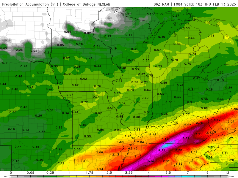
Yes, you’re seeing that right: through Thursday afternoon, some parts of WABBLES could see anywhere from three to SIX inches of rainfall! That’s an outrageous amount for grounds that are already quite saturated from the system that moved through late last week. Flooding will be a very legitimate concern for a lot of folks region-wide, but especially those who live in low-lying or flood-prone areas. Please take the incoming weather seriously and make the necessary preparations in case of emergency; know where to go if you must seek higher ground.
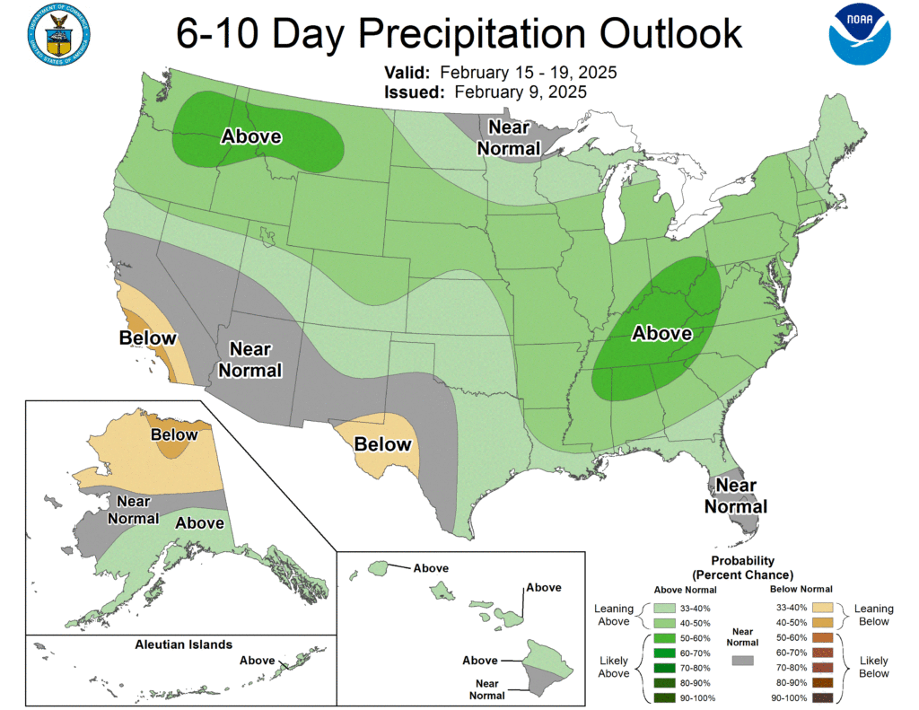
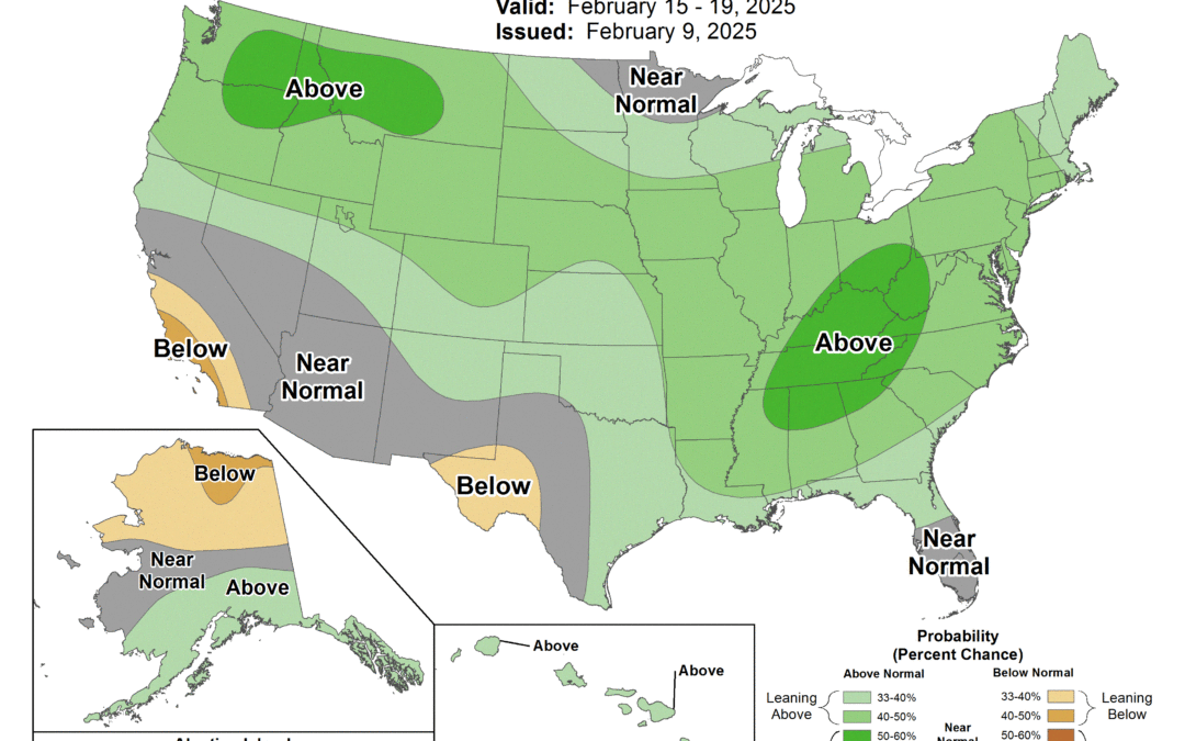
To no one’s surprise, the Climate Prediction Center has outlined WABBLES beneath a region that’s widely expected to see above-average precipitation over the next 10 days. And not to be the bearer of bad news, but that’s largely due to the fact we’re expecting yet another rain-making system to move in for the weekend; yes, you’ve got that right, we’re expecting THREE ROUNDS of torrential rainfall in less than 7 days. So please take this forecast seriously, folks!
Details will get quite a bit clearer as we approach the end of the week, so expect to see another forecast blog or two in the next several days going over what to think about for the weekend. Until then, please keep yourself safe out there WABBLES! We couldn’t do any of what we do here at WXornotBG without you, and our mission is to keep you safe by making sure you’re weather-aware.
If you don’t already, give us a follow over on Twitter; we use the platform to put out rapid-fire short-form forecast updates as events are happening, so once the rains arrive this week, that’s absolutely the best place to keep in touch with us. If you experience flooding as a result of these systems, send us some pictures and videos (if you can safely do so, of course!) so that we can share them with the rest of our Wabblers to keep everyone informed!
That’s all we’ve got for you today. Please take care of yourselves out there, WABBLES – we’re a family here, and it would break our hearts for any of our WABBLES family to find themselves in some trouble as a result of the incoming storms. Take those flood precautions and stay weather-aware, because we’ve got your back all the way!