")
Good Monday morning, WABBLES! We’re starting over fresh to kick off February, ringing in the month with dry weather and some well-above-average temperatures for this time of year. But don’t be fooled! Wet conditions return by Wednesday and linger well into the end of the week, with scattered storms and widespread showers expected through Friday morning. We’ll cool down just in time for the weekend as a result, but the rain won’t leave our forecast as quickly as some of those warmer temps… let’s go through it all together in today’s weather blog!

Today’s Forecast
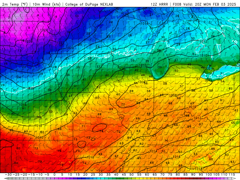
We’ll start our week’s weather breakdown by reviewing what we expect to be a delightfully calm Monday! As I mentioned earlier, we’re getting a real treat of some above-average temperatures this afternoon, with our highs across WABBLES topping out near the low-70s.
Combined with clear, cloudless skies, it’s the perfect day to get out and about before conditions change pretty drastically mid-week! Despite Punxsutawney Phil’s forecast of six more weeks of winter (and we don’t entirely disagree with him…) it definitely won’t feel much like winter at all this afternoon. So get outside and enjoy it!
So… When Does the Rain Start?
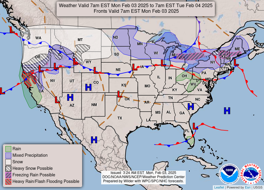
I’m glad you asked! Though the warmth and calm weather will be a nice beginning to the week, unfortunately, it won’t last too long. A slow-moving low pressure system is expected to push in beginning Wednesday morning, bringing some scattered to widespread showers as the warm front lifts north across the region. Right behind it will follow a stronger cold front, likely bringing in some more thunderstorms as we go into the daytime on Thursday, until the entire system starts to move out Friday morning.
Despite how widespread we’re thinking a lot of the rainfall associated with this system will be, we aren’t overly concerned about extreme rainfall amounts. Current models have the WABBLES area receiving anywhere from a half inch to an inch of rainfall through Friday morning, which isn’t so much on its own, but our grounds are likely still a bit saturated from last week’s torrential rains. Regardless, keep an eye out for some light or localized flooding in those low-lying problem areas just in case!
The good news is that we’ll have a little break from the messy weather during the day on Friday; but the bad news is that our break won’t last very long at all. Another system is currently lined up for the upcoming weekend, potentially bringing in some more scattered showers and possible thunderstorms. It’s a little out of focus now, as we’re nearly seven days away, but the trends are there: we’re in for another wild month of active weather in WABBLES!
That’s about all we’ve got for you today, y’all! Make sure you enjoy our last few days of calm, dry weather before we start seeing things flip on their head into the rest of the month. Keep those rain jackets and boots nearby for the next week or so, because you won’t want to go out without them, that’s for sure! We’ll have another blog out later this week detailing things like specific start and end times for our upcoming systems, but until then, make sure you’re keeping up with us on Twitter, where we love sending out frequent updates on your latest WABBLES forecast.
Take care out there today, folks, and stay dry this week!