")
Good Monday morning, WABBLES! As we head into the final week of January, our weather pattern begins to trend towards more seasonable temperatures after a long period of overly chilly conditions. After the busy system conveyor belt and deep cold we’ve seen over the last few weeks, the cloudless sunny skies and warmer temps coming up to close out the month are definitely a bit of a blessing for those who are sick of our busy winter thus far! But not all good things can last forever; rain returns to the menu late Thursday into early Friday just in time for February’s arrival. We’re going through it all together in today’s weather blog!

Today’s Forecast
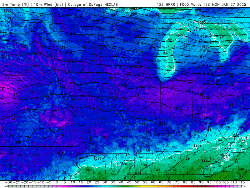
We’re kicking off the work week in WABBLES with the first day of a few to see some clear skies with light winds and steadily warming temperatures! Most across the region will see highs in the mid-upper-40s, which is definitely a treat after the harsher winter cold we’ve seen so far this month. Lows will dip down just below freezing for most overnight, only to return to the low-50s tomorrow afternoon to continue our warming trend into the midweek. And in tandem with the pretty significant temperature increase we’re expecting, we’re also likely to see some breezier winds overnight tonight as that warm air advection really gets going.
Rain Finally Returns Later?
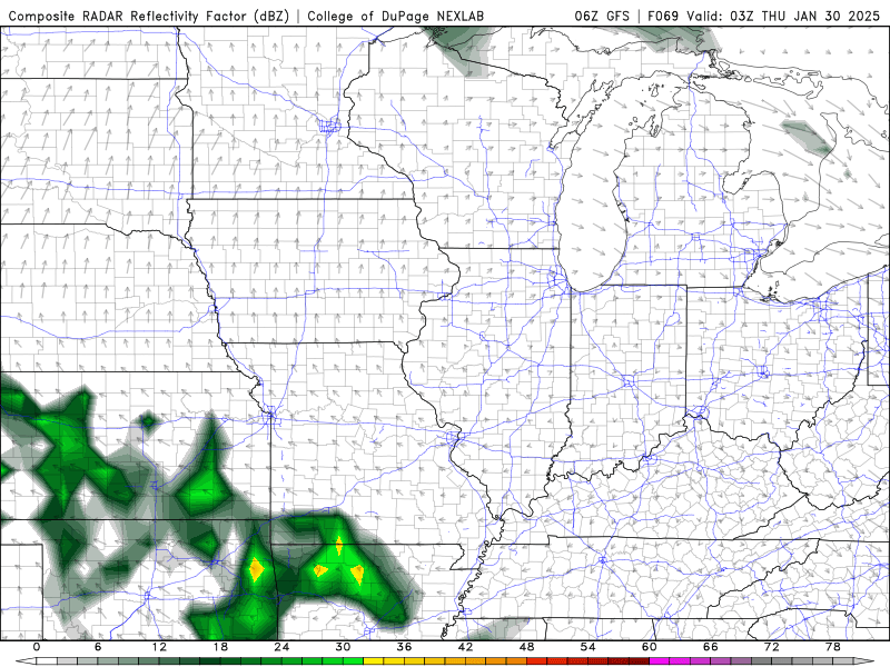
You bet! Though we’ve got a couple of nice days lined up this week, we’re currently eyeballing a new system that’ll most likely move into the WABBLES area late Thursday into early Friday morning. Because we’ll have been so warm thanks to all the high pressure and warm air advection we’ll see this week, we aren’t counting on any kind of wintery precip; so it’ll largely take the form of a messy frontal system that’ll be able to produce a LOT of rain here across the region.
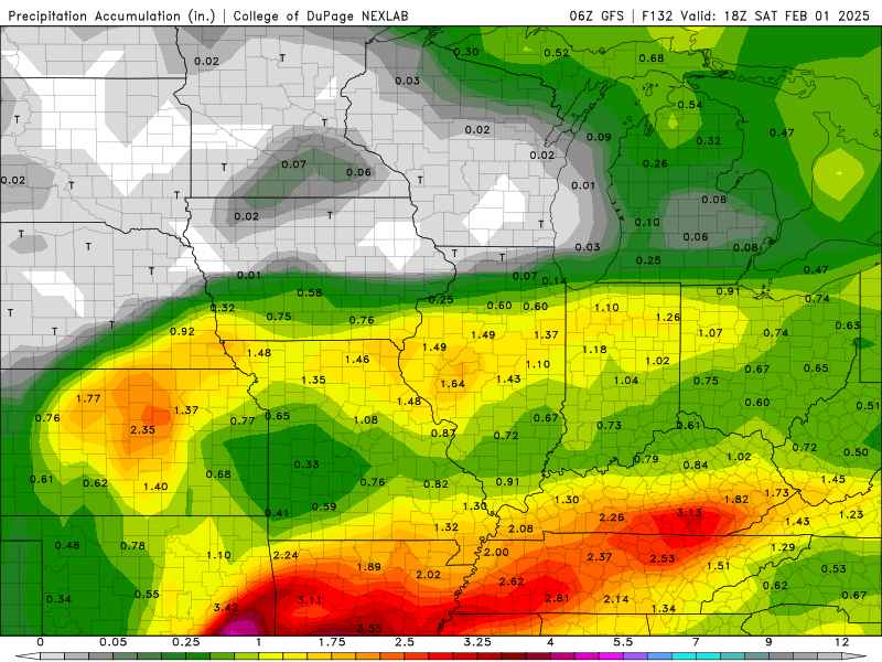
Preliminary estimates on rainfall amounts here in WABBLES are clocking in at anywhere from 2 to 2.5 inches through midday Saturday. While those amounts are likely to change a bit as we get closer to the system’s arrival, it’s a good beginner estimate on system intensity and moisture availability. No matter what, we’re finally going to see some really good gully-washing to kick off February, that’s for sure!
All of this to say, we’re headed into a warmer and wetter pattern as we step out of January and finally get into February after a long and trying month full of off-the-wall weather. At least for the next little while conditions will be much closer to average, so as long as you’ve got some umbrellas lying around you’ll do just fine.
Other than that, we haven’t got much for you this beautiful Monday here in WABBLES! Make sure to enjoy these next few days of warm, dry sun, because goodness knows we’ve been hurting for it. We’ll be back here with another blog later this week to cover our end-of-month rain system, but until then, check us out on Twitter for some more frequent updates. We love interacting with y’all, so don’t be shy!
We’ll see you later, folks. Take care!