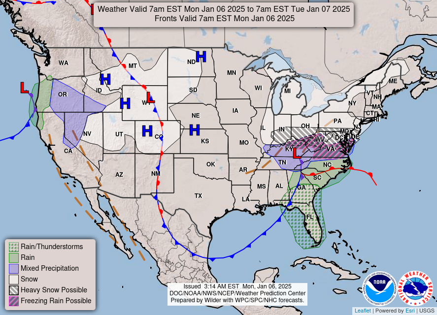
Good Monday morning, WABBLES! We’ve had a wild weekend of messy weather, and as this winter storm finally starts to exit our area, we’ll see those conditions continue into the start of our work week today. The northern counties of WABBLES, including Warren County, remain under a Winter Storm Warning until 6:00 PM this evening due to possible additional ice and snow accumulations. Though most precipitation will end before sundown today, the story will then transition to the extreme cold we’re expecting by midweek. We’re going through it all together in today’s weather blog!
Today’s Forecast
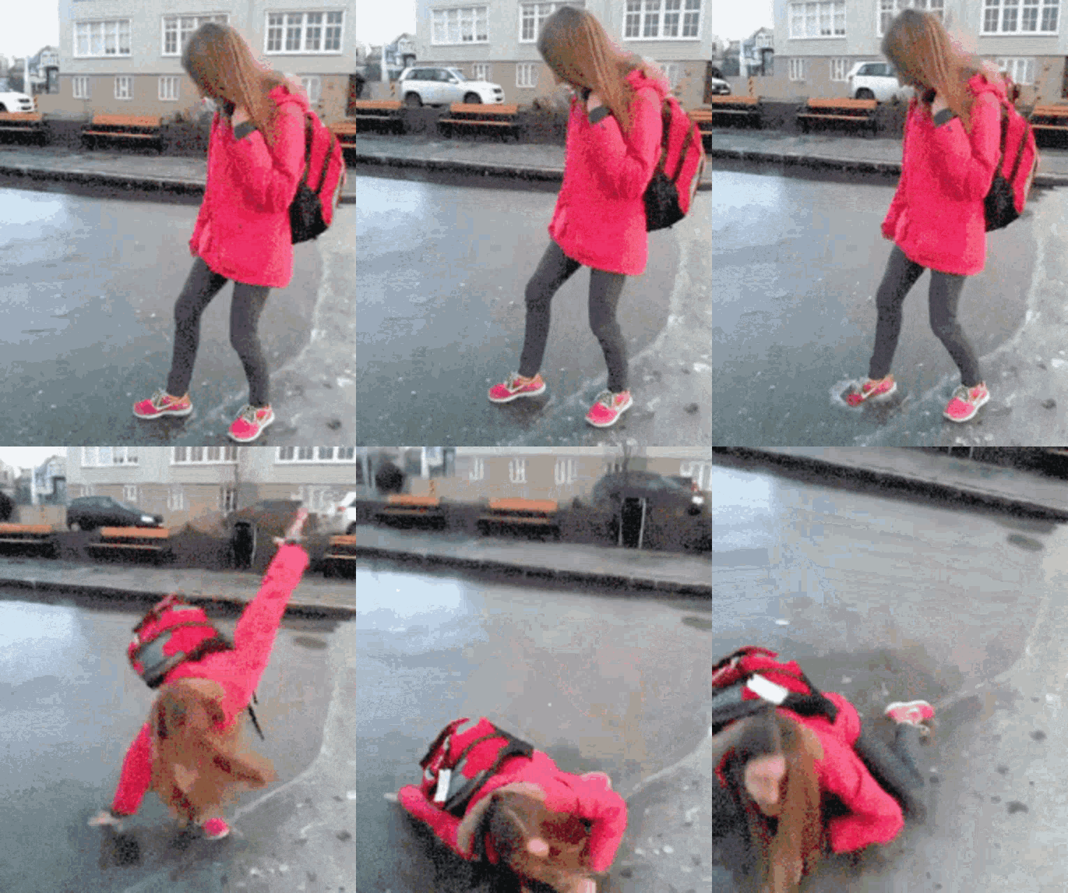
We’re starting off the week with a bang, as freezing drizzle will transition back and forth from snow and sleet as we go throughout the morning here in WABBLES. Wintery precip on the backside of the low pressure system will wrap around as the system exits to our east, laying a fine coat of additional wintery precipitation on top of our already slick surfaces. The mix is definitely messy and slick enough to keep those kids from getting back to school today, as a pretty significant amount of businesses and other institutions are operating on either a weather delay or total closure to kick off the week. That routinely updated list can be found here, on WBKO.com.
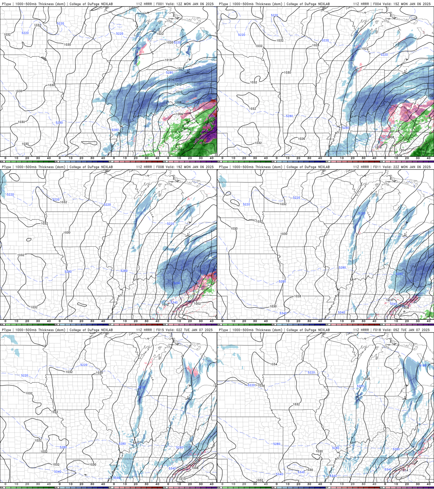
Some folks in WABBLES are still dealing with local power outages, which is no big surprise due to the chaos of all the freezing rain and sleet we’ve seen in the last 24 hours! While most of our lovely counties are now just dealing with isolated issues, Logan and Butler counties will continue to see issues through the morning as emergency crews work to get those outages resolved.
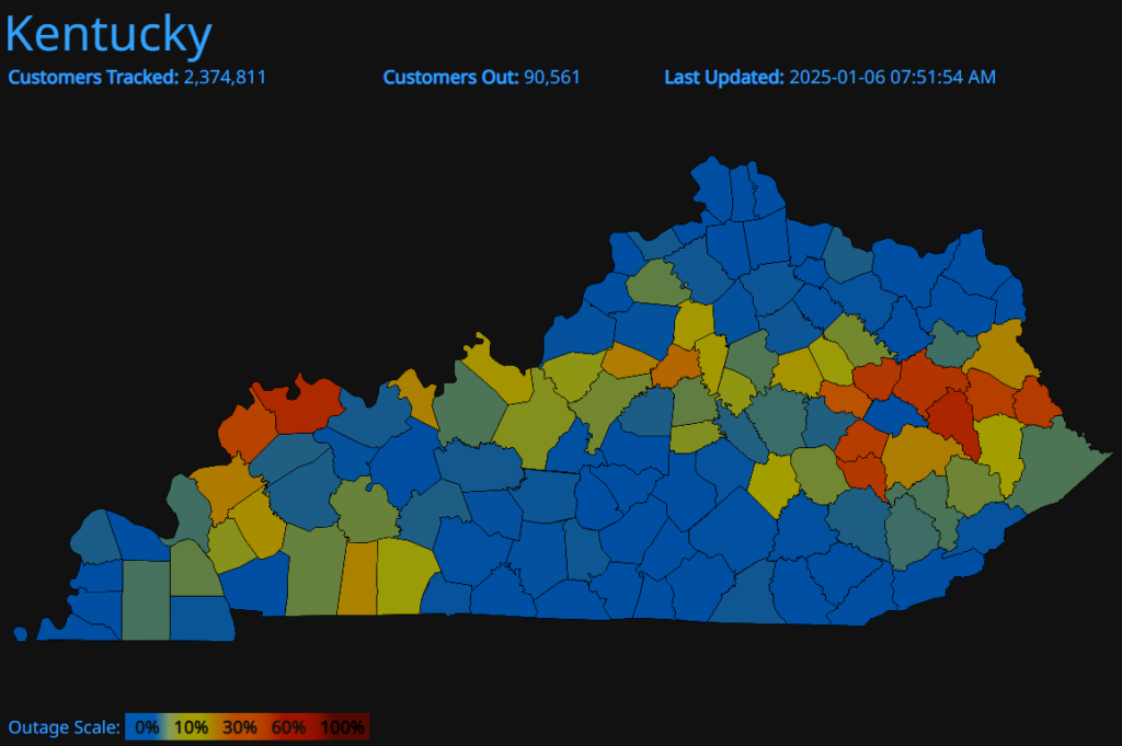
Any More messy Weather on the Horizon?
Good question! In the short-term… Maybe? While we are eyeing another potential winter weather-maker around the end of this week, it’s still a little too far out to tell if that system will drift north enough to impact WABBLES, so for now we’re focusing on all the extreme cold we’re likely going to see once our current system departs this afternoon. While our high temperatures for the week will largely remain in the upper 20s to low 30s, our lows will dip all the way down into the mid-teens and approach single digits on Wednesday night. Breezy winds will make those feels-like temperatures plummet as well, especially overnight, so please make sure you’re staying warm this week!
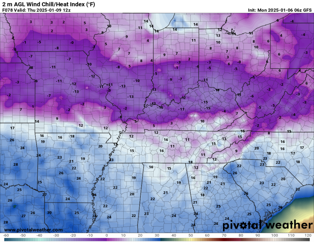
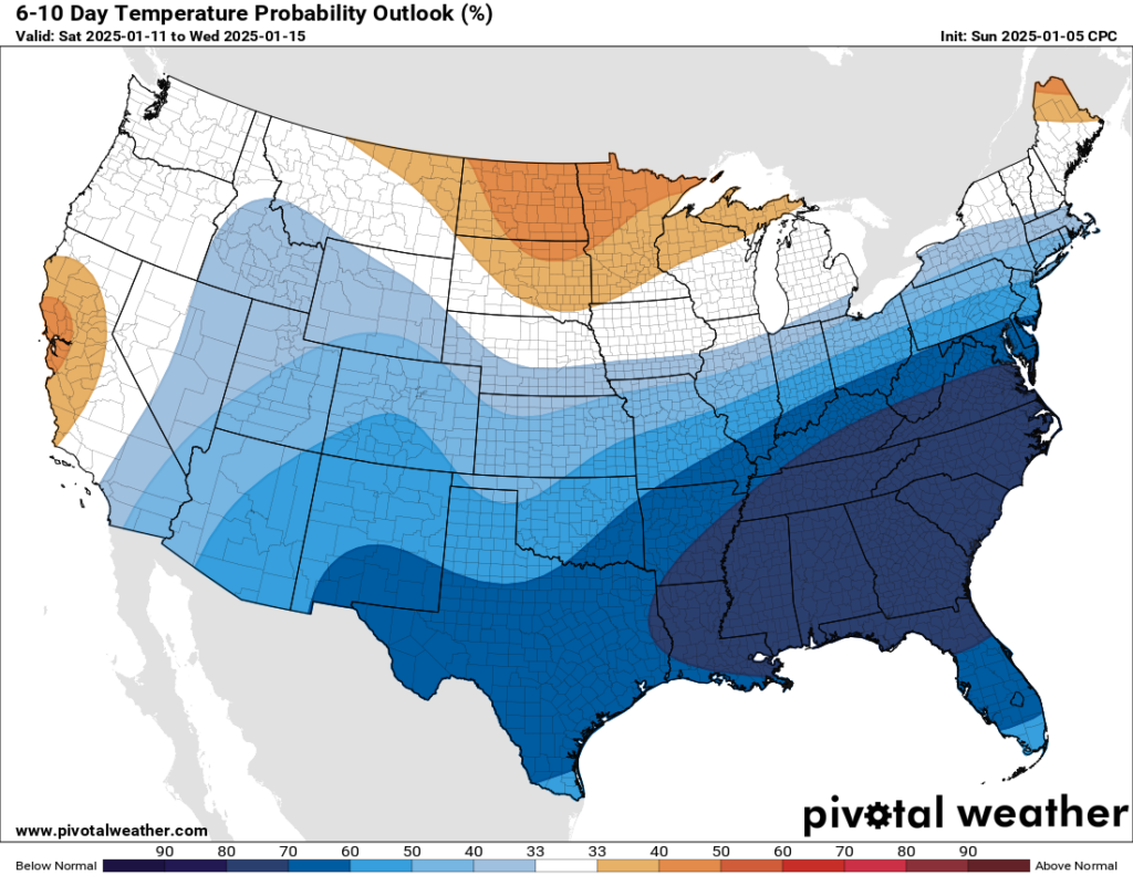
Unfortunately, these far below average temperatures are expected to stick around for a while, as the Climate Prediction Center has outlined for the next 6-to-10-day period. If we do expect to see any more messy winter weather, it’ll definitely be cold enough, that’s for sure! But in the meantime, it’s important to stay bundled up and as warm as possible, especially with the incoming arctic blast we’re expecting this week.
That’s about all we’ve got for you today, WABBLES! Please stay safe out there as we enter into the perils of winter proper, with slick roads, downed powerlines and trees, and frightening cold air. Winter weather is no joke, no matter how messy it appears!
As always, we’ll be back later this week with another blog post to cover a second weather system that could possibly impact WABBLES. But until then, make sure to give us a follow over on Twitter, as we’re very active with all the latest forecast updates as well as retweeting your local ground truth reports on what’s really going on across the community! Please keep warm and safe this week, and we’ll see you again very soon. Take care!
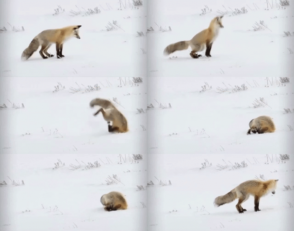

My papaw Loyde Hunt always said if snow stays on the ground for 3 days without melting that it was waiting around for another snow. Have you ever heard this?