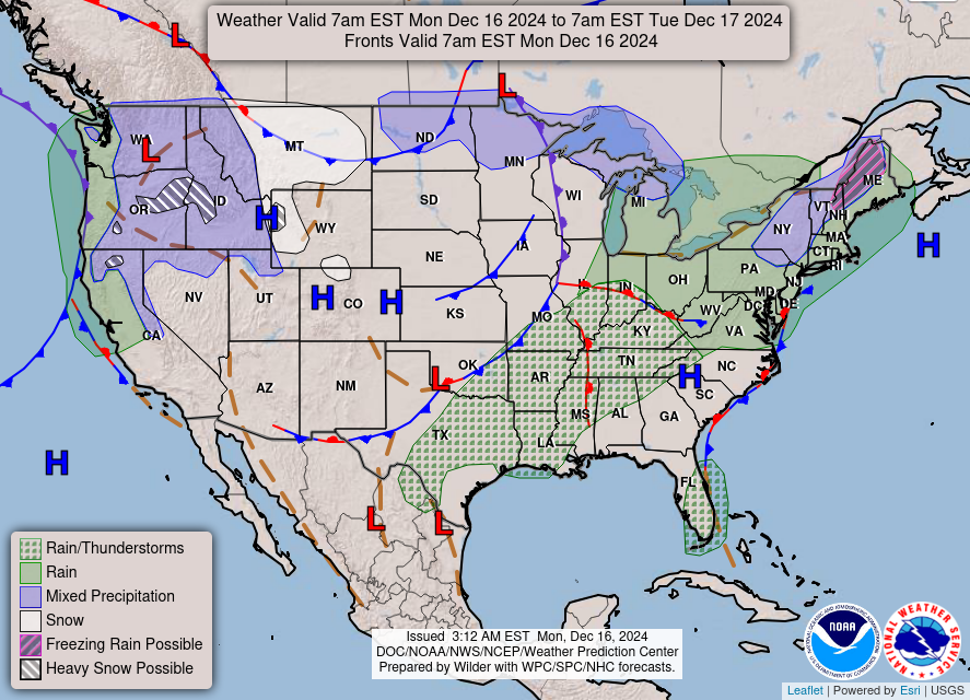
Good Monday morning, WABBLES! Active weather is the name of the game this week, with warmer temperatures and a dynamic atmosphere bringing more rain to our forecast. We’ll tough out a few more precipitating systems before things really start to cool down again near the end of the week, with nearly a 20-degree difference of our daily high temperatures from Monday to Friday. So keep those rainjackets out for just a little longer, because we’ll be trading them out for warm winter gear soon enough; we’ll go through all of it and more in today’s weather blog!
Today’s Forecast
We’re starting off the next several days with another wave of rainfall slated to enter the region within the next several hours. A surface boundary oriented southwest to northeast has sparked some rain showers and some scattered heavier downpours off to our west, and throughout our Monday will move into WABBLES, likely closer to the early afternoon. We aren’t expecting anything severe with this line of rainfall, however, some embedded pockets of heavier precipitation may put down a good amount of rain in a short amount of time for some isolated locations.
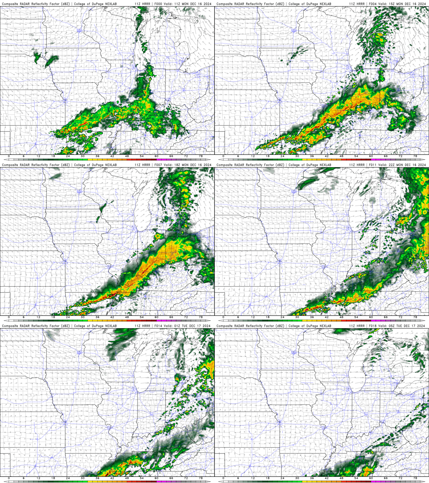
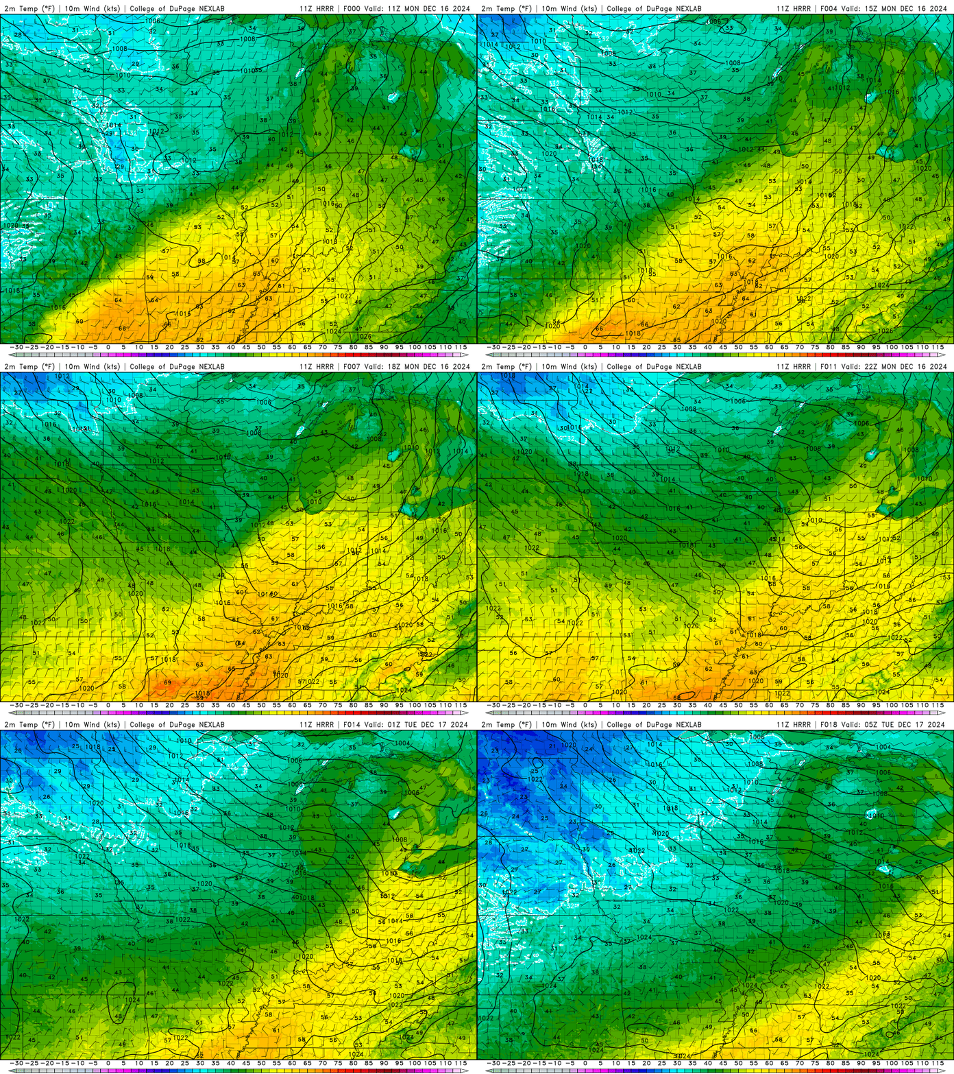
This system will be quick-moving and exit our area without much issue around sunset, though the weak cold front behind it will cool us down just a little bit for our daytime high temperatures on Tuesday. We’ll see highs closer to the mid-60s today knocked down into the mid-50s, but that’s nothing compared to how much cooler they’ll get by the end of the week across the region!
More Rain this Week?
You guessed it! We’ll have a very brief period of dry weather on Tuesday before more scattered showers return late Tuesday night into early Wednesday morning, making for a messy midweek system that’ll bring us wet conditions once again. Much like the system we’re expecting to see today, most of the precipitation will take the form of scattered showers with some embedded heavier downpours, though lightning and some gusty winds can’t be ruled out. Once again, nothing severe, but the cold front behind this wave of rain is a little stronger, so temperatures will take a quick plummet once the last of the system has moved out late Wednesday afternoon.
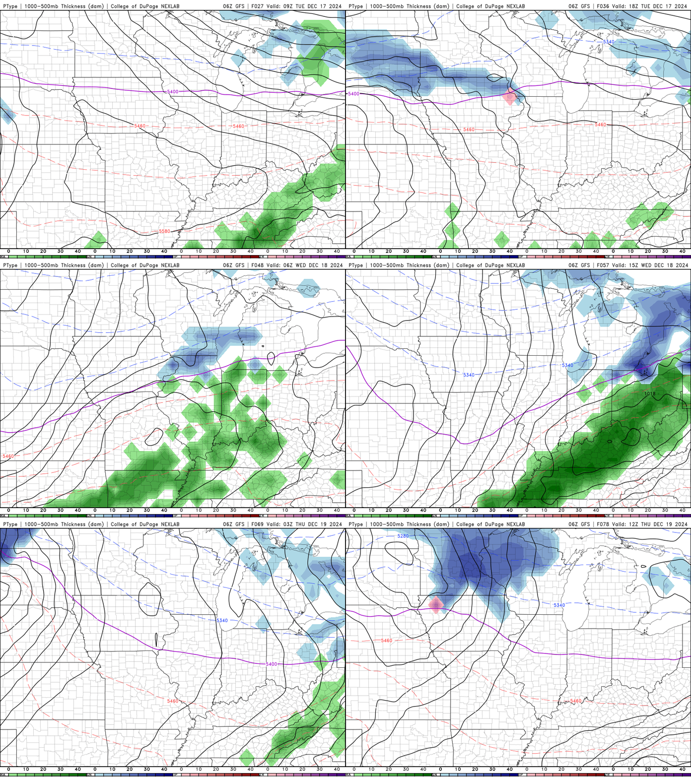
The good news is that once our Wednesday weather has moved out of WABBLES, we’ll stay dry through the rest of the week! High temperatures will drop down into the low-40s and upper-30s for most, but conditions will be relatively calmer across the board. So as I mentioned before, make sure you’re keeping those umbrellas and rainjackets out for a little while longer! You can swap them out for some mittens and a scarf by Friday, when we could see some early morning flurries gust in from the north as a result of our drastic dip in temperatures.
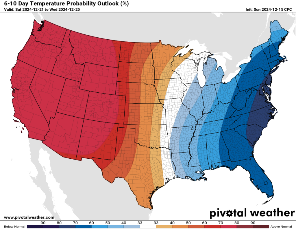
And, as a result of all these passing cold fronts, it should be no surprise that the Climate Prediction Center forecasts that WABBLES will be a bit below average when it comes to temperatures for the next week or so. Now that we’ve given you all the juicy info, it’s up to you to prepare accordingly! Stay dry, stay warm, and stay safe out there as we continue to approach the holidays. Give us a follow over on the Twitter page if you don’t already, as it’s a great way to stay in touch with us between blog posts, but we’ll be back later this week with all the most up-to-date info on your WABBLES weather forecast!
Take care out there y’all, and we’ll talk soon!


