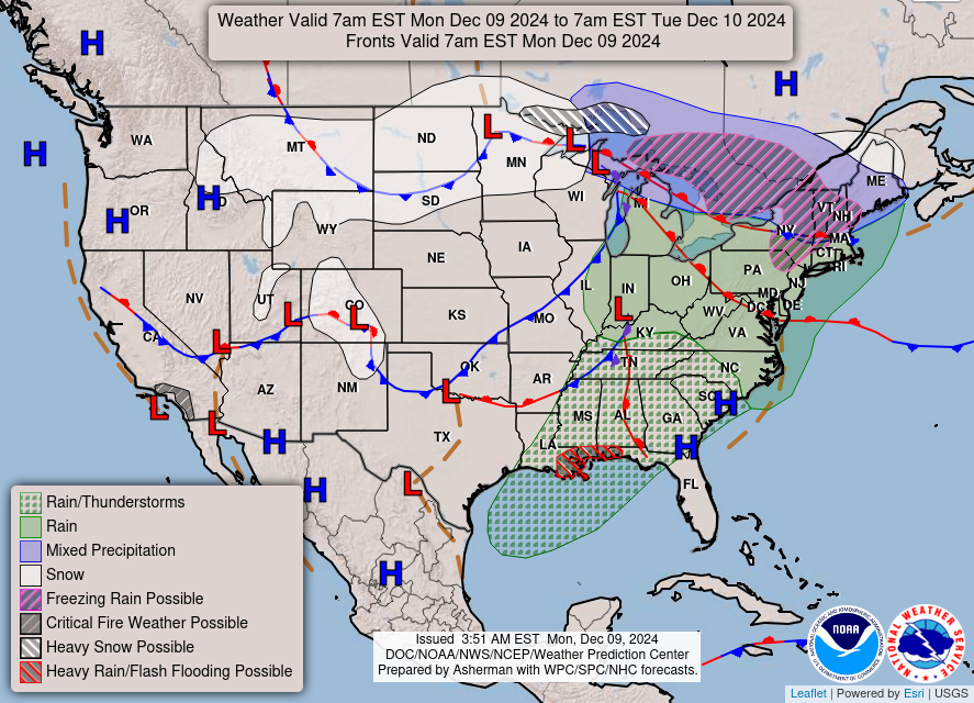
Good Monday morning, WABBLES! We’re in for a messy week of wintery weather as a few waves of rain and seasonably cold temperatures make their way through the region over the next several days. While our overnight rain has largely moved out of the area this morning, scattered showers and sprinkles may remain through this evening, when a passing potent cold front is expected to bring more consistent rainfall and some bitterly cold temperatures. And once this cold air has pushed down into WABBLES… maybe some light snow showers will return to the region before we warm back up to end the week! We’re breaking down all of the upcoming weather together in today’s weather blog!
Today’s Forecast
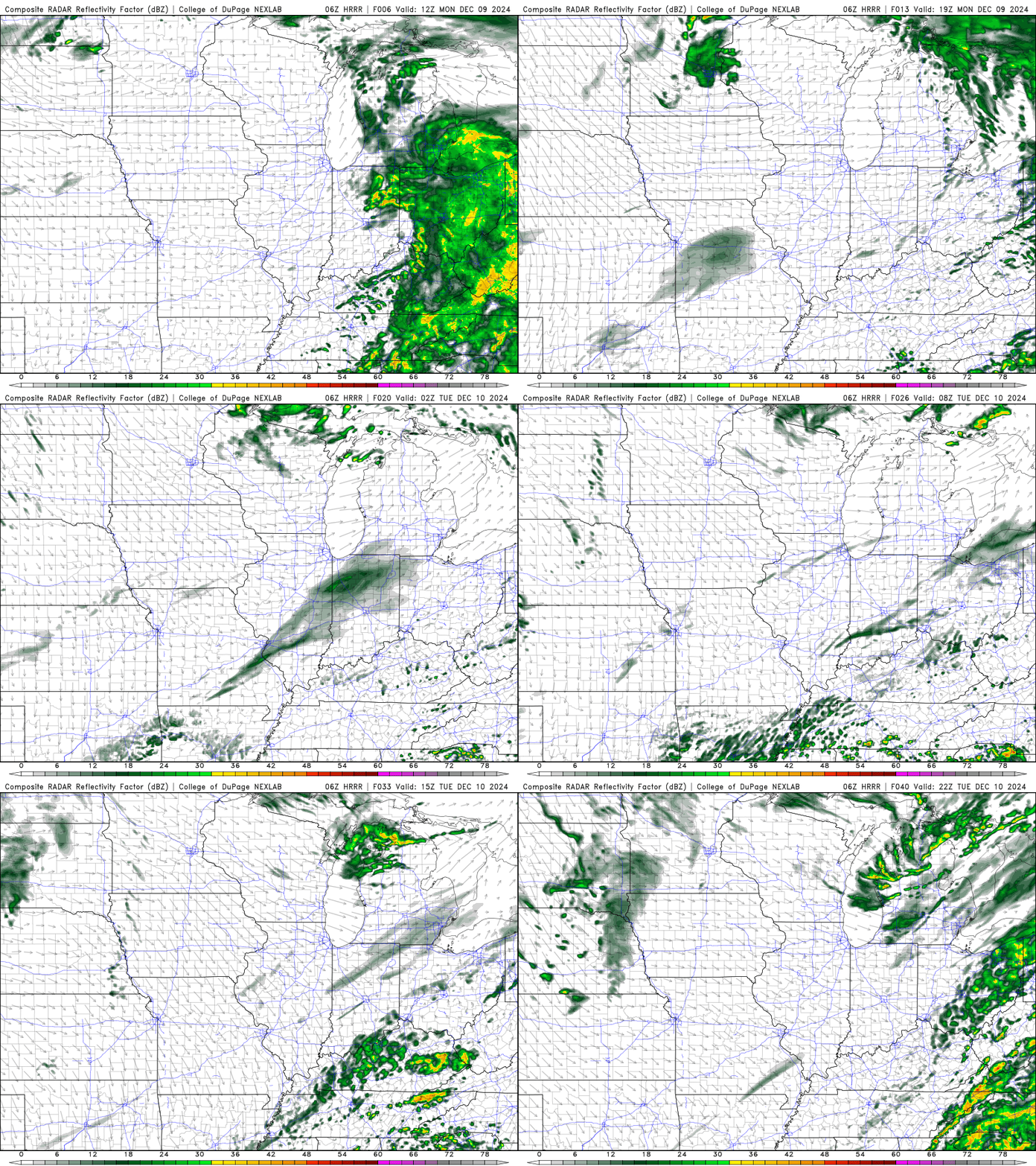
We’ve got quite a bit of activity lined up for the next several days, so let’s start small and keep away from the messy stuff by covering today’s forecast first. As you might already know, a passing warm front lifted north overnight to bring us some consistent widespread rainfall through early this morning, which has since tapered off and moved out of the WABBLES region. Our local atmosphere is still quite moist, however, so it’s possible that today and tonight a few scattered showers end up lingering in some places before our cold front moves in tomorrow night.
In the meantime, expect high temperatures to approach 60 degrees today as the last of the strong warm air advection out of the south keeps us moist and warm ahead of our upcoming frontal passage! Temperatures will dip into the upper 40s overnight, however, the real cooldown will come on Tuesday.
So… Messy Mixed Precip Possible this Week?
It’s looking more likely! We’ve got quite the saturated environment here locally, which has allowed us to see a lot of rainfall overnight last night and associated with the cold front that’ll move through tomorrow night. As it does so, those below-freezing temperatures may interact with some of that lingering moisture in the way of sleet or snow showers Tuesday night into Wednesday morning.
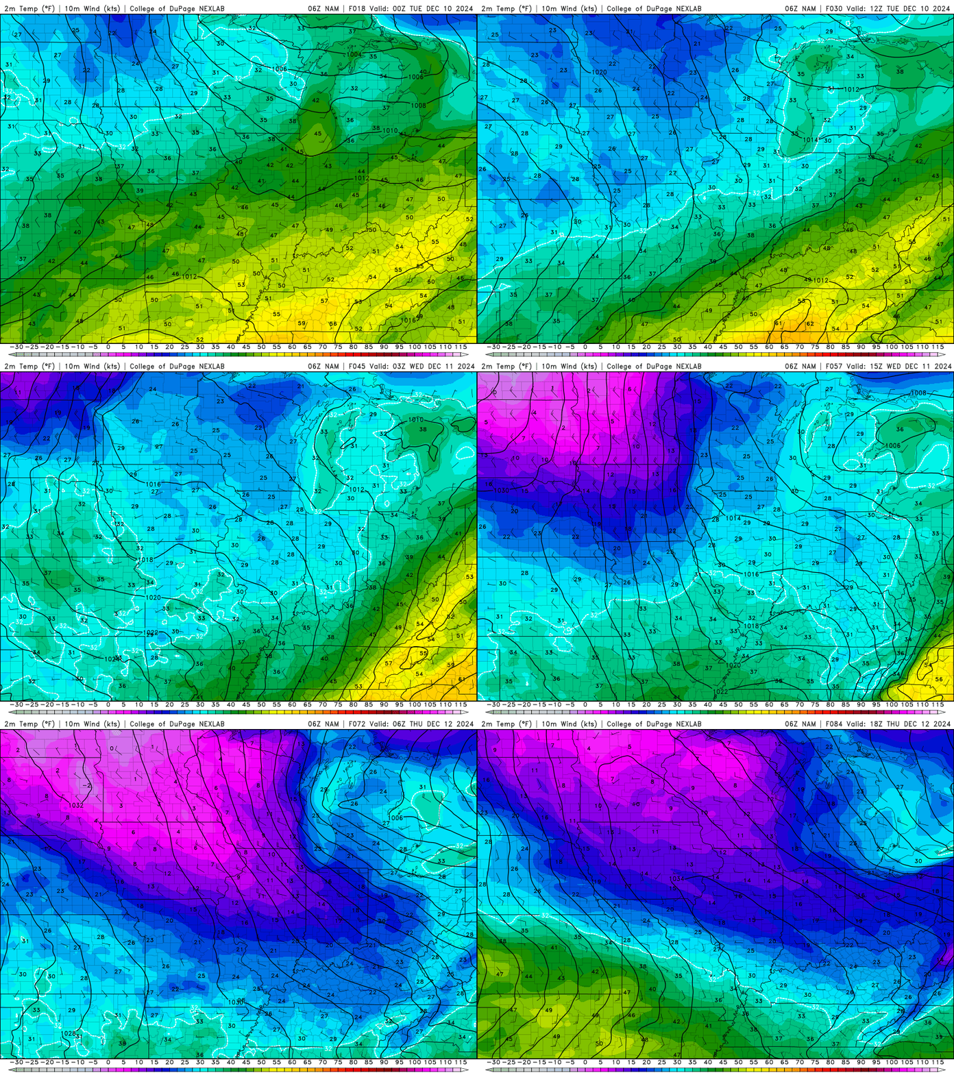
While most of the heavier precipitation will have pushed off to the east by the time stronger freezing temperatures have made their way into our region, a few lingering pockets of lift may be able to provide enough energy to get some snow showers off the ground late Wednesday morning.
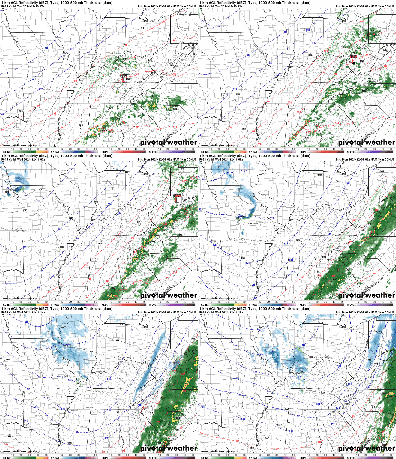
If some of us do end up seeing some wintery precip on Wednesday, it’s very likely that it won’t accumulate any more than a dusting on grass in some places. Temperatures will still be warmer at the surface, possibly above freezing, which will make it hard for any falling sleet or snow to stick. That’s very helpful for those of us who want to avoid a messy morning commute, but sorry to disappoint some of our long-time snow fans! We’ll definitely have some more opportunities for real measurable snow later this season, so don’t give up hope!
That’s about all we’ve got for you today, folks! We’ve had a bit of reprieve from the biting winter cold recently, so make sure you’re prepared to see those temperatures plummet back down below freezing this week and dress accordingly. Travel safe if you’re busy over these next few days, and if you end up seeing some snow showers on Wednesday, don’t forget to snap a pic and tag us in it on Twitter! We love getting our local weather reports from lovely WABBLES residents, and it does a great job of helping us narrow down exactly where our messy weather is happening in real-time.
Otherwise, stay tuned here on the blog for more updates on our forecast later this week, and stay safe out there! We’ll see you again soon!
