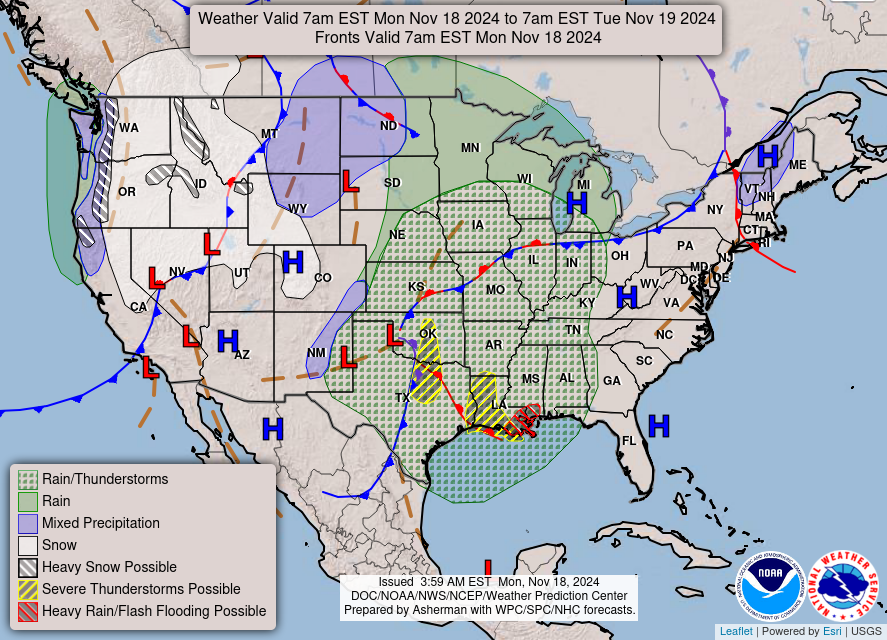
Good Monday morning, WABBLES! We’re back in the saddle again as yet another rainy weather system moves in early this week, bringing a blast of arctic air with it to remind us that winter is on the way. We’ll see a huge fluctuation in our high and low temperatures this week, so pull out those warm jackets and thick socks before you forget; you’re definitely going to need them. Stick around, because we’re going through all the details together in today’s weather blog!
Today’s Forecast
Today’s the last day we’ll see highs in the low-70s and dry conditions across WABBLES for the foreseeable future, so if you can, get out there and savor it. Scattered cloud cover and a light breeze will keep things comfortable but not too chilly before sundown; however, winds will pick up as we draw closer to midnight, hinting at the strong frontal system that’ll pass through in the early morning hours on Tuesday.
So What’s Up with the Rain?
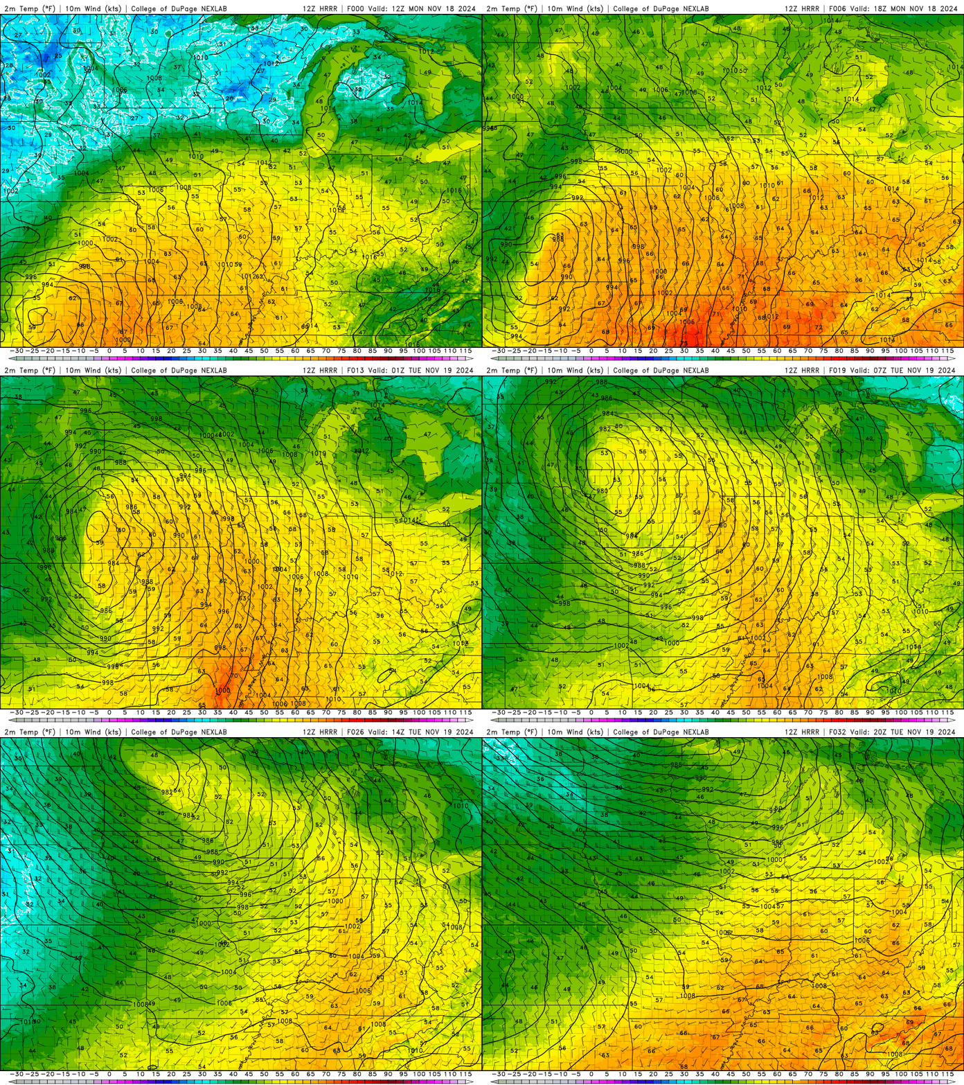
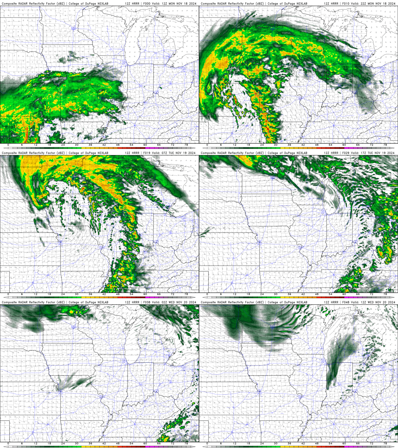
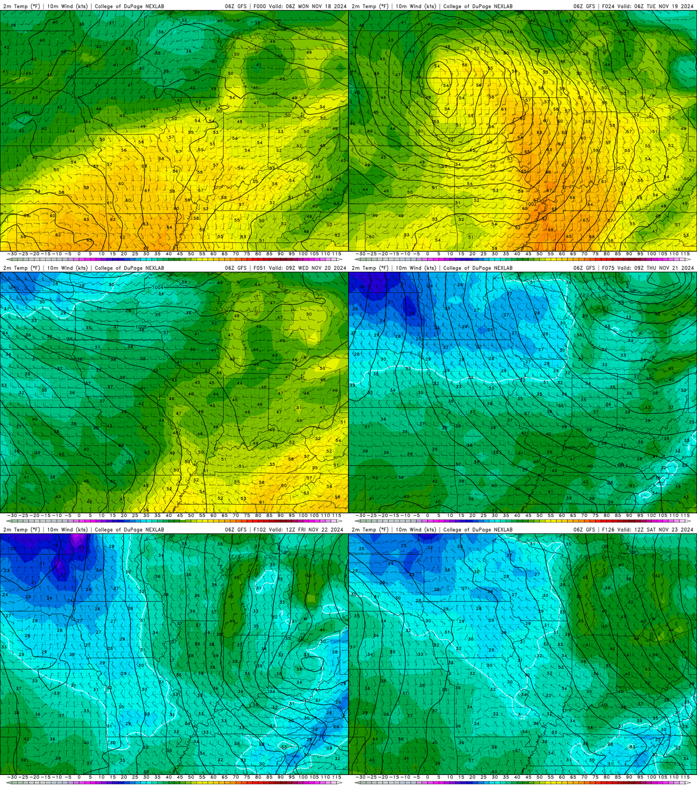
Good question! Here’s what we know: shortly after midnight tonight, a large cold front will push its way west to east across the WABBLES region, bringing with it a wave of rain. Scattered showers associated with the frontal passage could linger into the midday to early afternoon time period, but most everyone will be dry once again by sundown on Tuesday. The air behind the front, however, is going to be incredibly chilly! Following the rain, some of the coldest conditions we’ve seen so far this season will push in behind, driving our high temperatures down into the 40s and lows into the 30s for the rest of the week.
In fact, take a look at the below GIF to get a good idea at all that cold air we’re expecting to follow this system! There won’t be any moisture standing in its way, so a very crisp and dry cold will carry us through the rest of the week once all our rain has departed the area.
Yes, ladies and gentlemen, it’s time for that first cold snap of the year, and just in time for Thanksgiving! So pull out those winter coats, start tracking down those hats and gloves, and get into the winter spirit; it won’t be long now until we start getting an idea of when our first winter snow will arrive in WABBLES. But until then, stay tuned here to the blog and also to our Twitter page, where we work hard to keep you as updated and informed as possible about real-time weather conditions across the region!
We’ll see you again later this week; so take care and stay safe out there, everyone!
