Good Monday morning, WABBLES! We’re closing out the month of September with one last foggy start as the last of Helene’s moisture makes its way out of the region. But in the wake of last week, conditions will be downright pleasant compared to the tropical trouble we’ve seen here recently! Expect to see clearing skies and cooler temperatures as we foray into fall… and a relatively quiet weather pattern to boot. But how long will the calm last? And could we see more activity in the Atlantic next month? We’re breaking it down together in today’s weather blog!

Today’s Foggy Forecast
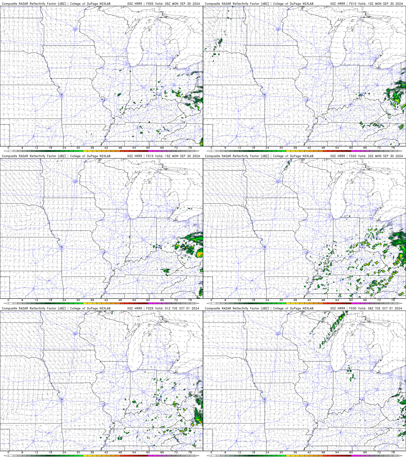
As mentioned previously, September’s chapter will close on a hazy note as most if not all of us WABBLERs will wake to scattered dense fog this morning as temperatures have approached the dew point overnight. However, most fog-related issues will be short-lived as we’re expecting the last of the low cloud cover to dissipate by late morning. We’ll warm up into the mid-70s later this afternoon with a small chance for scattered showers through the late afternoon, but skies clear and dry conditions return by sundown!

So What About October?
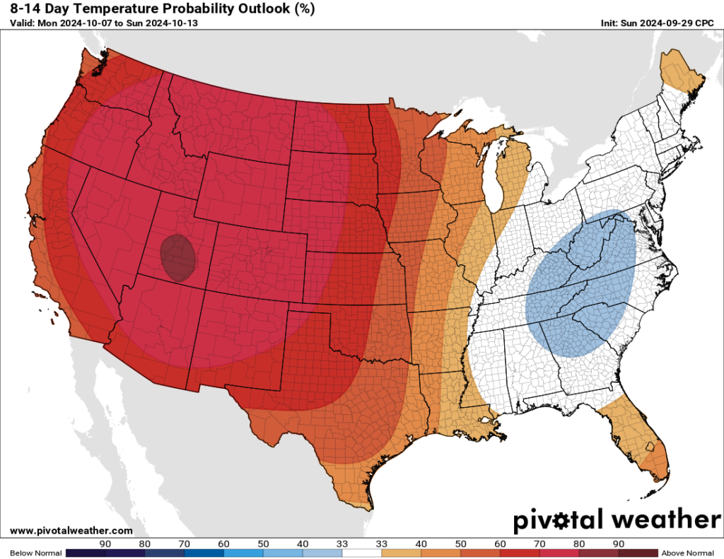
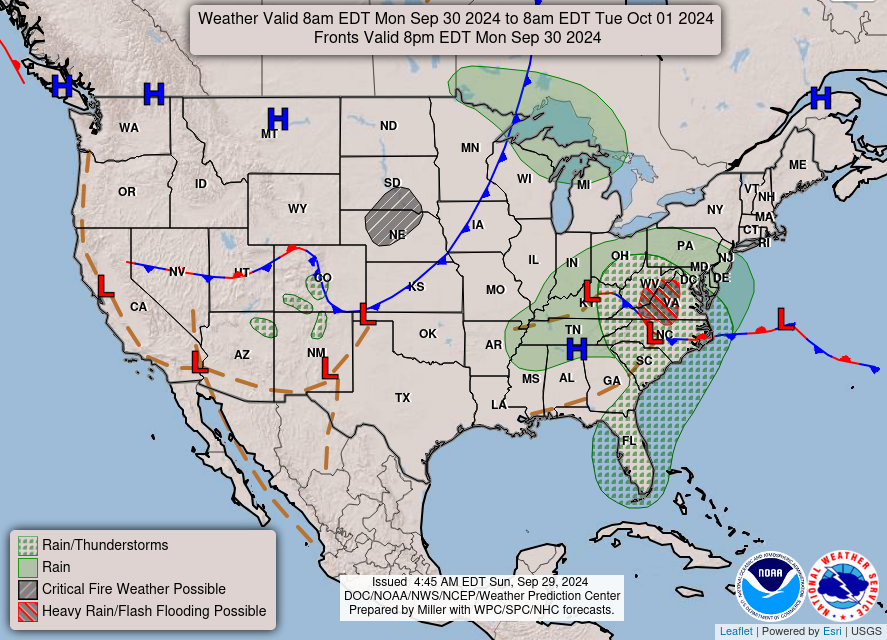
Great question! So far, the start of October seems to be a breath of fresh air compared to what we’ve been through lately. Expect cooler temperatures to move in behind a meandering cold front Tuesday night (with some possible light showers associated), but for the rest of the week, we’ll be passing the time with blue skies and high temperatures in the mid-to-high-70s! In fact, the Climate Prediction Center believes we’ll stay on this cooler trend through the next two weeks, as our area will linger around average or cooler conditions while the west heats up.

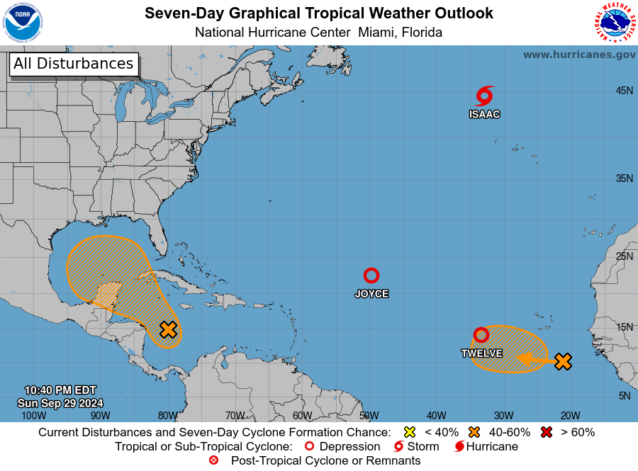
In terms of precipitation, our mid and upper-level weather pattern currently suggests that we won’t see any large-scale weather systems for a good chunk of time. We’ll have to keep an eye on the tropics, however, as both the main development region and the Gulf of Mexico are staying primed for activity, and it won’t take much for us to see some more tropical rain if another system forms and moves onshore in the south.

That’s about all we’ve got for you today, folks! Make sure to tune back in later this week for more installments of the blog, and give us a follow over on the Twitter page if you haven’t already. We’re always there, making sure you get the most accurate weather information as it happens. Until we see you again, take care, enjoy your week, and stay safe out there!


