")
Good Monday morning, WABBLES! The dry spell is officially over; this week, rain chances return for just about everyone in the region. After a long period of moderate to severe drought for most of our area, the incoming precipitation should serve as a massive help for our heaviest-impacted communities- however, with opportunities to see rain every single day this week, some outdoor activities are likely to see delays until conditions clear up. Is our summer dry spell truly over? And could we see any dangerous storms this week with all this rain? We’re going through everything together in today’s weather blog!

Today’s Forecast
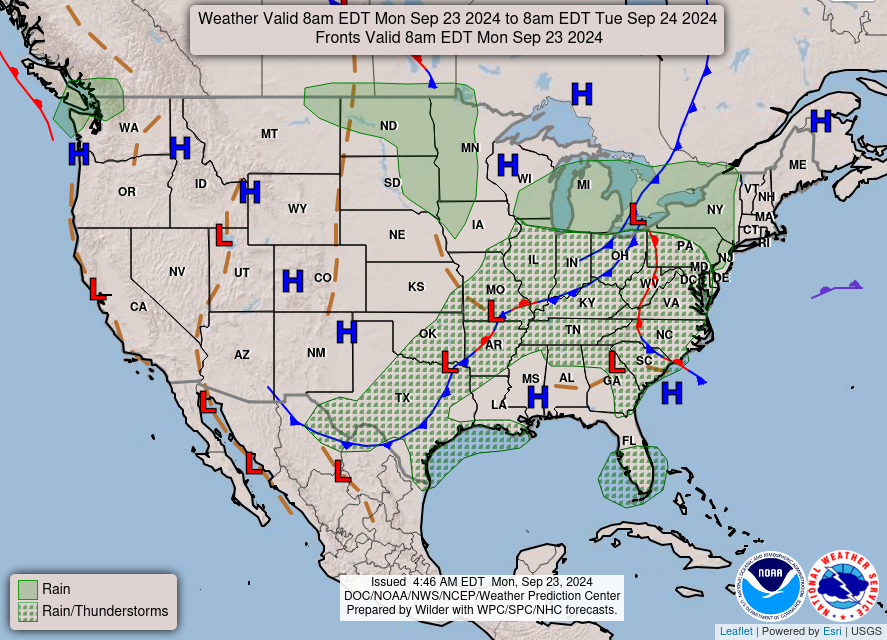
We’re kicking off the week with- you guessed it- some rain chances on this fine Monday! While we’ve largely dodged our morning showers already, we’re expecting a larger complex of showers and some embedded storms to move in later this afternoon both from the west and the south. As with many of the precipitation opportunities this week, it’s likely that some heavier downpours and frequent lightning will occur with some of these larger groupings of rain, but most, if not all are expected to stay sub-severe.
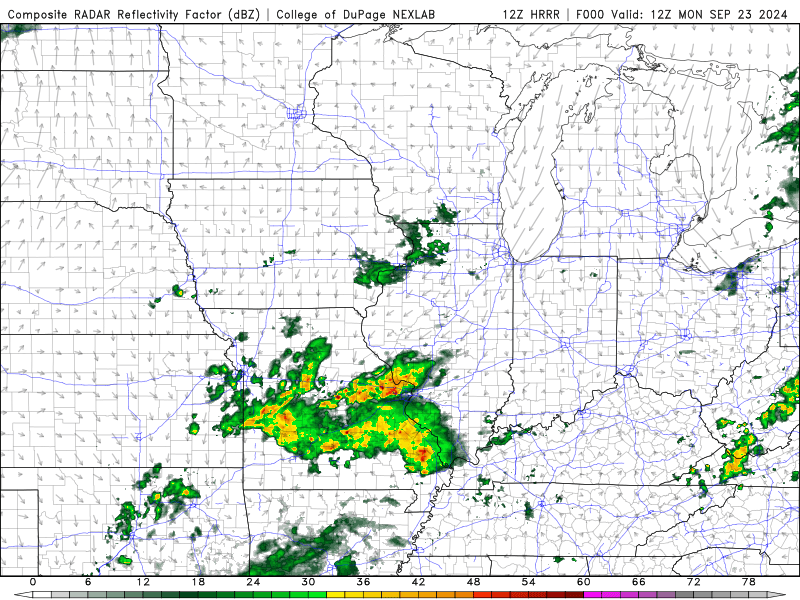
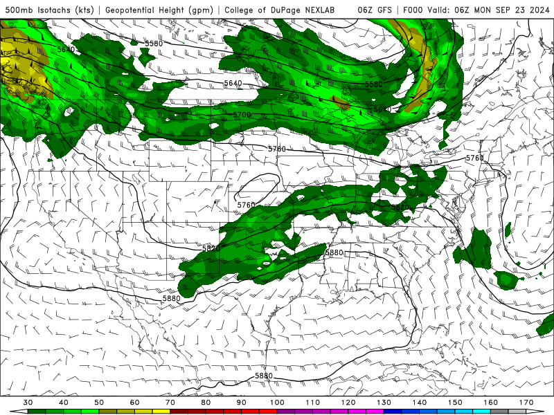
Most of this rain is associated with a digging trough currently ejecting much stronger winds in the upper levels right over our WABBLES region, allowing for increased shower and storm development across the entire Ohio River Valley and up into a few Midwest states. And while this trough will keep our temperatures on the decline throughout the week, even once its associated cold front moves through in a day or two… the fun doesn’t end there, as it looks like a tropical system moving onshore from the Gulf Coast could bring even more rain to the area over the weekend!
Dry Spell Ends with Tropical Moisture?
That’s the idea! Or at least what we think could happen by the end of the week, as our longer-range models have begun to hint that we could see another tropical system or even a possible hurricane make landfall in the US Thursday night or Friday morning. Something that we don’t know, however, is how that tropical system will interact with our already unstable upper-air setup over most of our WABBLES region.
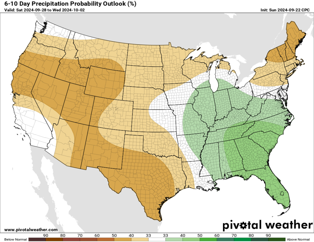
While spotty showers and storms will rule each day through about mid-week, more consistent rainfall will be possible with a landfalling tropical system; and depending on when and where it does so, we could potentially see some stronger storms or even just long stints of moderate to heavy downpours to ring in the weekend. Regardless, the Climate Prediction Center believes the next week or so in WABBLES will look a little wetter than usual, though the rest of the US seems to be atypically dry.
Though it’s a little too difficult now to nail down exactly who and where will see the bulk of the rain this week, it’ll serve you well to keep an umbrella or rainjacket on-hand if you’re planning to spend any time outdoors and want to stay dry. We’ll have the latest on the end-of-the-week forecast here again this Wednesday, so make sure to check back in here to catch the new blog posts as they come out! And if you’re a fan of more frequent weather updates, make sure to go check us out on Twitter; rain or shine, wet or dry, we keep you in the loop with all the latest forecast news in real-time.
That’s all we’ve got for you today, WABBLES! Be safe, take care out there, and stay dry!