

")

After a stormy midweek throughout WABBLES, we’ve seen some drier weather head in our direction. However, that same front may not be finished with us yet as we head into the weekend
Into the Weekend: Friday and Friday Night
Before our rain chances return, however, things are looking rather nice!

Things are looking sunny as high pressure temporarily settles into the region from the northwest. This looks to bring us some slightly more comfortable air in conjunction with the sunshine throughout the region.
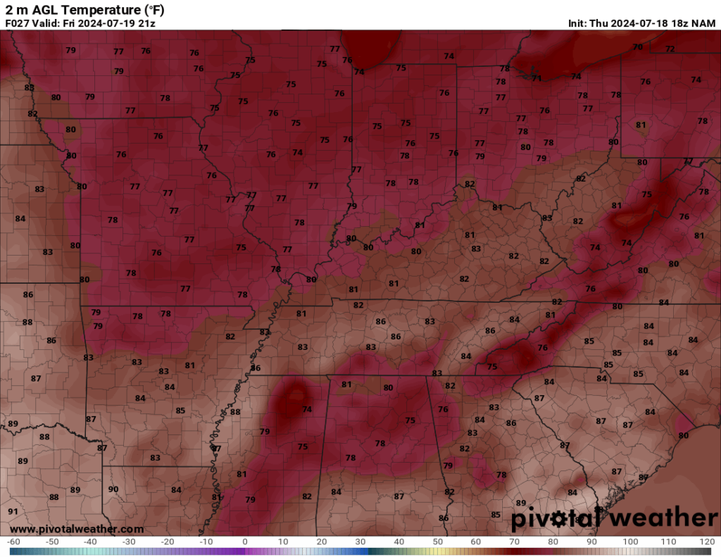
I mean, we’re talking low humidity by mid-late July standards, so we’ll still feel it as temperatures settle into the middle 80s for daytime highs. You can put the oars up for now, though, as it won’t have that “I wish I had gills” feeling out there.

Overnight, we’ll try to see a few clouds sneak into the picture, but for the most part, it’ll be a nice July night as lows are back into the middle 60s.
Ladies and Gentlemen, The Weekend

Heading into the weekend, our attention turns back to the frontal boundary that brought some stormy weather to us earlier this week. It’s baaaaaaaaaaack. As this boundary continues to wobble back into WABBLES, we’ll watch for an increase in spotty storm chances as we head into the day on Saturday.
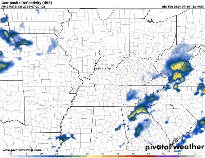
As is typical in July, as temperatures head into the middle and upper 80s, we’ll see scattered showers and storms bubble up into the afternoon hours. Not everyone will see one, but those that do can expect some heavy rain and potentially gusty winds at times as we head through the afternoon and evening hours. Some of those could linger into the overnight hours, but lows only make it into the middle and upper 60s.
Clouds may try to keep us a bit cooler into the day on Sunday, with highs in the middle 80s. However, we’ll still be dealing with an increase in showers and thunderstorms as we head through the day with this front stalled out in the region.
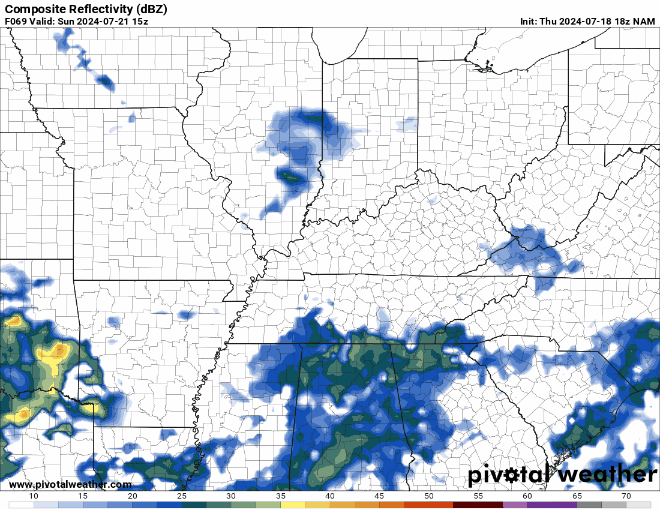
Some storms may again contain some gusty winds and heavy rain, but widespread severe issues are not expected. Yet again, some storms could linger into the overnight hours with those lows back in the lower to middle 60s.
Looking Ahead
The potential remains for more showers and storms to work through the region as we head through next week, thanks to this stubborn frontal boundary that won’t want to work on out of the region.
The positive to this is not only do we need some rain around here, but we could also use some cooler temperatures. The clouds and showers we have in place should help us keep temperatures out of the 90s as we head through next week. However, we’ll still have to deal with intermittent showers and storms.
It’s looking like another series of soakers as we head through Monday and Wednesday. It won’t rain the whole time, but we could see some showers and storms at any point. The pattern doesn’t seem to favor widespread severe weather moving toward WABBLES, but I can’t rule out some brief gusty winds to go along with the heavy rain.
Outside of storms, things stay seasonable, but not extreme. We’re back in the lower to middle 80s for daytime highs…just be prepared for the mugginess to stay firmly in place as we head through next week.
That’s it for me for now! You can always keep up with the latest on all of our social media platforms. Have a tremendous day and a great weekend!