After a warm and stormy start to the work week, we’re finishing it out on an absolutely exquisite note throughout WABBLES. Yesterday’s windy weather is at bay as our pleasant pattern continues.
Into the Weekend: Friday and Friday Night
This is the type of weather you absolutely cannot beat in early June.

We’ve got high pressure in place over the region following yesterday’s frontal boundary switching our winds around to the north and west. That high pressure equals sinking air…which equals plenty of sunshine.

With northwesterly winds in place, we’ll continue to see the drier air mass in place as well. This means our highs will only top out in the upper 70s and lower 80s…with low humidity! With the dry air overnight and the high pressure in place, we should see clear skies as lows fall into the upper 50s.
Weekend Forecast: Saturday and Sunday
We’ll see a slight change in the pattern as we head deeper into the weekend. A low pressure that’s been spinning well to our north may start to interact with moisture coming in from our south as high pressure scoots off to the east. This could bring us a few spotty showers by Saturday and Sunday. But this isn’t all bad news!
I think we’ll start Saturday off with a mix of sun and clouds, but go mostly cloudy as we head into the afternoon and evening hours ahead of a weak cold front. This thing won’t have a ton of moisture to work with, so we’re looking at just a couple of scattered showers pushing through during the afternoon. Certainly no washout.
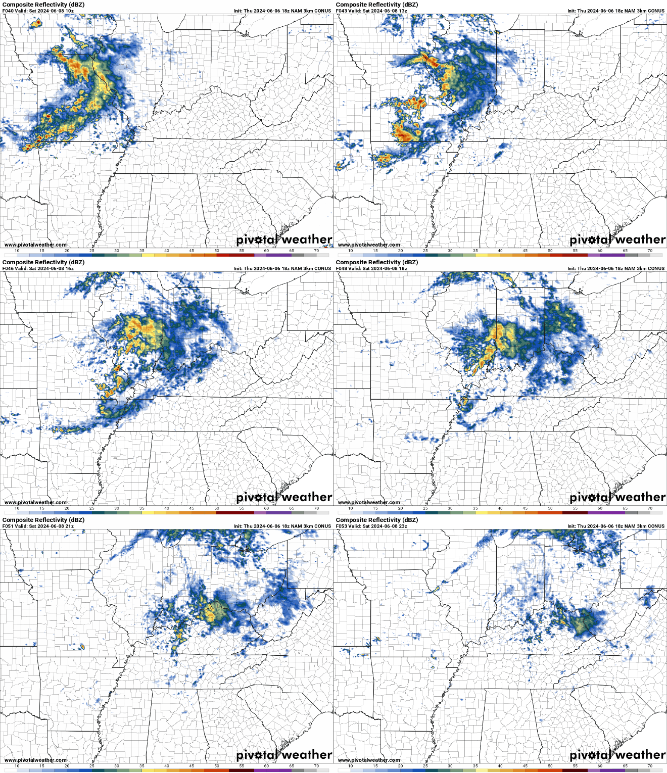
Outside of showers, we remain mostly cloudy with highs still making it to near 80º or so. Some showers could linger into the overnight as lows are back into a more muggy mid 60s range.
A few more showers look possible as we head into the day on Sunday with another weak disturbance pushing through the region. However, nothing looks too widespread, even into the afternoon. Otherwise, skies stay partly cloudy as we make it back to around 80º or so. Clearing skies overnight should keep lows back around 60º or so as we head past dark.
Looking Pleasant Past the Weekend
After the scattered weekend showers, sunshine looks to return to the region as high pressure builds back in to start the work week. However, this high pressure looks different…because it looks like it gets warm…
The heat won’t show up right away yet, though, with pleasant weather taking over first. Plenty of sunshine looks possible as we head into the day on Monday. Highs are back into the middle and upper 70s with pleasant humidity. That dry air should keep us nice overnight, with clear skies and lows in the upper 50s or so.
We slowly warm up through the 80s as we head into Tuesday and Wednesday with plenty of sunshine in place through the afternoon. Overnight lows are back in the lower 60s.
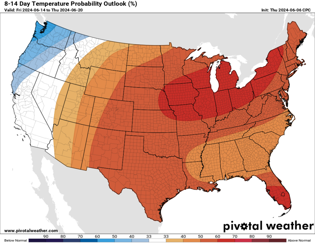
As this high pressure starts to scoot east, we’ll start to see temperatures making a run back into the middle 80s or even higher as our rain chances look to stay low. CPC’s 8-14 day outlook taking us through the middle of the month indicates that warmer than normal temperatures are heading our way as we head into the second half of the month.
So, it looks like summer’s not too far away now!
That’s it for me for now! You can always keep up with the latest on all of our social media platforms. Have a tremendous day and a great weekend!

