

")

June will be upon us this weekend and it looks like Mother Nature will finally bring summer weather to WABBLES as meteorological summer takes over.
Drying Out: Friday and Friday Night
We’ve spent the month of May under the influence of various and sundry upper level lows that have brought us seemingly unceasing showers and thunderstorms. And it looks like we’ll have to deal with a few more during the day today.

Following the chase for a strong storm or two early this morning, scattered showers and perhaps a few thunderstorms will continue to roam the region as we head through the afternoon hours. If you’re not catching rain, the likelihood is that things will be partly to mostly cloudy during the afternoon.
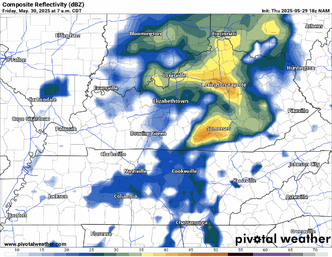
Either way, the last Friday in May likely doesn’t look like a pool day, as highs only make it back into the middle 70s. Showers should start to wane overnight, but lows will start to settle back into a comfortable range, back into the upper 50s.
Mostly Staying That Way: Saturday and Sunday
We’ll get Friday’s system out of here in a timely manner, which means we should be in pretty good shape as we head into the day on Saturday.

Now, this isn’t necessarily a high pressure situation where we’re locked into bright blue skies, but rather a situation where we’re likely to be dealing with clouds and perhaps a stray shower or two as we’re stuck in a more northwest flow pattern.
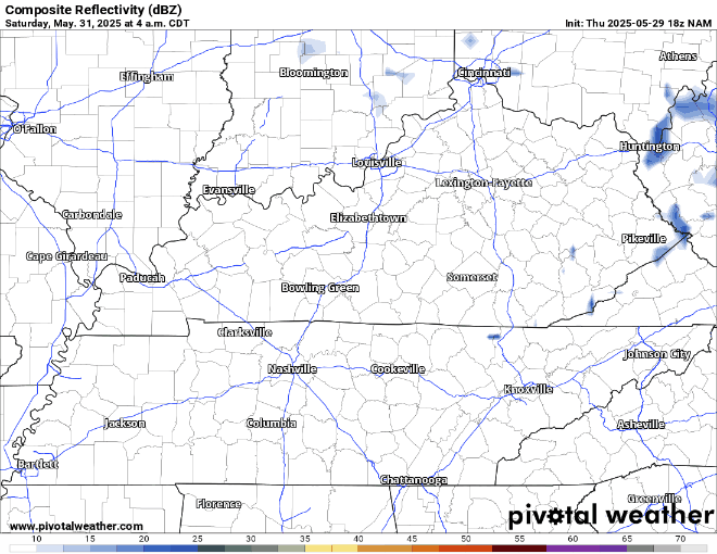
That pattern will continue to keep temperatures near or just below average as we close out the month, but it could also lead to a few more clouds on Saturday afternoon. Maybe even the aforementioned shower, but it shouldn’t hurt temperatures too much, with highs still making it into the upper 70s to around 80º or so.
Any showers should diminish overnight as lows fall back into the upper 50s to around 60º.
We’re looking at more of the same as we head into Sunday, though the chance for showers may tick up a bit.

We await another spoke of energy swirling around that big low pressure off to our northeast that may try to spark a few showers in the region as we head into Sunday afternoon. Though, some of the latest data keeps these showers to our south.
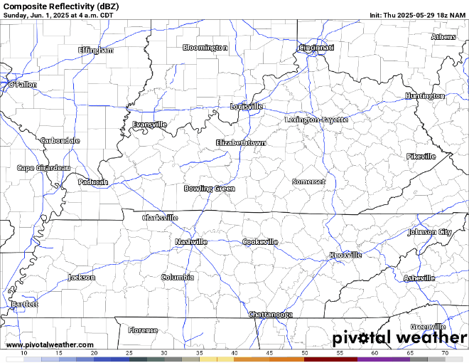
By no means will this be a washout or anything of the sort, but if you have outdoor plans, have that backup ready to go if you need to run inside.

Temperatures should be comparable to Saturday, with highs peaking right around 80º or so. Showers should diminish overnight as high pressure starts to move back in, lows still drop near 60º.
New Pattern, Who Dis?: Into Next Week
After a week-plus of below average temperatures and nearly ubiquitous overcast, the sun looks to finally make its triumphant return as we head into the first full week of June.

This is all thanks to the latest upper low to plague us this May finally pushes off to the east, replaced by a large dome of high pressure across a ton of real estate in the nation’s mid-section.
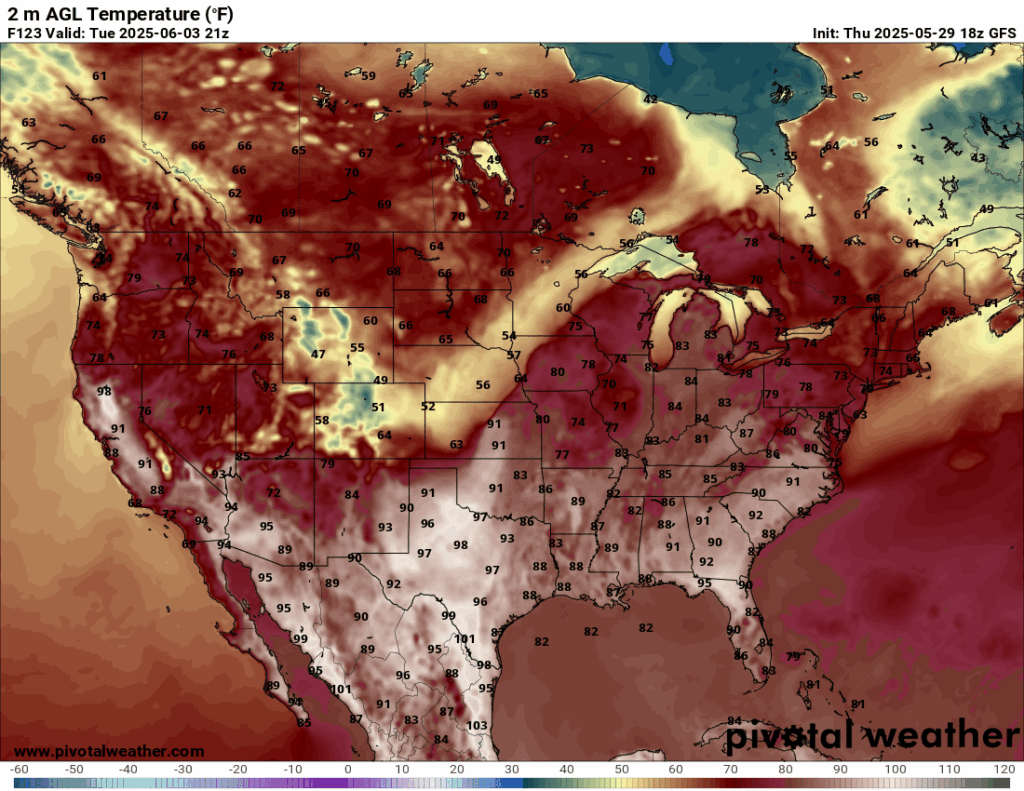
For us, this means the sunshine is back, as are southerly winds. In short…it’s getting warm. Monday starts pleasant enough as highs climb back firmly above the 80º mark into the lower 80s as sunshine dominates the daytime hours. Overnight lows are back into the lower 60s. Pool weather returns after that.

The core of the high pressure starts to shift to the east during the day on Tuesday, which will allow southerly winds on the back side of the high to really boost temperatures…and humidity levels.
Highs by Tuesday and Wednesday finally make it up to anticipated June levels, with highs surging up into the middle and potentially upper 80s!

The pattern continues to suggest we stay mostly dry as we head through the week, but I suspect we’ll be watching out for the return of some showers and storms as we head toward the middle and end of next week. Something we’ll be keeping a close eye on!
That’s it for me for now! You can always keep up with the latest on all of our social media platforms. Have a tremendous day and a great weekend!