

")

Feels more like summer around WABBLES thanks to strong low pressure bringing darn near hot weather into the region. Combined that with a cold front moving in and you have a recipe for strong to severe thunderstorms.
Greatest threat: Friday and Friday Night
We’ve been watching the potential for strong to severe thunderstorms to move toward the region for days, and it appears today is the peak of this week’s threat.

It looks like storms will be around this morning as we continue to watch a weaker atmospheric ripple push on through the region. While this will at least somewhat impede our destabilization early, it’s likely we’ll break out into sunshine as we head into the mid-morning and afternoon hours…just building up storm fuel. Highs will get up into the upper 80s again tomorrow with summer-like humidity values. It will feel like late June instead of mid-May.
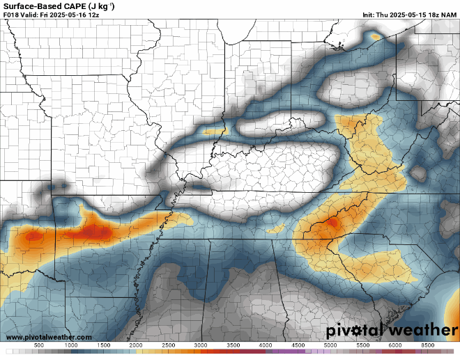
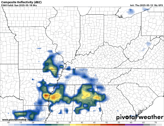
Once that storm fuel builds, we’ll watch the cold front start to push in from the west. As it does, it looks to begin developing individual cells across parts of Missouri, Southern Illinois, and Western Kentucky.
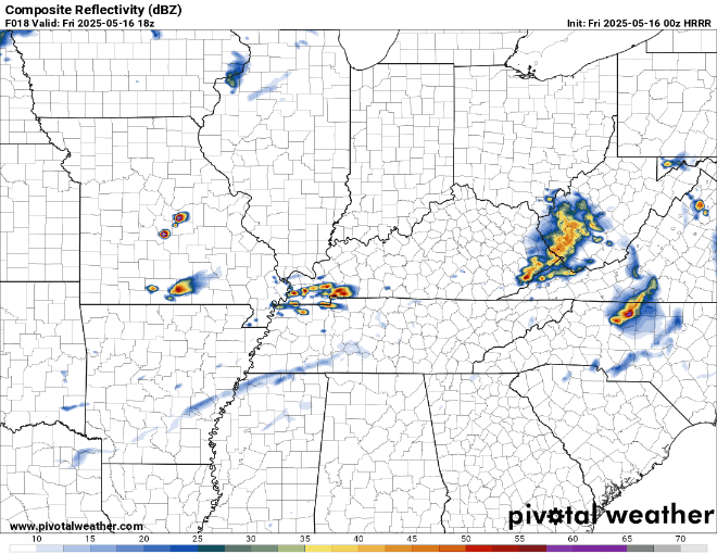
As these cells first develop, the greatest threats will be large to very large hail (1-2″ in diameter…quarter to egg size), and the potential for tornadoes. Should any storms stay isolated and out on their own, strong tornadoes will be possible. Please remember that overall, the statistical likelihood of your house specifically getting hit by a tornado is quite small, but we have to pay very close attention to where these storms are going.
As storms continue to develop upscale, the likelihood is that they will begin to congeal into a line as we head through the evening hours, this is where the threat would begin to transition to more of a damaging straight-line wind threat, with gusts of 60-75 MPH possible. While not a tornado, this kind of wind can still do widespread damage! Especially as we have a full canopy of leaves on the trees.
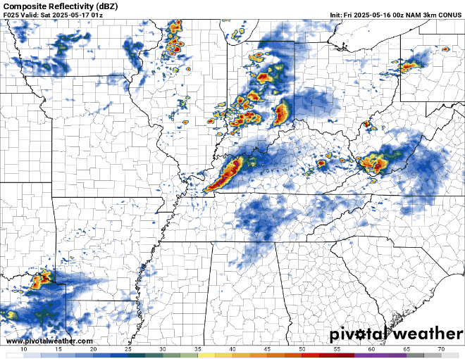
So, to recap: storms will be possible during the morning hours. Severe threat with those is lower, but hail would be the main threat along with perhaps a brief tornado. The atmosphere recharges during the afternoon as rotating supercells blossom to the west. The main threats with those will be the potential for large to very large hail and tornadoes, some of which could be strong. Storms may try to congeal into one or more lines of storms later into the evening where damaging to destructive winds in excess of 65-75 MPH will be possible alongside lower threats for large hail and embedded tornadoes.
Everyone needs to stay weather aware through the day and into the nighttime hours, so keep up with the latest on all of our social media platforms. Make sure that all electronics are fully charged and ready to go in case you lose power as these storms roll through.
Heading into the overnight, things should calm down as we head later in the night as lows fall back into the muggy 60s.
Quieter Weekend: Saturday and Sunday
Things finally look to calm back down just in time for the weekend.

Clouds will likely hang around a bit as we try to dry things out on the back side of our cold front.
The front will usher in slightly drier air, but the cold front doesn’t look very cold. As sunshine breaks back out, we should be back into the middle 80s for daytime highs. Partly cloudy skies continue overnight, but lows stay muggy, only into the middle 60s.
We may try to bring some showers back as a weak disturbance pushes in later into the day on Sunday.

I think the start of the day will be mild and muggy, but dry as you head out to early service. Brief high pressure will sneak back in as we head into the afternoon, which should help highs get back up into the lower 80s. As they do, however, we’ll bring a couple of spotty showers/storms back to the forecast.
Not expecting a widespread storminess, but have a backup plan if you have outdoor plans during the afternoon. We’ll keep an eye upstream for the potential for more showers and storms as we head into the overnight hours. Lows are back into the middle 60s.
Not Finished Yet: Into Next Week
After a mostly quiet weekend, we’re headed back into a late spring/early summer pattern to begin the week.

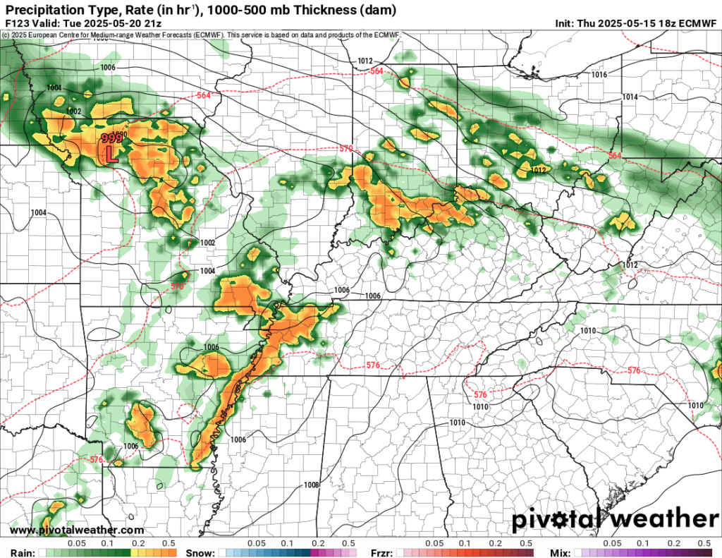
Showers and storms may be around with us during the day on Monday as highs are back in the lower 80s. Organization is not expected, but some heavy rain may occur. More of the same on Tuesday before we look back out to the west at yet another potential for storms…some of which could be strong.
While the signal is there for more storminess, there are still plenty more questions than answers regarding this setup, so check back with us often. Beyond that, it looks like we’ll trend a bit cooler as we head toward the end of the month.
That’s it for me for now! You can always keep up with the latest on all of our social media platforms. Have a tremendous day and a great weekend!