

")

After another variable work week around WABBLES, we’re finally clearing the showers out of there as we head into Mother’s Day weekend.
Another cut-off low: Friday and Friday Night
Cut-off low pressure systems have been the name of the game so far in May, bringing us scattered showers and thunderstorms to the region, and lo and behold, here we have been again.

Thankfully, our latest cold front continues to drop into the region, which should try to shove our latest low back to the south and should try to take the clouds and showers back with it.
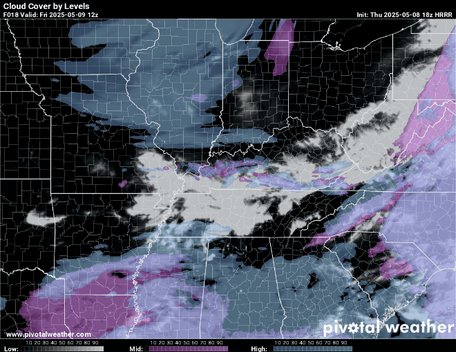
I can’t rule out some showers, especially early in the day, but I do think things will trend drier the deeper we go into Friday. Perhaps a shower hanging on right on the border and further south. Otherwise, things will be nice and comfortable, with highs back in the lower 70s.
Mother’s Day weekend Saturday and Sunday
With any luck, it looks like we may be able to get at least part of Mother’s Day weekend in dry as our low gets shoved back to the south.
Saturday looks to be the pick of the weekend, as it looks right now. Our frontal boundary may wobble around on or just south of the Kentucky/Tennessee border during the day. That should keep us mostly dry, but a shower or two can’t be completely ruled out.
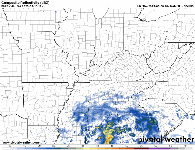
Thunderstorms aren’t expected, but some showers are on the table if you have outdoor plans during the day. Highs stay back in the upper 60s and lower 70s during the day. Scattered clouds continue overnight as lows are back in the 50s.
Mother’s Day itself could present a few more scattered showers returning to the region as our low starts to pivot back to the north. Either way, Sunday does not look like a washout by any means.
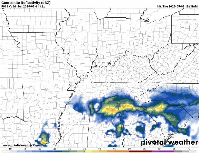
Some scattered showers will be around on an otherwise partly cloudy day as highs get back up into the middle and upper 70s during the daytime hours. Just make sure you do have a backup plan if you’re celebrating mom outdoors!
Some showers may linger into the overnight as clouds continue to thicken. Overnight lows look to only settle back into the upper 50s to near 60º or so.
Warmer and Unsettled: Into Next Week
Our old friend the cut-off low looks to pivot its way back into the region as we head through the early parts of next week, which should bring showers on back to the region as next week begins.
Temperatures will continue to warm when it’s not raining as highs pull back up into the middle 70s. Scattered showers will continue as we head into the overnights, with lows only near 60º or so. Some of those could continue into Tuesday as well as the low continues to push northeast.

Highs look to continue warming into the 80s as we may get a brief break between systems toward the middle of the week as a ridge of high pressure builds in. However, guidance continues to hint at the potential for showers and thunderstorms perhaps making a return if not late next week, then into next weekend. We’ll have to keep an eye on those.
That’s it for me for now! You can always keep up with the latest on all of our social media platforms. Have a tremendous day and a great weekend!