

")

We are quickly approaching Easter Weekend, WABBLES. And, especially when Easter falls in mid-April, we’re usually having to dodge showers and storms. This year is no exception.
Windy and Warm: Friday and Friday Night
The good news is that our Friday looks mostly dry as our next weathermaker starts to gather out to the west.

We’re going to be on the other side of a warm front, which should introduce gusty south winds back to the region.

Even with clouds pushing into the region, we’ll keep highs on the very warm side as those southerly winds move warm and moist air into the area.
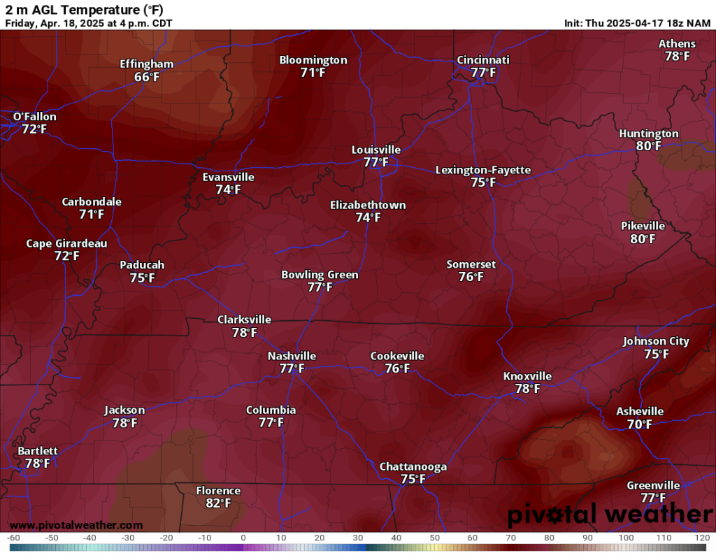
This should help boost highs up into the upper 70s and lower 80s during the afternoon as winds gust upwards of 30-40 mph at times.
While we’ll have some storm fuel in place, it is likely that we won’t see storms during the day or even into the evening because we won’t really have a trigger to fire storms. It’s likely that will continue into the overnight. Southerly winds will keep us mild overnight, with lows only in the lower 60s.
Complicated Easter Weekend: Saturday and Sunday
As we head into the holy weekend, the models have been struggling to lock onto a solution with these frontal boundaries.

Essentially, we’re going to be watching to see how two low pressure systems on different branches of the jet stream interact and phase as we work through the weekend. Friday’s front will likely stall out off to our north and west for the day on Saturday.
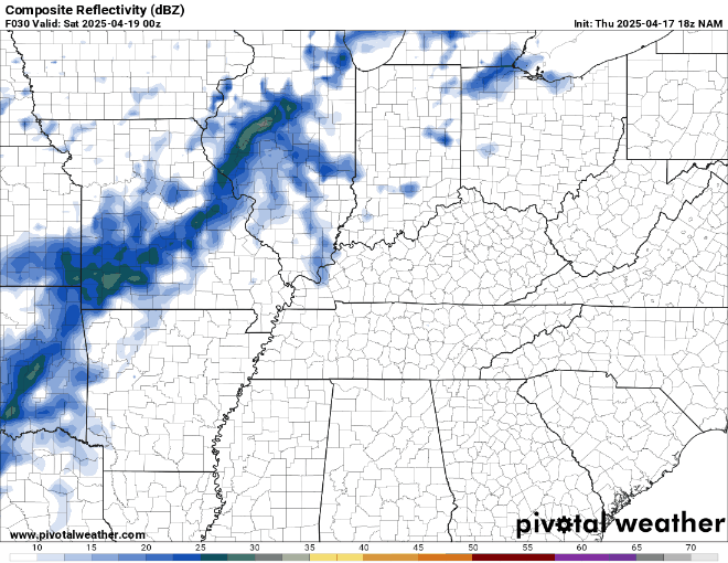
Essentially, where that front sets up is where the main axis of heavy rain will set up. The recent trends have suggested that that this will be across Illinois and Indiana, which is good for us, because we don’t need anymore rain!

At this point, the likelihood appears that the best chance for showers and storms will be well to our northwest, and while I can’t rule out a scattered shower, I think much of Saturday is dry…however, it will be warm and windy.
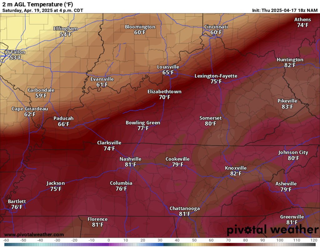
Highs should make it up into the lower to middle 80s again as we work through the afternoon. Any scattered storms that happen to blossom should fall apart with the setting of the sun, but the warm and windy overnight should keep us in the lower to middle 60s overnight.
By Easter Sunday, we’ll be watching another low pressure developing to our south and west, and it will eventually ride up the stalled frontal boundary, which will mean a renewed chance for showers and thunderstorms.
The latest trends continue to keep the stalled boundary to our north as low pressure spins up to the south and west. This may actually keep us somewhat “gapped” during the day as showers and storms erupt to our west, but we see cloudy but dry skies. This means that any outdoor Easter egg hunts you have planned may be able to go off during the warmest part of Sunday, when afternoon highs peak in the lower 80s.

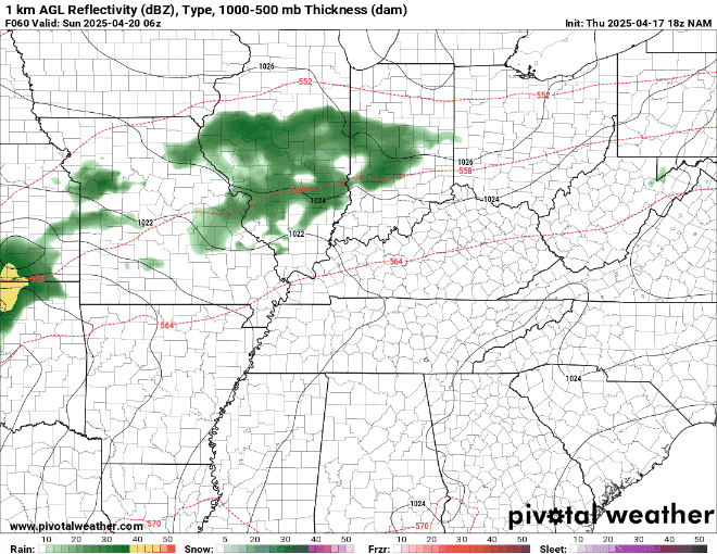
The strengthening low pressure across the south-central states should lead to strong and severe storms developing across the Ozarks and Mississippi Valley during the afternoon. Those storms eventually work our way as we head later into Easter night.

While the wind energy in the atmosphere appears ample, these storms will likely be running out of fuel the further east into the night. So, at this point, while I can’t rule out a strong or severe storm, this does not appear to be a big-time, all-night threat as it stands right now.
We’ll continue to keep an eye on this as we head into the weekend, so stay up to date on all of our social media platforms.
Overnight lows are back into the upper 50s with showers potentially sticking around.
Brief Break: Into Next Week
Once this storm system pushes east of the region, we’ll enjoy some relative calm for a couple of days before more unsettled weather looks to be in the offering for the latter half of the week.
For Monday, we’ll see skies trying to clear as drier air works into the region. Some showers may linger early in the day as our front moves east, but otherwise, we should be drying out.

We won’t cool down a ton on the other side of this front as spring continues in full effect. Highs will still make it into the lower 70s. Overnight lows will hover near 50º with clouds in place.
We look to clear out for Tuesday as highs make it back up into the middle 70s during the day, but clouds will increase yet again as waves of disturbances continue to push into the region for the second half of the week. The pattern suggests that the best chance for severe weather will be well to our west across the plains, but we’ll be keeping an eye on it!
That’s it for me for now! You can always keep up with the latest on all of our social media platforms. Have a tremendous day and a great weekend!