")
WABBLES, we have some good news to close out our week as spring is back. Beautiful skies and warming temperatures continue to be in our sights. I know it was cooler out there yesterday, but we do get warmer. As spring comes back swinging this weekend, we’ve got it all for you, and let’s dive in.

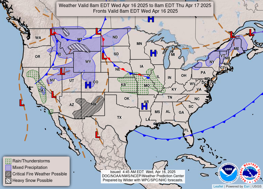
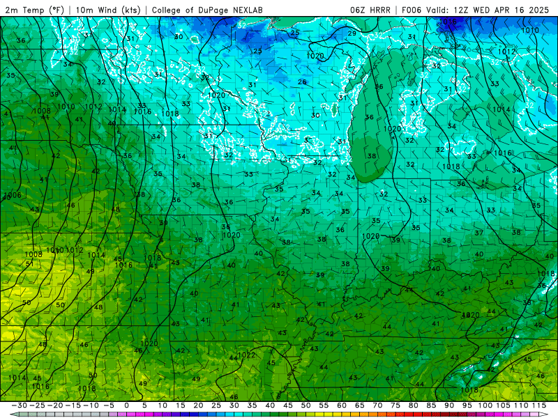
WednESDAY Weather
On this beautiful Wednesday it’s pretty quiet out there. Sunny skies and a high in the upper 60’s in the story of the day. Now when you go out for work, you’re going to feel that chill with the low in mid 40’s. If you have any plans for tonight, you can expect those temperatures to drop into mid 50’s.
Spring storms are back
Tomorrow, we continue the trend of warming up, however with that we may see some morning showers. WABBLES, some scattered showers may roll through around 4 am, and accumulations may only be upwards of 0.1 inches.
Friday will be a similar story, however warmer. With our high in the upper 70’s, the warm sector is recharging for Saturday as we look at some storms to disrupt our pattern. Rain will enter the WABBLES area late Friday night into the overnight hours.
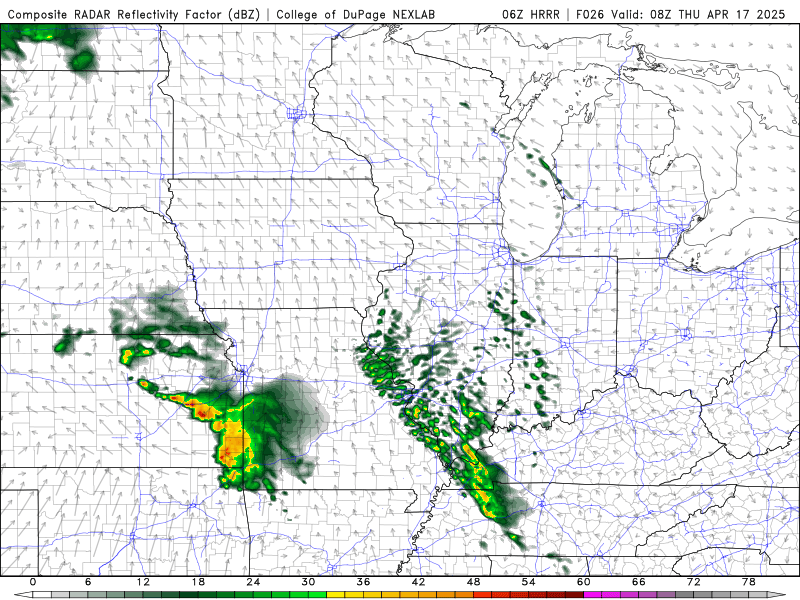
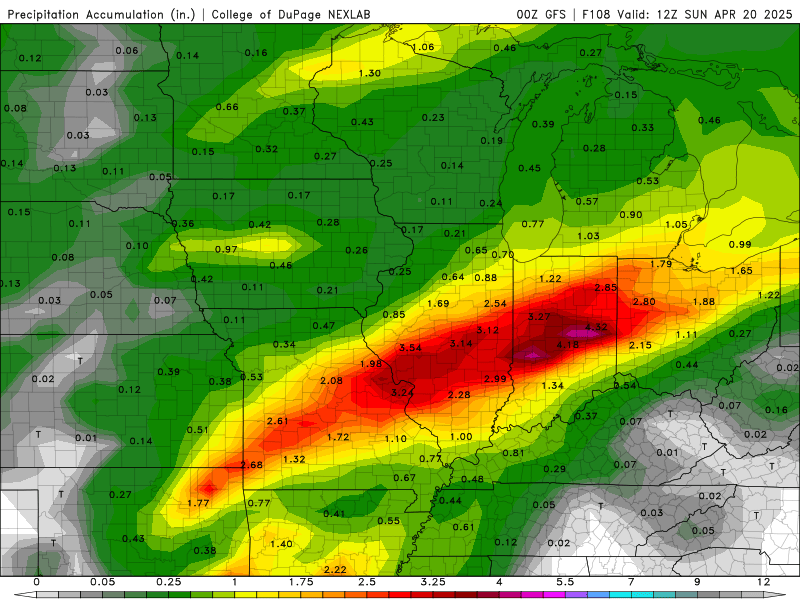
These overnight storms heading into Saturday have triggered a 15 percent risk from the SPC. We’re still unsure of the complete risks that are expected or the timing. Stay up to date with Friday’s blog or our Twitter as we get closer and get a better understanding of the risks. It’s a similar set up to last week as Reagan mentioned yesterday, yet the heaviest accumulations stay to our north.
That’s what we’ve got for you today. It’s pretty quiet out there as the sun is out and we’re warming back up. Stay up to date as those annoying rain showers roll through tomorrow with our Twitter. We will keep you updated with Saturday’s severe threat on Friday and as we learn more information. WABBLES, I hope everyone is still drying out ok as we have just a bit more rain to come nothing to put a damper on recovery efforts. Stay dry out there folks and enjoy the days of sunshine that we have going on.