

")

WABBLES has seen our fair share of active weather for the last week or so, with strong spring storms and major flooding. Thankfully, we’re looking at a much less active weekend around the region.
Cool and Cloudy: Friday and Friday Night
We’ve spent much of the week tracking a couple of clipper-like systems diving down into the Ohio Valley and into the south. Wait…clippers? I thought we were in Spring?

Well, we are! Though, the northwest flow is more of a winter-type pattern, but we can still see a few of these showers as they work through during the day on Friday, especially early.
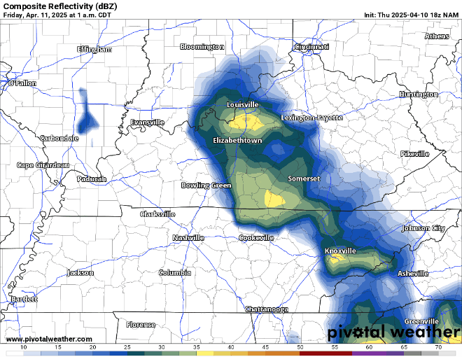
This isn’t a big deal or anything, but we’ll keep an eye on a few of those creeks and streams, especially after all of the flooding we’ve seen. Outside of showers, things will stay cooler and cloudy, with north winds continuing to keep temperatures in check during the afternoon. Highs only manage to get into the middle 50s for highs! We’ll try to clear out overnight as lows settle back into the middle and upper 30s.
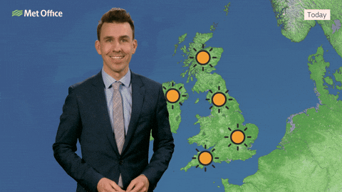
Looking Great: Saturday and Sunday
In a complete 180 from what we were dealing with this time last week, things are looking fantastic as we head into the weekend!

High pressure should start to scoot in from the west, allowing skies to clear and sunshine to become abundant!

The increase in sunshine will help somewhat offset the continued cooler north wind and allow highs to reach the upper 50s to near 60º during the afternoon. So yes, I’m telling you we’ll see comfortable weather and sunshine…which has been a rare combination these days!

The high pressure will be right on top of us on Saturday night. This will keep clouds at bay and winds calm, so it looks to be another near-frosty night around WABBLES as lows collapse back into the middle and upper 30s.
By Sunday, high pressure will be scooting off to the east. While this will mean potentially a few clouds returning to the mix, the main effect will be switching our winds around to the south and you know what that means!
Warmer air combines with the sunshine on Sunday to get highs to start to climb back into the upper 60s. Highs flirting with 70º combined with sunshine? Whatever have we done to deserve such wonderful weather?
Overnight lows will be warmer thanks to the warmer airmass we’ll have brought into the region. But the air looks to stay mostly dry, so we’ll see temperatures drop nicely back into the lower 50s.
More scattered showers: Into Next Week
As is often the case when we warm up during the spring, we usually pay for it with showers and thunderstorms. Thankfully, while we’ll have to deal with them, the ingredients are nowhere close to what we had last week, so widespread severe weather seems unlikely. Even then, I can’t rule out the potential for a couple of stronger storms.

We’ll likely have to dodge some showers and storms at times as we head through Monday and Tuesday. Monday should start out on the dry side, with clouds increasing throughout the day. What sunshine we get in the morning should help boost those temperatures up into the lower to middle 70s, going along with some breezy southwesterly gusts.
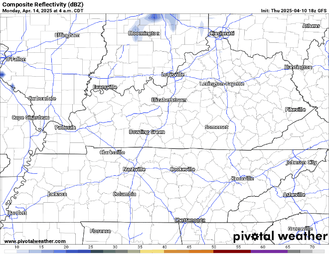
Showers and a few storms may try to scoot in late on Monday afternoon and into the evening, with them lingering into the early overnight. Lows are back into the lower to middle 50s. Some slightly cooler air may work in for Tuesday with highs back into the lower 70s.
A brief break may await us for the midweek before another system could throw some showers and thunderstorms our way as we get closer to Good Friday and Easter Weekend.
That’s it for me for now! You can always keep up with the latest on all of our social media platforms. Have a tremendous day and a great weekend!