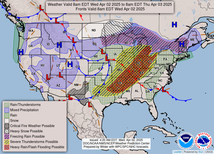
WABBLES, we have a chaotic way to end the week. Spring is here in full force as we look to see a very busy week to keep up with. Warm temperatures creep back in to ring in all the weather we’ve got this week. Today we start the show with a severe threat for WABBLES and throughout the week we will see rainfall and possible thunderstorms. Buckle up WABBLES, let’s get right to business.
Todays Weather
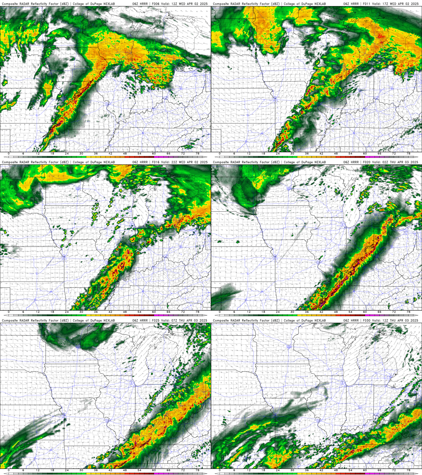
To kick it all off we have a moderate/enhanced risk (4/5,3/5) for the WABBLES area. All threats are on the table with this event, this includes damaging winds, large hail and tornadoes. We have a wind advisory in effect all day today and a flood watch in effect until Sunday at 6:00 am. We may see some early morning light rain showers, but these will clear by 10. High winds will be a problem before the line gets here. The main line of storms looks to enter the WABBLES area around 7 pm tonight.
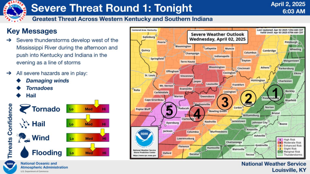
I urge everyone to have a plan and stay weather aware. Follow us on Twitter to stay up to date as these storms roll through. Before these storms you’ll notice a typical spring set up occurring, as the temperatures rise into the low 80’s, and dewpoints climb to low 60’s. Closing out today temperatures will start to drop as the cold front stalls out over Kentucky leading to our wet week.
Springs not done with us
That cold front that will stall over Kentucky brings all the spring weather with it. Temperatures tomorrow will be cooler in the low 70’s, but the rain won’t quit. We are in a slight risk (2/5) all threats are on the table however wind will be the biggest threat. One of the biggest risks that we will start to see happening is training of storms and this leads to flooding. What will determine the severe risk for tomorrow and into the weekend is how the stationary front moves across the state.
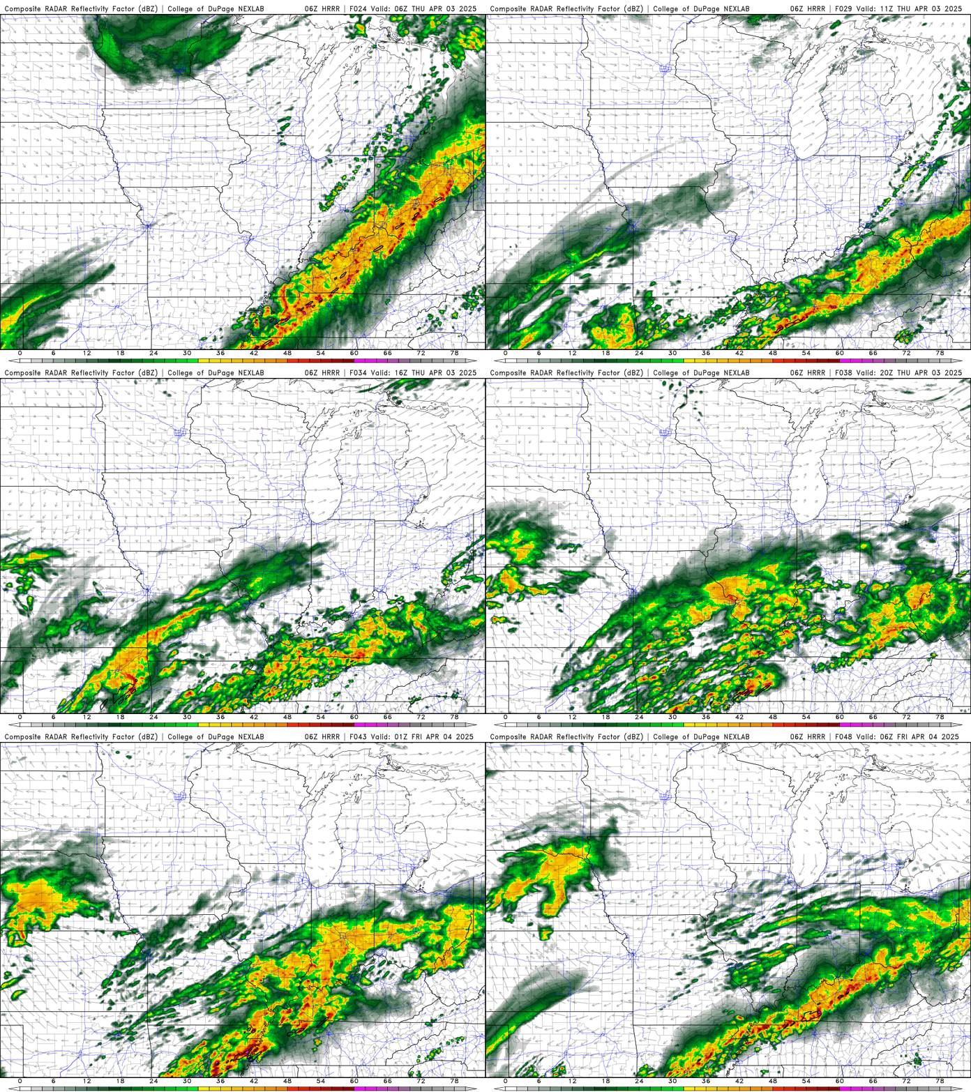
Friday, we continue this trend as we’re looking at a marginal risk (1/5) with heavy rainfall to be the biggest threat. Our high climbs back up into mid 70’s as we look to end up back on the warm side of the boundary. Saturday flooding becomes the largest problem as much of WABBLES will see between 6-10 inches of rain through next Tuesday.
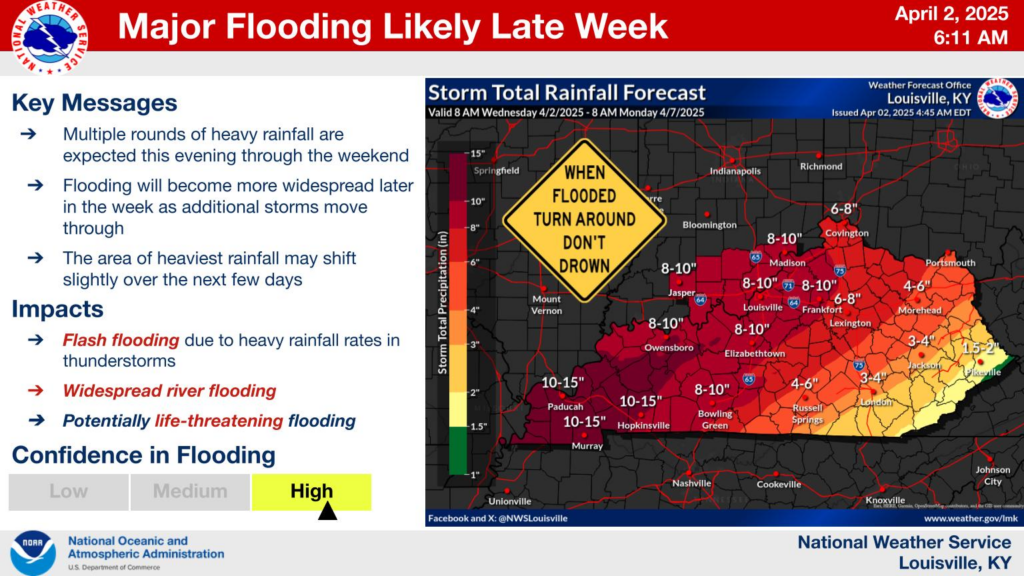
WABBLES, this week is one that we can’t ignore. The threats are real this week and we need to make sure we remain weather aware. Spring rolls in with a consistent punch through the weekend. Starting today makes sure you have a plan for tonight’s severe weather keep your phones on and have a way to receive warnings. Heading further throughout the week the tornado threat diminishes but flooding becomes a problem. Make sure “turn around don’t drown” and stay dry out there. Follow us on Twitter and stay safe out there WABBLES.


