

")
Good morning, WABBLES! April is coming in hot with an active week on the menu. Another round of severe storms will push their way into the region Wednesday afternoon. This system has a similar setup to the one this past weekend, but the main concern with these storms is the flooding risk as the rain will seem to stall over Kentucky. With a flood watch in place starting Wednesday evening until Sunday morning, it seems WABBLES just cannot get a significant break from these storms! We’ll get into the details later in this blog, so let’s get started!
April showers are about to begin. (Giphy)
TODAYS FORECAST
Today will be relatively calm now that some high pressure has settled over the area. Morning temperatures will be quite chilly, though, with temperatures in the 30s. We will soon see these temperatures warm back up into the mid-60s; another pleasant day for WABBLES.
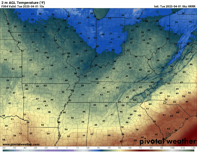
We will soon see those temperatues warm back up! (Pivotal Weather)
A RAINY AND STORMY WEEK AHEAD
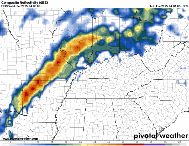
What better way to start the first week of April than with another round of severe storms? A warm front will push in from the south on Wednesday, warming those temperatures back into the upper 70s. This front will bring in warm, moist air that will fuel this storm system. As another low-pressure system moves northeast of us, it will bring in a trail of heavy precipitation and strong storms Wednesday evening.
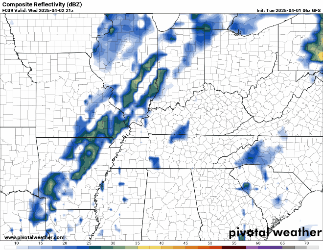
These storms will move in Wednesday evening and sit over the area. (Pivotal Weather)
Unlike many of our storm systems, this one in particular will seem to linger over Kentucky. Once the main storm line moves in Wednesday night, it will dance over the area before moving out Friday morning. We will catch a slight break on Saturday while the storms hang to the west before the final waves finally push eastward into the WABBLES region.
We’ll see some light rain throughout the day on Saturday before the stronger line pushes through late Saturday night into Sunday morning. (Pivotal Weather)
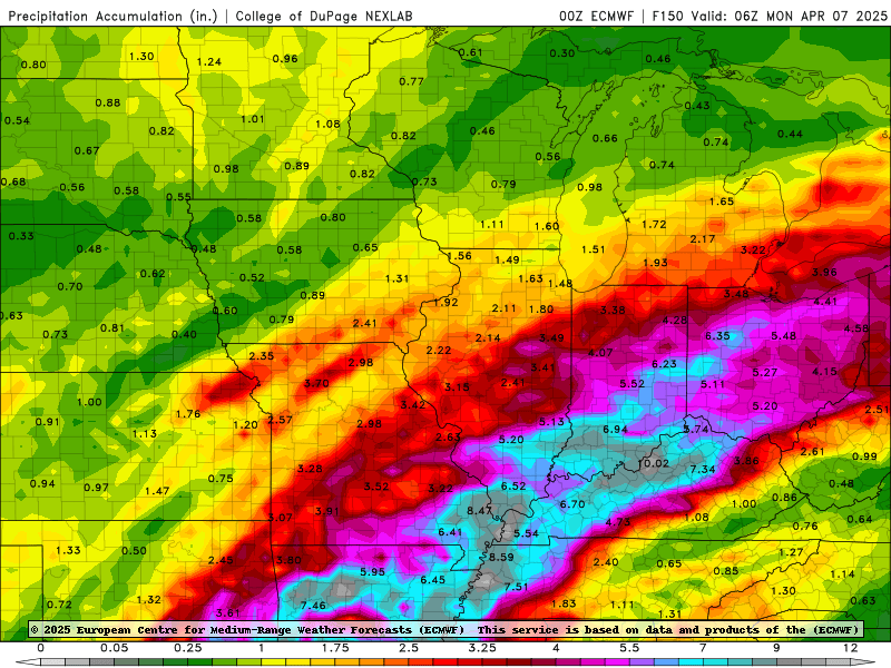
WABBLES is in for a very wet weekend! (COD)
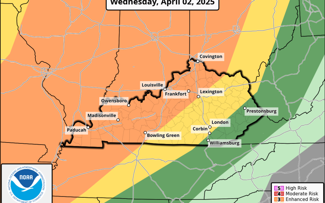
This heavy rainfall that stalls over us poses a huge issue: flooding. We can expect to see several inches of rain from Wednesday through Saturday night. On top of the flooding threat, the Storm Prediction Center has the part of the WABBLES region under an enhanced (3/5) risk for severe weather on Wednesday, while the rest is under a slight (2/5) risk. This storm will still contain all the hazards: strong storms and wind, hail, and the possibility of some spin-up tornadoes. For Thursday, the entire WABBLES region is under a slight risk.
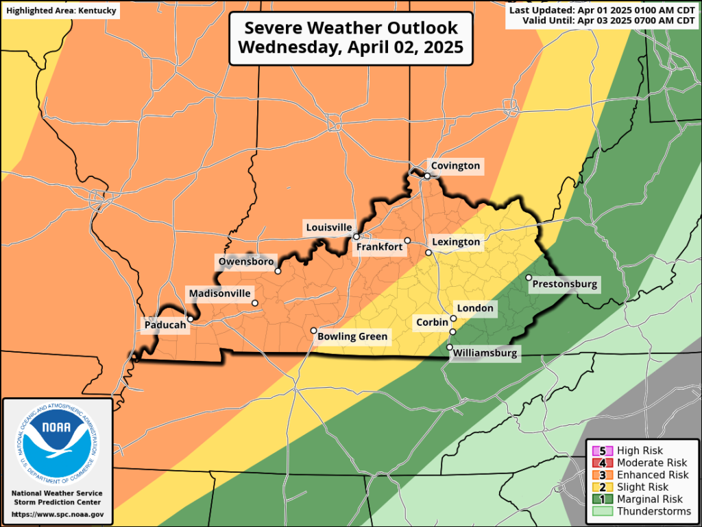
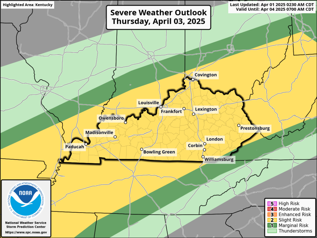
The Storm Prediction Centers outlooks for Wednesday and Thursday (SPC)
With the threat of flooding and severe weather, this is overall just a messy situation for WABBLES. That’s why here at WXornotBG, we are dedicated to providing you with fast and reliable updates on these current situations. It is important to stay weather aware, especially during this active severe-weather season. You can follow us on our Twitter to receive updates and tune in to our live stream coverage when things start to get messy.
So you may need your paddleboat for this one, folks, because it’s about to get very, very wet. As always, stay safe, WABBLES. Remember to turn around, don’t drown! Until next time..

Try to stay dry out there! (Giphy)
PLEASE!!!!! THIS IS HISTORY
CONNECT TO WBKO OR SOMEBODY’S PWS WHERE I CAN GET AN UP TO DATE WEATHER PICTURE. Also; is your camera at Russellville fixed on a bearing with The NWS radar ball at Trenton, Ky as sever storms for this area including Bowling Green seme to originate over area West South West of the Trenton/Paris/Memphis, Tn. line.
I’m 77 years old and have been a lay weather watcher for 65+ years of those 77 years, I remember when WLAC TV brought the first weather radar to the area market and Bill William’s 6 inches of no snow accumulation and recovering wind blown debris from Union Univ at Jackson Tn