

")

If last week’s warmth or this past weekend’s stormy weather didn’t clue you in, spring has sprung around WABBLES. No, officially! The vernal equinox was Thursday at 4:01am. Strangely enough, though, it will feel nothing like it.
Slow Improvements: Friday and Friday Night
After a cold start to spring yesterday, the improvements are on the way as high pressure scoots into the region.

That should increase our sunshine during the day, accordingly that should also increase our temperatures in the afternoon. With plenty of brilliant sunshine, our highs should climb back into the lower 60s.
However, our reprieve from spring showers will be short-lived, as another weak system will try to sneak into the system as we head into Friday night. I think things will be rather dry in the atmosphere, but I can’t rule out a sprinkle.
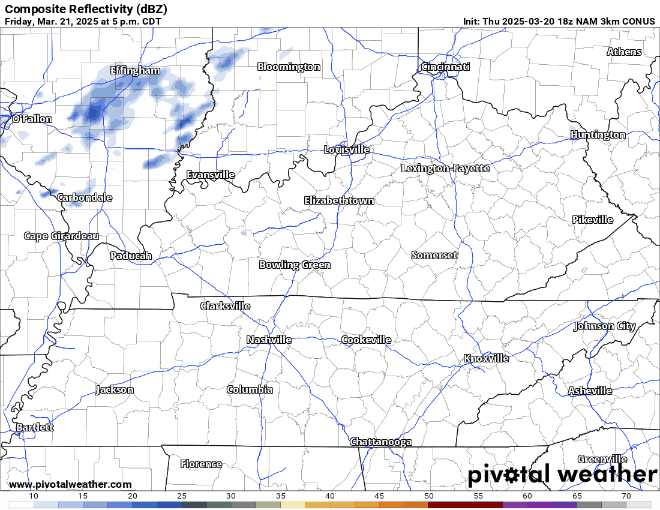
The increased cloud cover should keep us from getting too cool overnight, with lows only in the middle 40s.
Another Quick Hitter: Saturday and Sunday
We’ll try to get the latest system out of here as we head into the early hours of our Saturday, which should allow things to dry out to tip the weekend off.

Sunshine should return, at least partially, for the afternoon. That should help drive temperatures back up into the lower 60s by the afternoon. However, clouds should be on the increase into the overnight. That’s ahead of another system that could bring us showers and storms as we head into Sunday.
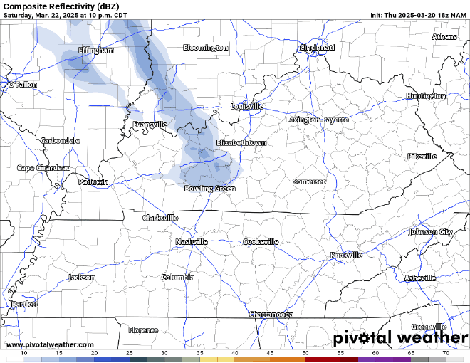
Some of the rain with this system could be heavy at times, so we encourage you to be wary of the usual flood prone spots as we head into the afternoon. I can’t rule out a strong storm or two either, but the ingredients are much better to our south and west.
Should at least be mild between showers pushing through. Highs look to peak back in the middle and upper 60s as showers and storms roam the area overnight. Mid 40s look to be in the offering with mostly cloudy skies between showers and storms.
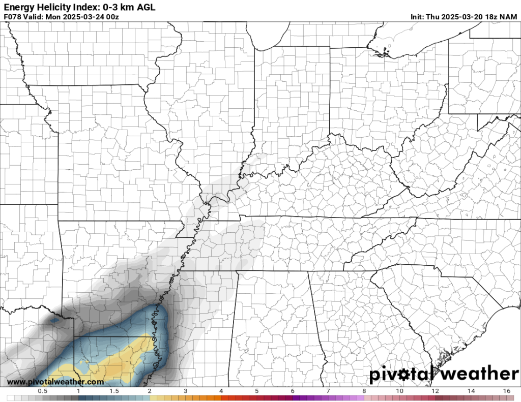
Cool but Active: Into Next Week
Despite the first work week of spring coming up, the pattern won’t seem to be too springlike as we head into Monday and Tuesday. We’ll be set up in a baroclinic zone, basically like a train track for storm systems. There’s good news and bad news here. The good news is that we’ll be in a more northwest flow regime, which should keep us a touch cooler…think average or thereabouts…and keep the widespread severe weather threat at bay.

The bad news, though, is that the storm track will be active, that will likely bring chances for showers back to the region at times throughout the week. It’s hard to nail down the exact timing of these features, so I would check back with us here and on all of our social media platforms when we’re able to narrow down a timeframe for these showers.
At this point, it looks like we’ll be able to get the rain out of here for at least part of the day on Monday. In fact, mostly sunny skies look possible, though highs only make it into the upper 50s to near 60º or so. Clouds build in overnight ahead of another chance of showers on Tuesday. We’re back near 60º during the day after overnight lows hovering near 40º.
That’s it for me for now! You can always keep up with the latest on all of our social media platforms. Have a tremendous day and a great weekend!