

")

Spring temperatures have been upon WABBLES this week, and while things have been pleasant, they usually come with a cost this time of year, and we usually pay that cost with strong to severe thunderstorms.
Warm and Windy: Friday and Friday Night
A tremendously strong storm system looks to be gathering out to the west, and while it won’t affect us directly during the day, we will feel its presence in the form of very gusty winds.

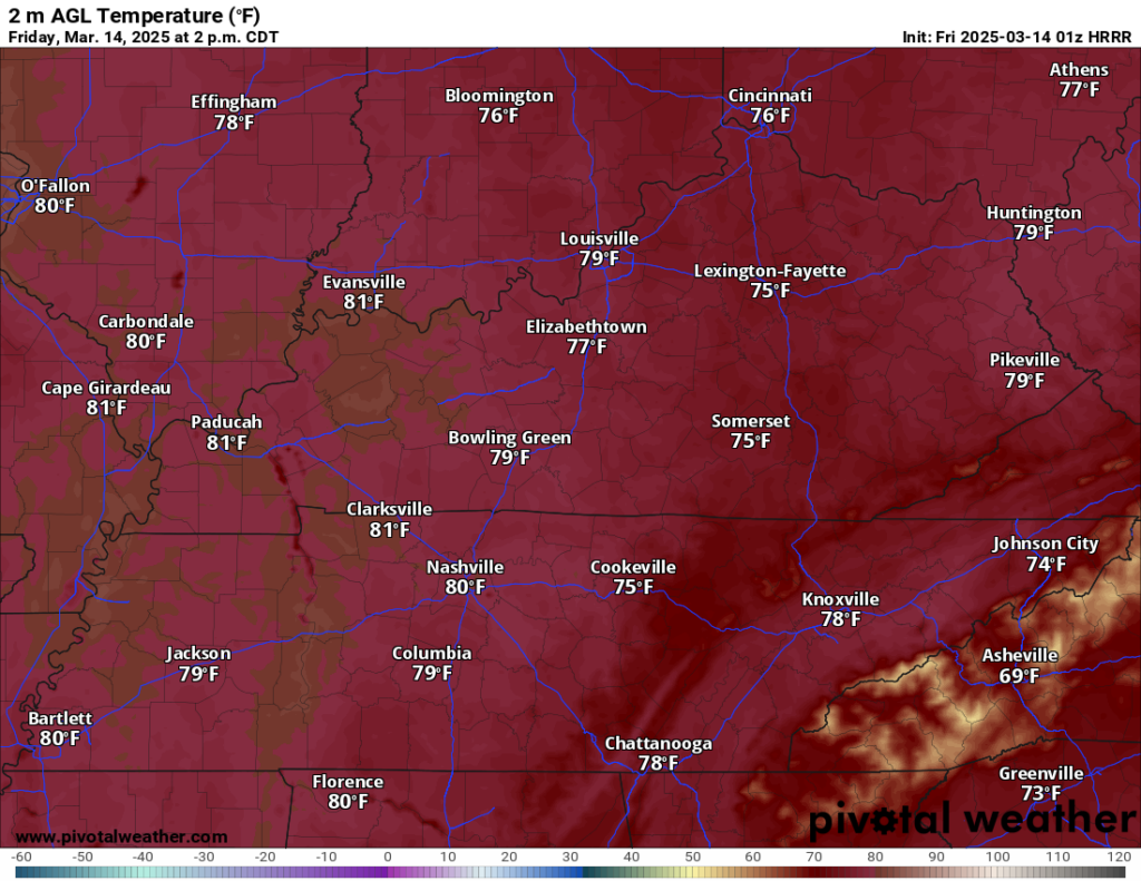
Southerly winds could gust at times up to 30-40 MPH during the day. That will provide us with more warm air as we head into the afternoon hours. We’ll likely see highs in the upper 70s, with warmer locations potentially flirting with 80º during the afternoon hours.
We’ll likely see plenty of sunshine during the daytime hours while strong to severe thunderstorms gather out to the west. The evolution of those storms will soon become key to how our Friday night and even much of Saturday will play out for us.
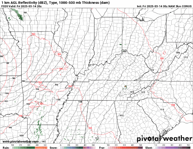
So far, I think the evening on Friday looks nice. Mild and breezy as clouds work into the region. As we head into the overnight, we’re going to watch how those storms start to work into the area. Models are hinting that the better opportunity for storms to blossom and become severe will be across portions of the Midwest and Mississippi Valley.
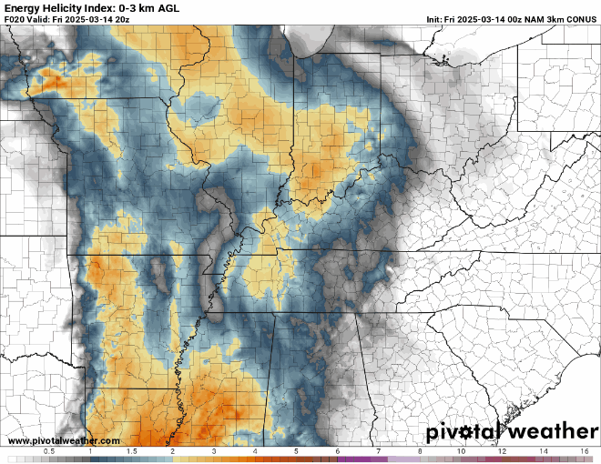
Those storms out to the west will have a threat of producing damaging winds, heavy rain, large hail, and isolated tornadoes. I think this threat, while it will be somewhat lower here compared to far western Kentucky, will still exist during the pre-dawn hours of Saturday.
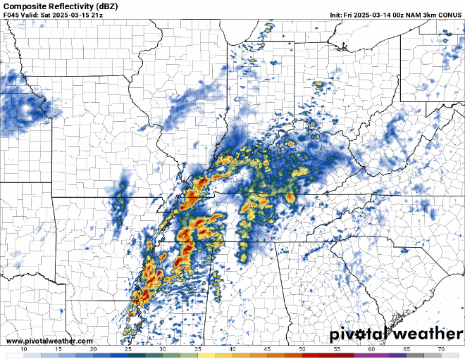
As the surface low races away on Saturday morning, where this boundary sets up will be key as to how the day on Saturday unfolds. Right now, I would expect showers and storms near daybreak on Saturday as lows only fall into the lower 60s. Those storms will have the potential to produce gusty to damaging winds, heavy rain, and perhaps an isolated tornado.
Severe Potential on Saturday
Scattered showers or storms may be ongoing as early as Saturday morning depending on how the storms to our west evolve. As a second trough rounds into the deep south later throughout Saturday, we’ll see another surface low develop somewhere across the Mississippi Valley or deep south.
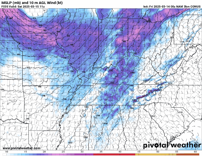
The likelihood is that severe weather will erupt as the low pressure develops and rides along the stalled out boundary. The greatest threat for severe weather looks to remain on the east side of the low, with the highest probabilities outlined across the deep south, in places like Mississippi and Alabama, where a tornado outbreak looks possible.
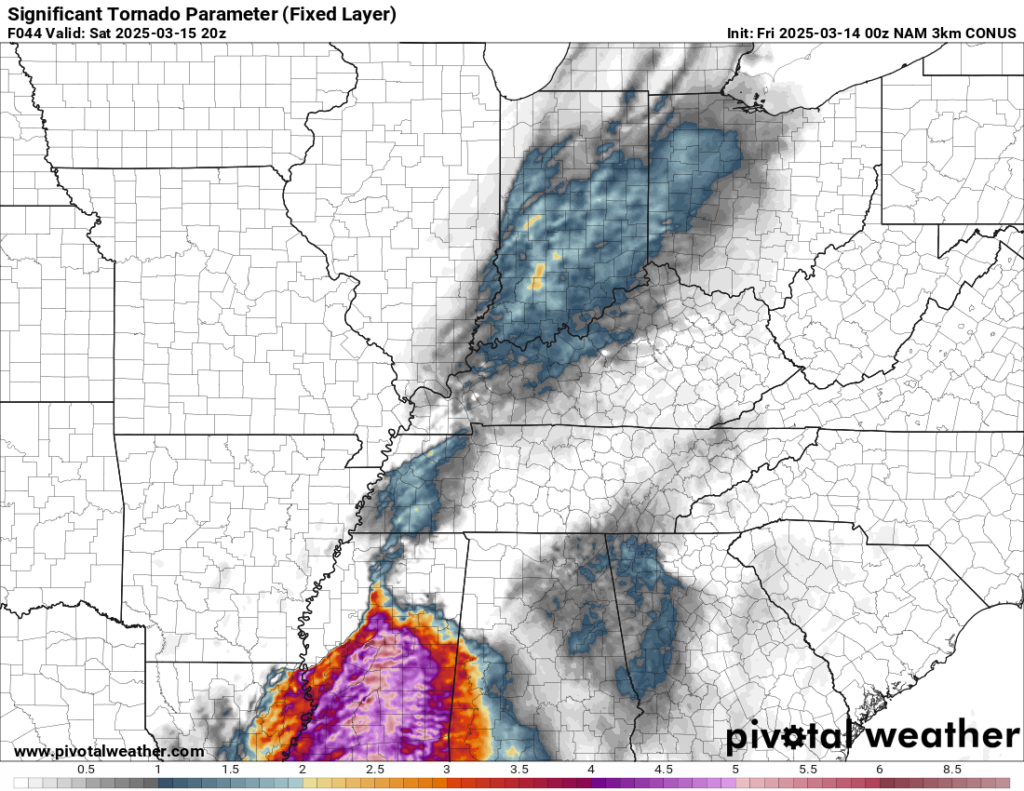
That doesn’t mean the severe weather risk in WABBLES is zero, but it is certainly lower than what they will deal with the in the deep south. One thing to watch throughout the day on Saturday will not only be the potential for sunshine to boost our severe weather threat, but also the potential for widespread thunderstorms activity across the deep south to rob moisture from us and thus lower our severe risk.
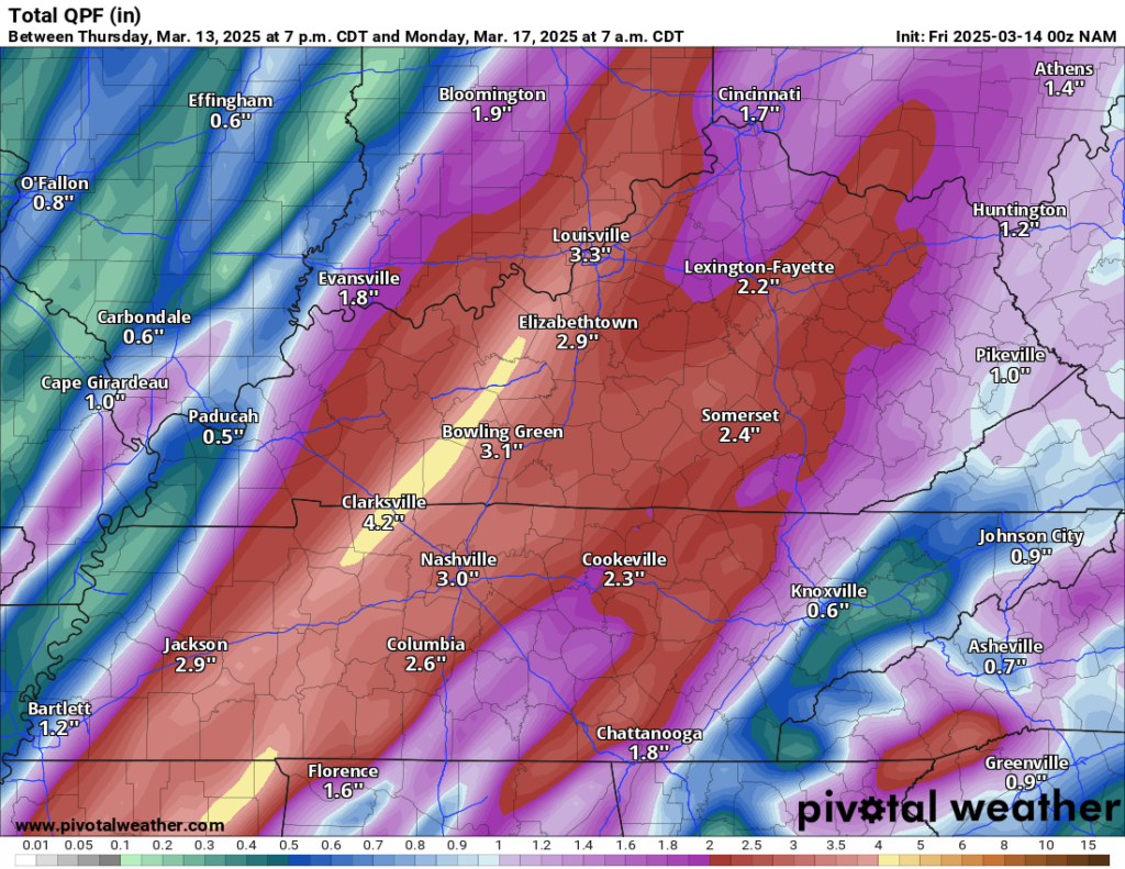
The other thing to watch is going to be the heavy rainfall, which looks to be lined up along and to the west of the low track. That could lead to flash flooding, especially in the typical flood prone areas (#avoidfairview).
After highs back in the lower 70s before rain and storms arrive during the day, with temperatures back into the 50s as the front pushes through overnight, with perhaps some showers lingering into the early hours of Sunday.
Up and Down: Sunday through Next Week
After we clear things out of here early on Sunday, we’ll enjoy much calmer weather as we hit the weekend’s home stretch.

Partly to mostly cloudy skies take over for Sunday afternoon as cooler air works in behind our front. Highs should only peak around 60º for the afternoon. Clear skies overnight should get us back into the middle and upper 30s for low temperatures.
High pressure takes back over as we head into the early part of the new work week. Overhead, this should help boost highs for Monday, back into the lower to middle 60s. We’ll do a few degrees better on Tuesday and Wednesday with highs back in the lower to middle 70s. Another disturbance could bring us scattered showers and thunderstorms toward the latter half of the week, but right now it isn’t jumping out to me as a major severe weather maker.
That’s it for me for now! You can always keep up with the latest on all of our social media platforms. Have a tremendous day and a great weekend!