

")

WABBLES has finally arrived at that time of year where the cold snaps are becoming fewer and farther between and we’re able to squeeze just a little longevity out of these warm spells! We’re back in the middle of one of those this weekend as we track shower chances.
Another System Stops In: Friday and Friday Night
Following that big bowling ball of a low that barrelled across the Central US earlier this week, Mother Nature has another hot on its heels. Thankfully, this one is more of a baseball softly rolling through the infield grass.

While it gathers steam to our south and west, weather on this Friday looks to be dominated by a ridge of high pressure centered to our south. That’s bringing up not only moisture for showers to return to the region, but also some much warmer air.
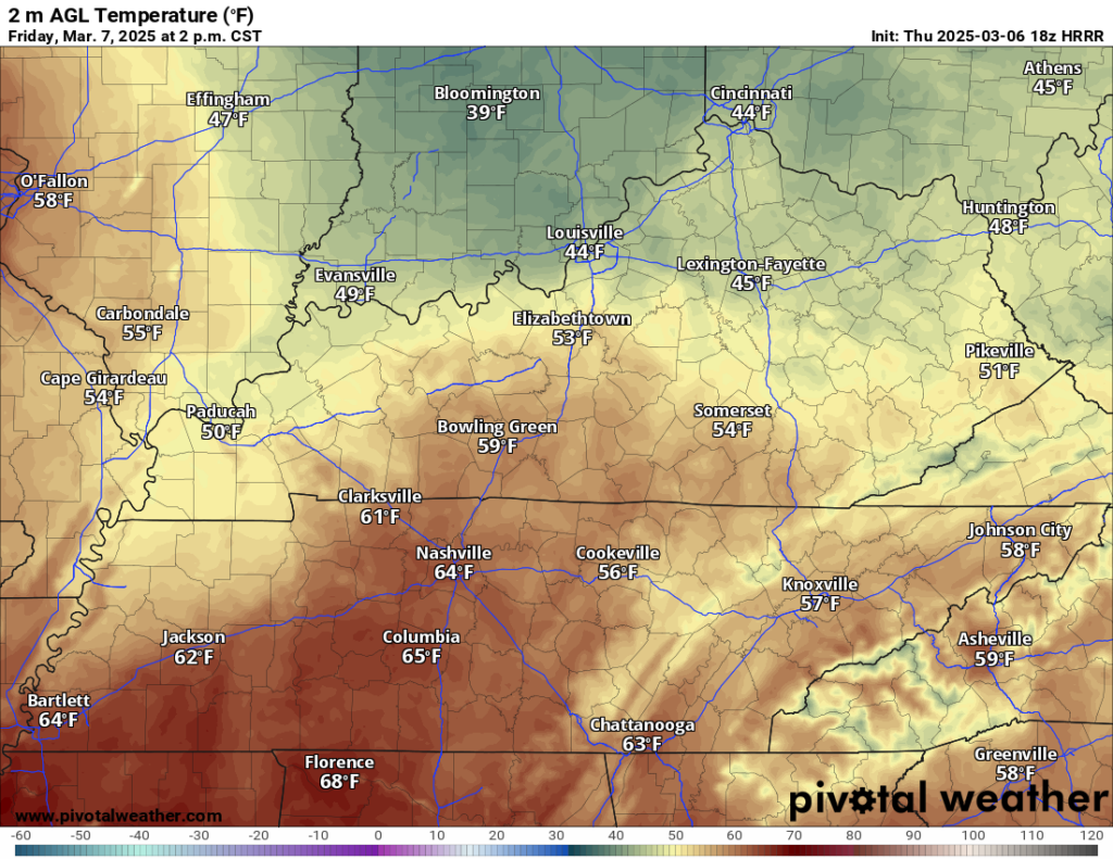
Following Thursday’s brief sojourn back into the 40s, we’re up into the lower to middle 60s as we head through our Friday afternoon. I know that’s shorts weather for some!

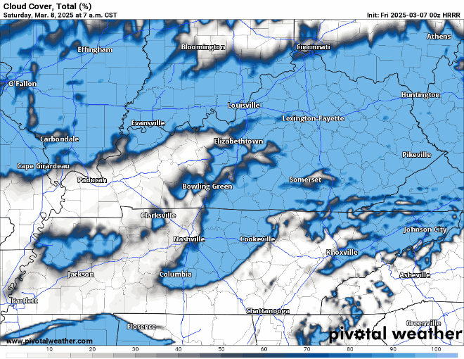
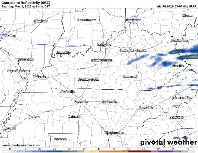
Clouds will be on the increase, though, heading through late Friday afternoon and into the evening as this weaker low pressure starts to scoot through the region. I think we’ll wind up being too cool for thunder, with lows in the middle 30s, but a nice soaking from scattered showers overnight is not out of the question.
A Tale of Two Weekend Halves: Saturday and Sunday
Anyone headed for some early Saturday errands better grab the raincoat, as some lingering showers may dampen your path through area parks or parking lots in the morning hours. We’ll try to scoot those showers to the east of us through the day, breaking out into some potentially partly cloudy skies at times.
As cooler air from our lead disturbance works through the region, we’ll see cooler temperatures as partly cloudy skies dominate the afternoon. Highs should end up in the lower to perhaps middle 50s. Another disturbance may try to bring showers back to the region overnight.
Temperatures should settle back into the middle 30s overnight. It looks like we’ll keep it cool during the day on Sunday as well as we break sunshine back out.

We’ll see more sunshine as northerly flow keeps somewhat cooler air in the picture. Highs are back into the lower 50s as opposed to the middle and upper 50s. Cooler, yes, but still around average. All in all, not a bad day out there! Clearing skies overnight should have lows back into the middle to upper 30s as we finish off another weekend.
Rollercoaster Continues: Into Next Week
We’re headed back up as we head into the early portions of next week as a ridge of high pressure settles back into WABBLES for Monday and Tuesday.

Sunshine should reign supreme with the high pressure around, and this should really help boost those temperatures!
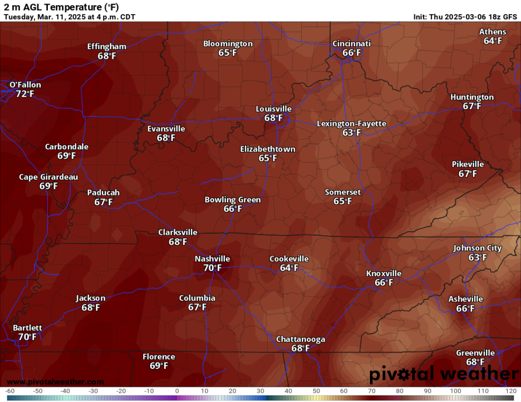
We’re talking highs approaching the middle 60s during the day and temperate lows in the 40s at night. Tuesday looks even better as highs look to get up into the lower 70s!

However, the weather may turn unsettled later in the week as we watch another weaker disturbance for midweek and yet another stronger storm system trying to work in as we head toward next weekend.
That’s it for me for now! You can always keep up with the latest on all of our social media platforms. Have a tremendous day and a great weekend!