

")

We’ve enjoyed a nice break from February’s horribly active pattern around WABBLES, but Mother Nature likes to work in patterns and it seems to be about time for our pattern to turn active yet again.
Another Break in the Action: Friday and Friday Night
Following the midweek’s widespread showers, we continue to temporarily dry the region back out as a temporary shot of high pressure works across the region.

We look to keep things mild as we head through the afternoon and evening hours, highs surge back up into the middle 60s during the daytime hours…not too bad, eh? The only thing we’ll have to watch out for will be the potential for some very gusty winds as we head into the afternoon. We could see gusts 25-30 mph at times, especially if the sunshine we’re expecting works into the region.
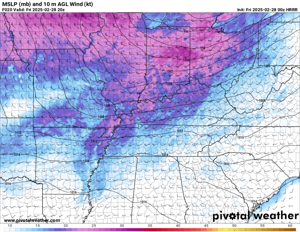
Overnight, scattered clouds and light southerly winds should keep us from getting too chilly overnight, lows only fall back into the lower 40s.
We Deserve This Weekend!: Saturday and Sunday
After brutal winter cold throughout WABBLES this season, we’re finally on to a weekend worth celebrating with high pressure in place, though it will be a little chilly.

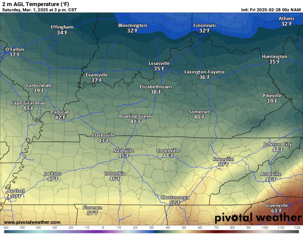
Following a dry front moving through Friday night, highs on Saturday look to only make it into the upper 40s to near 50º with the northwesterly winds we have in place. Not overly warm, but not too bad!
Saturday night may be the coldest night we’ll see for quite awhile, with clear skies allowing lows to plummet back into the lower to middle 20s throughout WABBLES. Certainly not feeling like the start of March!
Sunday looks to be even cooler, with a reinforcing shot of cold air pushing into the region. That means even with sunshine, we may not make it out of the middle 40s for daytime highs. We’ll be a little milder as we head into Sunday night, but still chilly with lows back into the upper 20s.
The First Work Week of Meteorological Spring: Looking the Part
Meteorological (or climatological) Spring runs from March through May, and after entering it during the weekend, Mother Nature will make sure it looks the part through the week.
Things look to start out dry but mild on Monday with plenty of sunshine accompanying southerly winds, which should get our highs back up into the middle 50s, with a passing disturbance Monday night providing us with a small chance for showers overnight as lows fall back into the middle 40s.
That should set the stage for an active midweek timeframe. We’ve been tracking this particular system for nearly two weeks now and it looks like it will begin moving toward the region by late Tuesday and into Wednesday.
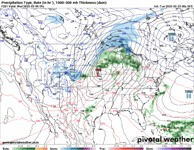
Global models have been indicating the potential for this big trough to move onshore and trigger the development of a surface low off the front range of the Rockies that deepens quickly as it tracks up into the Great Lakes.
If you’ve lived in the Ohio Valley long enough, you’ll know a strong storm signal when you see one and when a low pressure deepens and moves toward Chicago, you start looking for ingredients to complete this soup.

Based on model trends, the most favorable area for severe weather looks to be across parts of Texas, Louisiana, Arkansas, and Mississippi during the afternoon and evening on Tuesday. However, some potential for strong to severe thunderstorms will exist across WABBLES as we head into late Tuesday night and early on Wednesday.

This is quite a dynamic system, so we have plenty of wind shear in place, however we continue to monitor trends to see just what the main threats are, but have that timeframe in the back of your mind. Thing can and likely will continue to change as we hone in on this system. Especially because we’ll be smack in the middle of Severe Weather Awareness Week here in Kentucky. We’ll continue to keep an eye on it as we work through the weekend.

Outside of storms it looks to be windy, with highs back into the 60s. We’ll cool down briefly through the second half of the week and into the weekend, this should calm us down briefly. However, we are entering a very active pattern as we head into the beginning of severe weather season.
That’s it for me for now! You can always keep up with the latest on all of our social media platforms. Have a tremendous day and a great weekend!