

")

Good morning, WABBLES! I hope you have been enjoying the beautiful weather these past couple of days, as we are finally seeing some warmer air. If you need a little encouragement after the wintery weather this past week, I noticed some daffodils emerging from the lingering snow as a promise that spring will soon be on its way! This week’s weather is going to be relatively calm with more bearable temperatures except for a weaker midweek disturbance starting Wednesday night. But without further ado, let’s dive into the details of this week.

How those flowers feel after this warm-up. (Tenor)
TODAYS FORECAST
If you’re hungry for a taste of spring, prepare for another beautiful day across the WABBLES region. As these morning clouds move eastward, we will be left with sunny skies and highs reaching up into the mid-60s! This is a much-needed warm-up compared to the bitterly cold past week that had us chilled to the bone. A light breeze from the west will help keep the air warm today, but we can still expect to drop back into the upper 30s tonight as we head into the overnight hours.
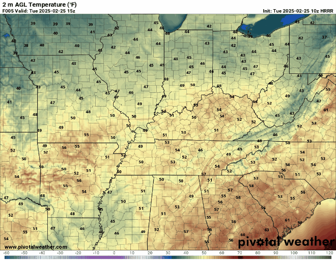
A more pleasant color scheme if you ask me.(Pivotal Weather)
SOME ACTIVITY DURING THE WEEK
As mentioned in yesterday’s blog, we are still looking at a low pressure system that is going to push over the Great Lakes this week. With this, a line of heavy precipitation will sweep into the WABBLES region Wednesday night into Thursday. The majority of the rain and snow will stay well north of here, as we are much too warm and will be getting the tail end of this system. It won’t be an intense event, but we can still expect to see a couple of downpours throughout Wednesday night.
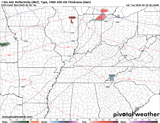
This line of rain will push through the WABBLES region late Wednesday. (Pivotal Weather)
As this rain moves out of our area in the early hours of Thursday morning, we will be left with slightly cooler temperatures as another cold front makes its way into the region. But fear not, WABBLES, it will not be as cold as last week, as it will only drop high temperatures to the mid-50s and lows to the 30s. We will see those temperatures gradually return to the 60s by the end of the week.

Woohoo!(GIPHY)
So, get out there and enjoy this beautiful weather! As always, remember to stay weather-aware and stay tuned for this week’s upcoming blogs. If you haven’t already, hop on over to our Twitter page to stay up to date with weather information! Take it easy, WABBLES! Until next time.