

")

The weather throughout the WABBLES region has been insane the past week. We went from mild air, heavy rain, thunderstorms and tornadoes, to bitter cold capping off another impactful winter storm that dumped several inches of snow on us! I think it’s time to tell Mother Nature that we’ve earned a breather…and it mostly looks that way as we head through the weekend.
Climbing out of the arctic again: Friday and Friday Night
Temperatures are on their way back up, but when you’re climbing out of a temperature regime that would be more at home in an Antarctic borehole…it’s gonna take a little time.
High pressure in firm control overhead means that even as the sun rises on Friday, things are still very, very cold. We look to start from the single digits in the morning, only improving to near 30º as we make it into the afternoon under full sunshine.
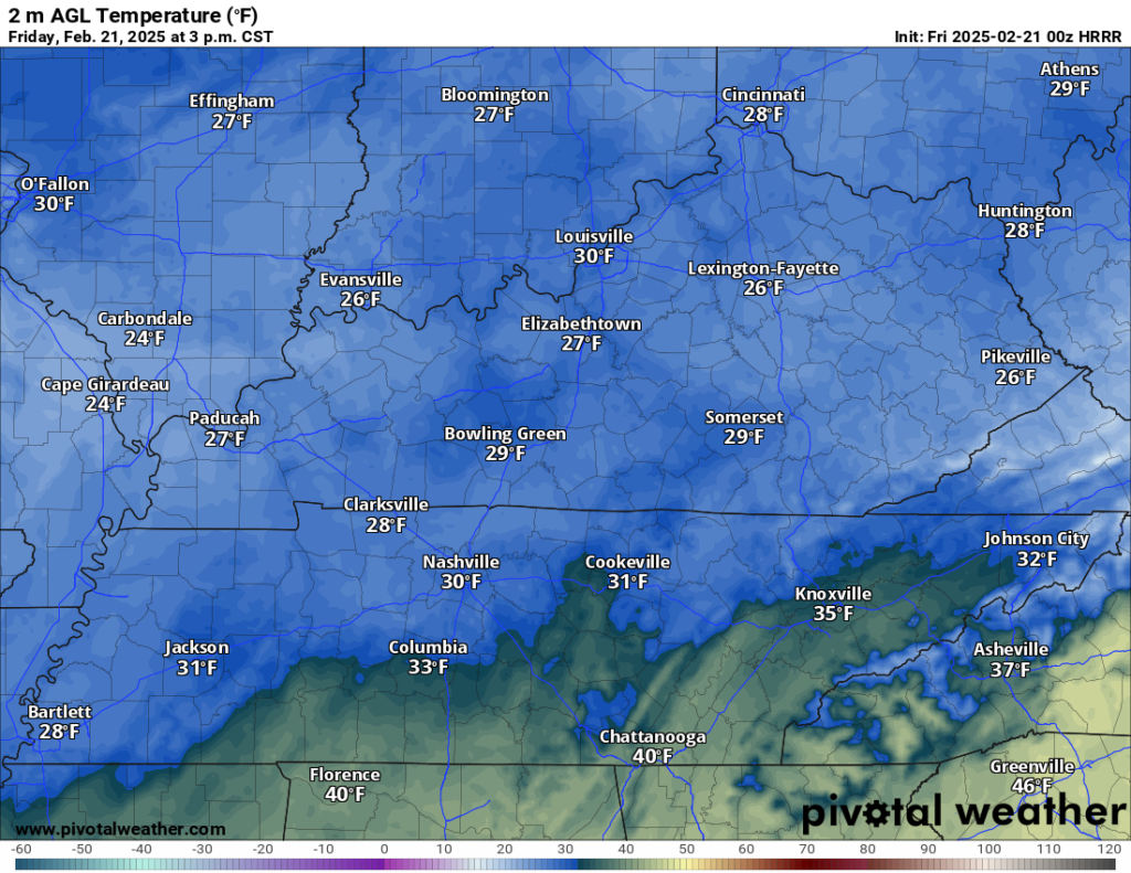
However many of us flirt with freezing in the afternoon, however, we’re getting dunked back into the ice bath overnight. Clear skies will keep things calm, allowing lows to clip back into the middle teens overnight. Cold, yes, but technically an improvement!
Above freezing!: Saturday and Sunday
While a weak disturbance may try to make a run at us as we head later into the day on Saturday, but dry air should keep it from making too much of an impact.

However, some semblance of moderation should try to take hold as we head into a partly cloudy afternoon on Saturday. Highs will finally firmly get back above freezing, in the upper 30s to near 40º!

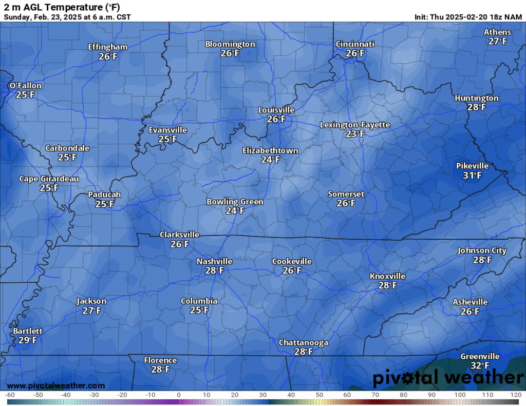
The only issue here is that mostly to partly clear skies on Saturday night should help temperatures dip back into the lower 20s again, so anything that melts has the potential to re-freeze on area roadways. This could cause some slick spots early Sunday morning if you’re headed out to Sunday services.
Things really look to improve as we slowly watch the arctic high shift off to the east on Sunday. While we’ll stay dry in between systems, the improved flow out of the south should boost afternoon highs up into the middle and upper 40s!

Partly to mostly clear skies look to continue Sunday night, allowing lows to fall back to the much more reasonable lower 30s.
Milder air to finish February: Into next week
We may try to break out of this horrendously active pattern we’ve been in as we head into the early parts of next week. Not only will we drop the precip chances at least temporarily, we’ll also keep things closer to normal for late February: highs in the middle 50s!

A weak disturbance in the flow may try to through some clouds our way late Monday into early Tuesday, but that shouldn’t hurt temperatures any. Lows overnight finish up above normal near 40º, with daytime highs hanging in the middle 50s!
We may try to sneak a couple of more weaker systems in here toward the latter half of the week, but nothing to this point looks as impactful as what we dealt with a couple of days ago. Our up and down pattern continues as well…with winter not quite done yet as we head into March. Though, the pattern may try to take a more active look again as we head into the early parts of March…something to watch!
That’s it for me for now! You can always keep up with the latest on all of our social media platforms. Have a tremendous day and a great weekend!