

")
Good morning, WABBLES! I hope you have been staying warm during this chilly start to the week because it is about to get interesting. Our Winter Weather Watch has now been upgraded to a Winter Storm Warning. It begins at 6:00 P.M. until Wednesday at 11:00 A.M. for the snowstorm arriving late tonight. With this snowstorm, we can expect to see anywhere from 2-5 inches of snow in our region, with localized areas potentially seeing more! But without further ado, let’s dive into the details of this week.
TODAY’S FORECAST
Temperatures will stay quite chilly throughout the day, with lows in the lower 20s and highs only reaching into the lower 30s. Light winds from the north can offer some chilly breezes today. A few snow showers may sneak their way into the area this afternoon, as a teaser trailer for the snowstorm tonight.
THE MAIN EVENT: TONIGHT’S SNOWSTORM
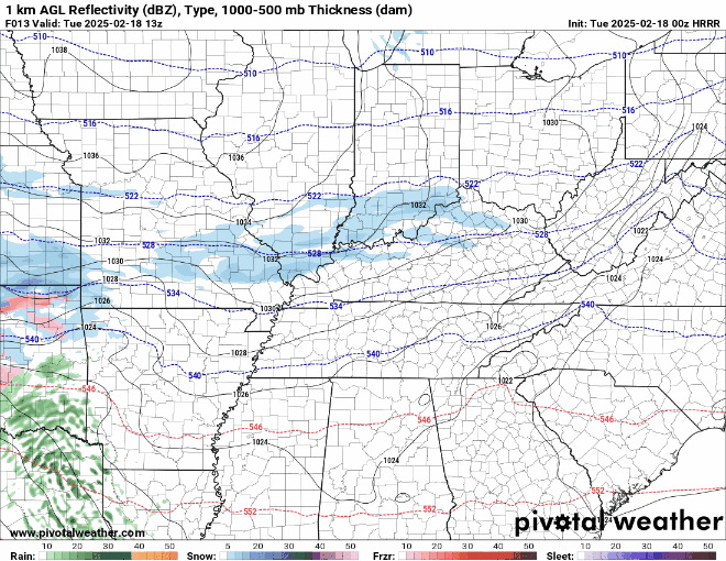
Here it comes! (Pivotal Weather)
This system is now well underway in making it to our region tonight. As this storm rides along a smooth temperature gradient, it will arrive this evening and will work its magic overnight. As it snows throughout the night and into the early hours of Wednesday morning, we can expect to see 2-5 inches of snow across our region, with some areas to our north receiving more.
That’s enough snow for some snow angels! (GIPHY)
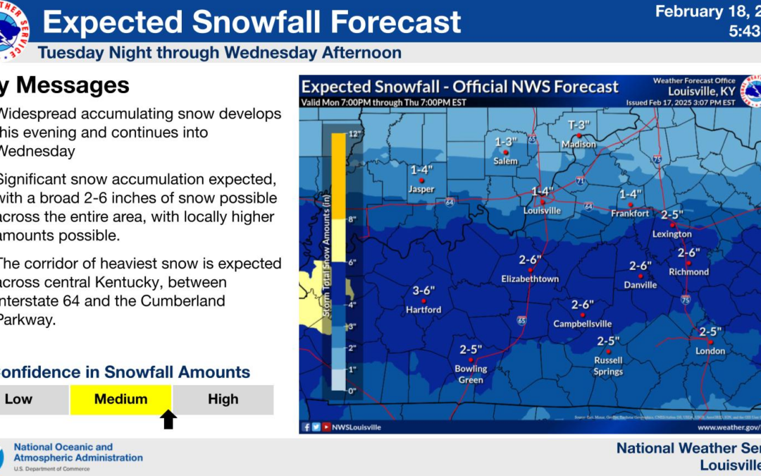
The heaviest of the snow band for our area will fall in the middle of the state between I-64 and the Cumberland Parkway. Areas outside of that can still expect to see a few inches of snow.
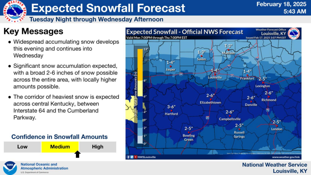
Parts of the WABBLES region can see anywhere from 2-6 inches of snow! (NWS Louisville)
So, don’t be surprised to wake up to a winter wonderland Wednesday morning! With that being said, this snowfall will make the morning commute difficult with snow-covered roads and some slick spots, so try to stay off the roads as much as possible, and please take it easy if you have to.
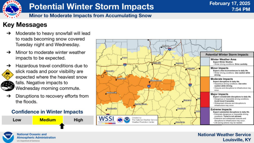
This snowstorm may make roads icy and slick, so be sure to take precaustions. (NWS Lousiville)
This system will make its way out of our area throughout Wednesday morning, and leave behind an unpleasant surprise… cold air.
COLD AIR FOLLOWED BY THE SNOWSTORM
If you thought this was cold, it is about to get a lot more frigid, WABBLES. Behind this snow system is a mass of mean arctic air that will try to creep into our region from Wednesday night to Friday. We may also get an additional dusting-1″ of snow with disturbance swinging in on the backside of the main weather maker! Crazy!
The majority of this cold air will remain to the west of Kentucky, but that doesn’t mean we are out of the hole. We can still expect temperatures to drop into the single digits, with windchills even falling below zero!
That’s some cold weather! (GIPHY)
So grab your snow boots, and prepare to be immersed in a winter wonderland this week! Remember to take it easy on those roads this week and to stay weather-aware. Stay tuned to this week’s posts for more forecasts, and remember to follow us on social media to stay up to date with weather information! Stay warm, WABBLES! Until next time.