

")

It’s been a nice spring preview throughout WABBLES this week, however, it is still meteorological winter and Mother Nature will remind us that Old Man Winter still has us on his triptych.
Brief Break: Friday and Friday Night
Following Wednesday and Thursday’s messiness, we’re set to enjoy a brief break in between systems during the early hours of our Friday.

This break, while short-lived, will bring sunshine back to the region for the morning and afternoon hours. That should allow us to get back into the lower to middle 50s for daytime highs…though clouds will be looming in the distance.

Clouds will be filtering into the region ahead of our next disturbance, which could lead to showers infiltrating the region as early as overnight Friday and into Saturday.
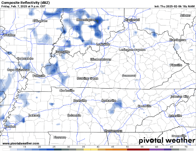
Those increasing clouds and showers will keep lows mild again for Friday night, with readings only sinking down into the middle 40s.
What Goes Up Must Come Down: Saturday and Sunday
One more shot of spring looks to come our way on Saturday as we look to warm rapidly ahead of another cold front.

Unfortunately, there won’t be much time to sunbathe as we watch more showers and storms scoot through the region.
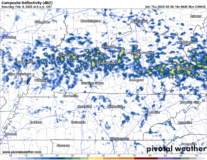
As temperatures soar up into the lower 70s for highs, we’ll also watch to see if we can’t bring in a little bit of instability into the region. That could be the catalyst for some thunderstorms trying to sneak in as the front scoots through late in the day.
If we get enough instability, it will combine with the wind fields we have in place to trigger a strong thunderstorm or two. Widespread severe weather looks unlikely, but we’ll have to watch for gusty winds and small hail.
Eventually, the cold front blasts on through the region during the overnight hours and into the early hours of Sunday, bringing us back to a stark reality that winter is still here.

Drier air should start to move into the region as we work through the early hours of our Sunday, though that will likely accompany colder weather as chillier air works in.
We’ll see some clouds to start on Sunday, but return to some sunshine in the afternoon. Temperatures remain near normal for this time of year as highs wind up in the middle and upper 40s. However, more unsettled weather appears to be in our future.
We’ll continue to watch the potential for more showers to try to sneak into the region late Sunday night and into early Monday. Despite cooler lows in the middle 30s, we’ll keep everything liquid…for now.
Colder Yet Active: Into Next Week
We’ll look to keep the storm train rolling right along the tracks as we enter into next week.
This means more disturbances bringing us chances for showers, only now we’ve got some colder air in place to worry about. No, we’re not headed into the deep freeze again…I just hope you haven’t gotten used to the spring-like temperatures we’ve been seeing.
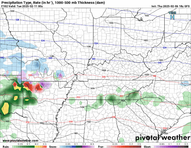
Our latest disturbance will try to work through during the day on Monday, bringing us yet another round of rain showers as highs only make it into the middle 40s. Overnight, however, we’ll need to keep an eye on the potential for some wintry shenanigans as colder air throughout the atmospheric column could keep things frozen longer.
Nothing to give your paycheck over to Butternut and Prairie Farms yet, but something to watch on Monday night as lows fall back into the mid 30s.
That chance for a few flakes or sleet pellets continues as colder air takes hold in the region toward the middle of next week. Highs by Tuesday and Wednesday only slightly make it above 40, with overnight lows in the upper 20s to near 30º. Certainly something to watch…especially if you’re Cupid and need to figure out if you’ve got to put a jacket on over your diaper.

That’s it for me for now! You can always keep up with the latest on all of our social media platforms. Have a tremendous day and a great weekend!