")
WABBLES, we had a visit from false spring this week as Monday was absolutely gorgeous and yesterday felt much cooler. Well, it’s not over yet we’re about to see some fluctuations in temperature over the next few days brought on with some rain. We see some average temperatures and some of those warmer more spring like days. Get ready that umbrella ready as you take off and put back on those layers in today’s blog.

WednESDAY Weather
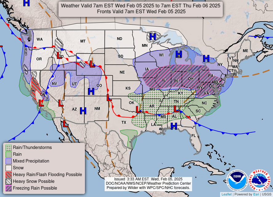
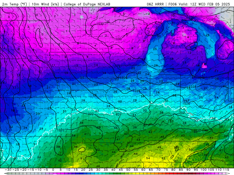
Today we will see another shift in our weather pattern as we have some rain and thunderstorms with the possibility of severity in our forecast. While the temperature will feel similar to yesterday, we are driven by a warm front that is trying to work its way into Kentucky. Our high here in WABBLES today will be in the low to mid 50’s.
Rain today looks to be more like more like isolated showers especially in the early afternoon and as we transition into the evening and overnight, we see more of these rain showers turn into thunderstorms. The biggest thing of today is that we are under a marginal risk here in WABBLES. With this comes the risk for damaging wind gust, small hail, and possibility of some rotation. The biggest threat of these factors will come into tonight.
As the warm front pushes through and dewpoints rise over the night hours. This will combine with enhanced shear to prepare our environment and becomes more and more sufficient for these thunderstorms to become a hazard. As you go to sleep tonight keep your phone on and get your weather radios ready. Some of these storms may bring heavy rain amounts that could cause flash flooding in some areas.
Temperature Roller Coaster
Tomorow, we see this warm front take effect, and our roller coaster ride really starts to ramp up. Our high for today will be sitting in the upper 60’s warmer than we are today. The thunderstorms continue from tonight towards the morning commute, however it looks like we may get a break in the late morning early afternoon hours. I hope you enjoyed today’s high because tomorrow night we see a cold front come through bringing more rain with it.

Friday, we get a break from the rain, but it will be on the cooler side in the low 50’s. With that though it’ll be mostly sunny, and you can soak it all in. Friday night we’re right back at it as another warm front starts to work its way north. We will see more rain with this as we head into our weekend.
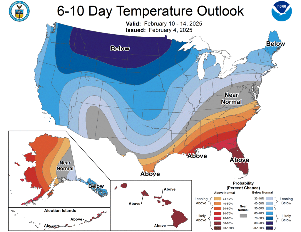
Now by the time we get into the weekend and you’re soaking wet and don’t know what to wear anymore. I’m sure you’re ready for this weather to figure itself out. I have good news; it’s finally going to level out into next week. Bad news though, it’ll be on the cooler side of the scale. The Climate Prediction Center has us in a near average or just below average trend over the next two weeks.
WABBLES, stay dry out there while rainfall amounts won’t be near what they were last week. Stay weather aware today folk, because tonight as all the conditions are met, we must be prepared. This severe weather will be most prominent while you’re sleeping tonight, so make sure you have a way to wake yourself up if the weather does get bad. Our Twitter will update you as storms pass through WABBLES today and tonight. WABBLES stay dry, stay safe and keep your hands and feet inside the temperature roller coaster at all times and enjoy the ride.