WABBLES is in the homestretch of the year, and despite now being in winter for a week, it doesn’t feel much like it. As we reach the end of 2024, we’ll continue to see things stay mild and soggy.
Soggy Weather Returns: Friday and Friday Night
The pattern has been more active than a small child on Christmas morning.

For us, that means we’re in for yet another round of rain as our next system starts pushing in from the west. Clouds and showers start to work in as we get up in the morning. Southerly winds will help highs get back up to near 60º during the early part of the day. You know…wintry.

Showers will continue on a scattered basis as we head throughout the day as our disturbance continues to push into the region.
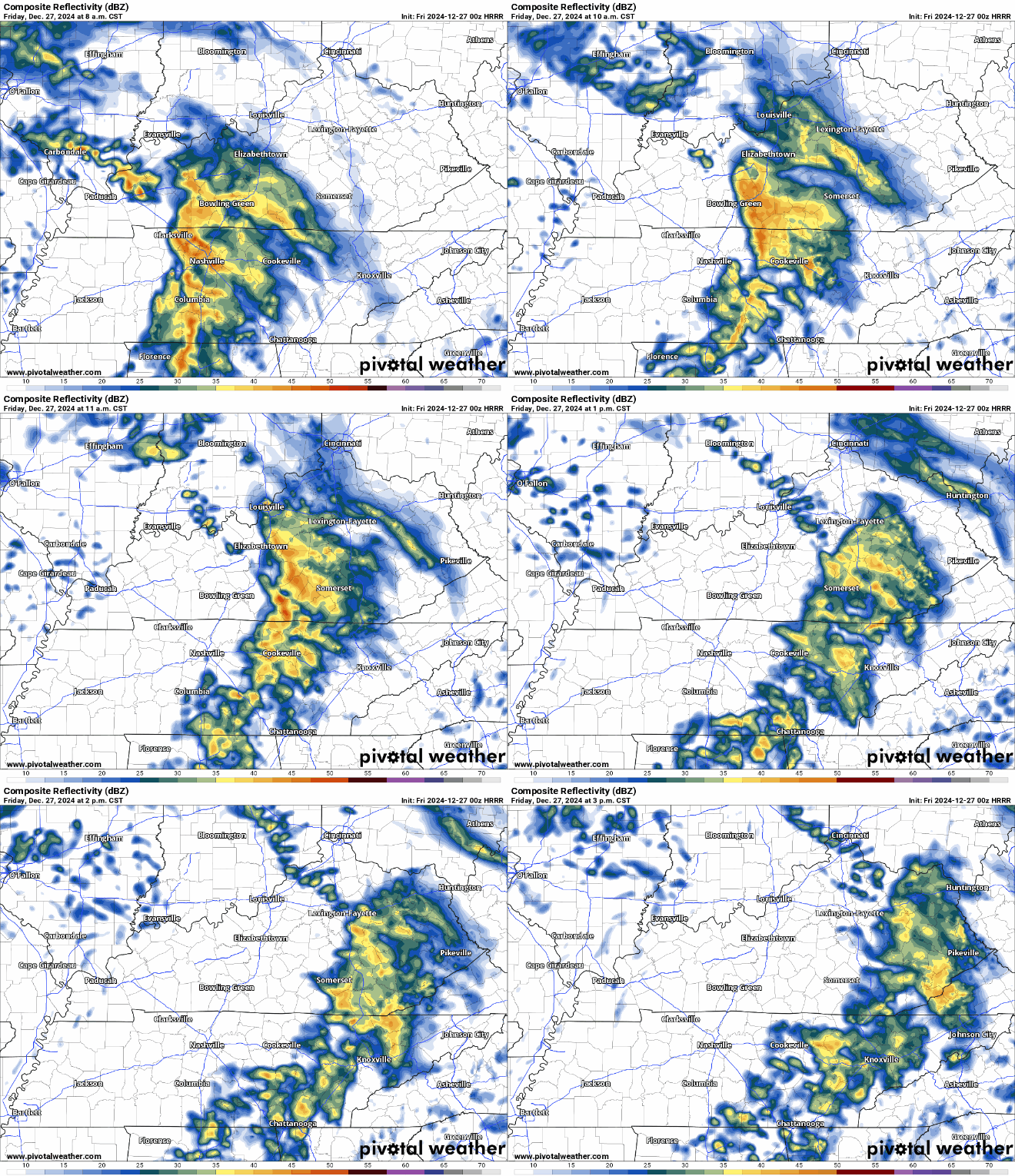
It won’t rain completely all day, but it will be hard to time out when our breaks will fit into the day, so keep the rain gear handy. That includes if you’re headed out to a post-Christmas Christmas party, or perhaps a very, very early New Year’s party.

Grab the coat for the rain overnight, if not for the temperatures, because they’re not moving a ton with the showers in place. Lows only in the lower to middle 50s.
Showers Continue: Saturday and Sunday
Like many of us this time of year, Mother Nature is moving a little slower than usual as well.

The next in a series of weather system looks to work in just in time for the weekend proper, bringing rain chances back to the region.

Southerly winds have continued to pump moisture back into the region, so this system will have plenty to work with to produce showers, with rain getting heavy at times.
I can’t rule out some thunder and lightning at times, but severe weather chances are rather low with this particular system. In between showers, our highs are back in the lower to middle 60s. Not very late-December-like.

Showers ramp up overnight as the frontal boundary continues to scoot in from the west. We could hear some rumbles of thunder here too with a little bit of instability. Either way, it looks to stay mild and a little muggy with overnight lows only falling to near 50º.
Showers continue with us on Sunday as our system begins to slowly scoot out of the region.
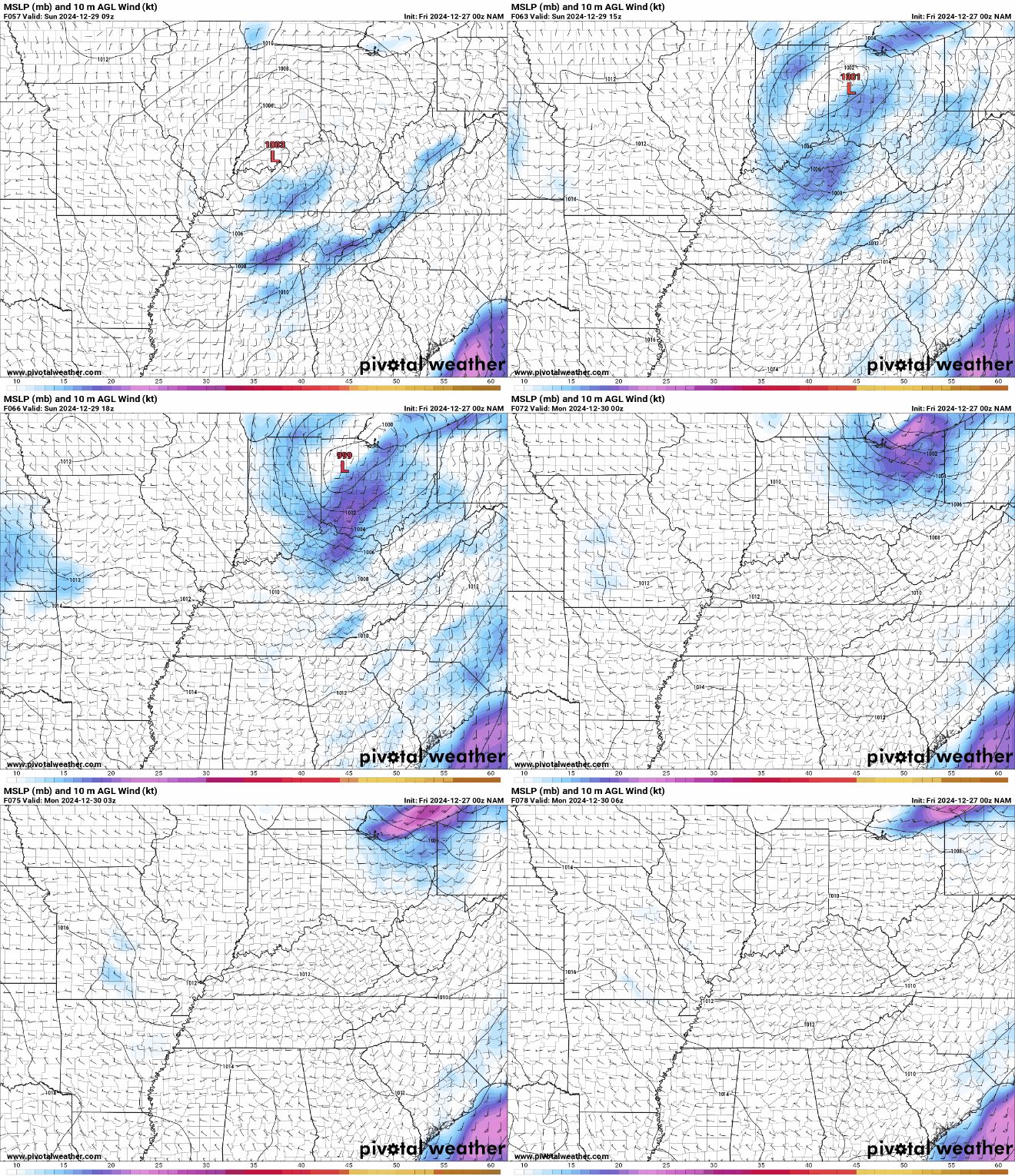
The best chance for showers looks to be before noon as our frontal boundary scoots through the region. Clouds will be with us during the midday, with perhaps a few sun breaks as we head into the afternoon hours. Despite the front moving through, highs look to stay mild.
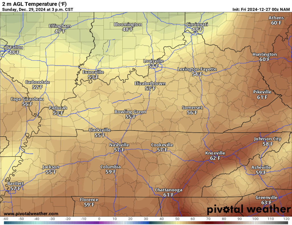
Highs still look to hang out in the upper 50s to near 60º or so. Partly cloudy skies overnight will ave us down into the lower to middle 40s overnight.
Soggy Finish to 2024: Into Next Week
High pressure scoots into the region as we settle into the day on Monday for what looks to be a quiet day in between systems.
Said high pressure should lead to at least some filtered sunshine during the day as highs are back in the upper 50s to near 60º. However, high pressure with highs that mild tend not to last long in the waning hours of the year.
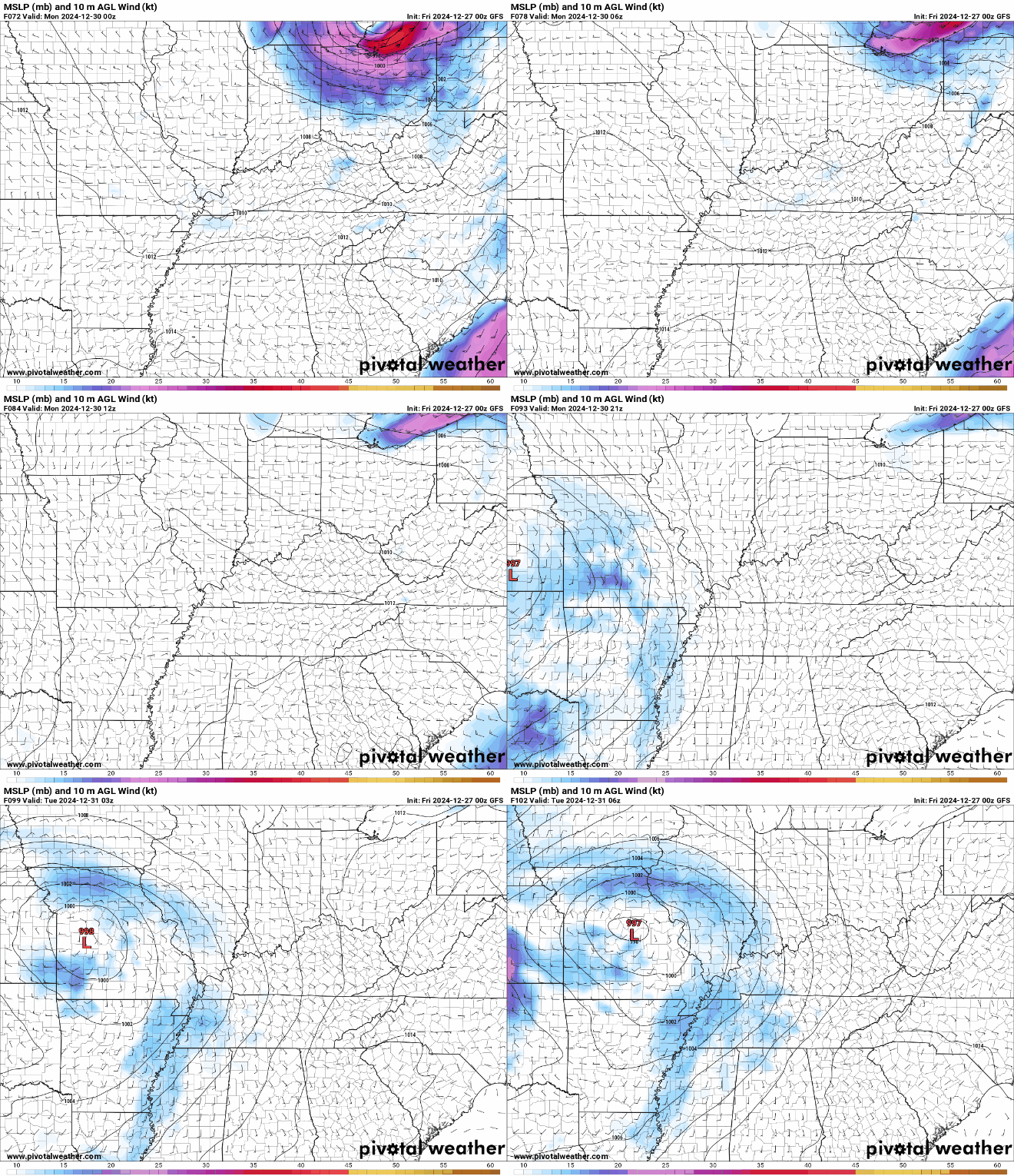
We’ve been watching another strong system try to move into the Ohio Valley late Monday and into Tuesday, which will bring us yet another chance for moderate to heavy rainfall at times as we head into New Year’s Eve. Highs look to stay mild as well, staying in the 50s during the day on Tuesday.

As you put up the new calendar on Wednesday, however, we’ll see drier and cooler conditions take over, as highs struggle to get out of the 40s!
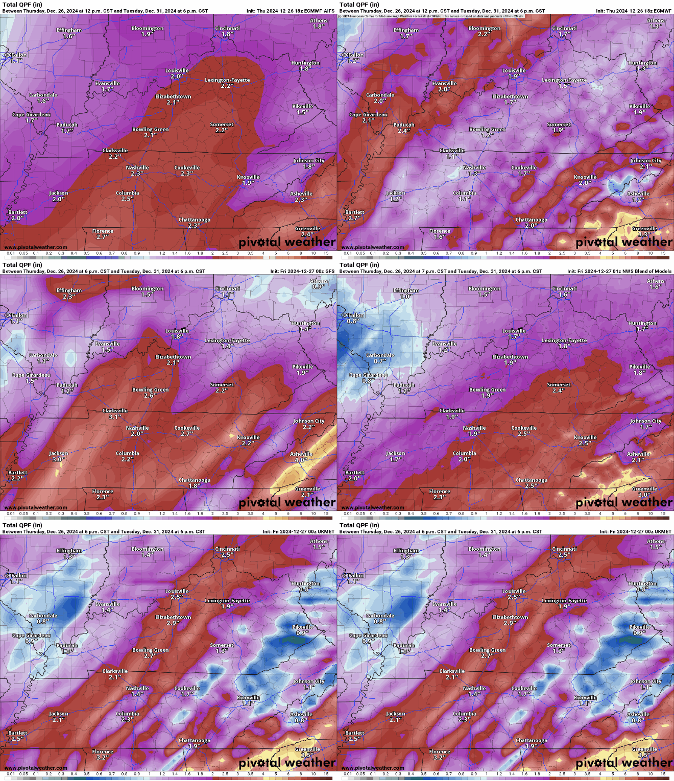
After all is said and done, it looks like we’ll see between 1 and 2 inches of rain for many of us, with locally higher amounts possible. Models are still having a hard time figuring out exactly where that heavy rain band will set up.
That’s it for me for now! You can always keep up with the latest on all of our social media platforms. Have a tremendous day, a great weekend and a Happy New Year!

