Following a wet and warm start to the week around WABBLES, we’re finally seeing a return to winter’s chill as the winter solstice nears and Santa gets ready for his big night.
Wintry Chill Returns: Friday and Friday Night
We await another weak weather maker moving into the region as we head into the daytime hours of our Friday.
As wintry air continues to filter into the region from the northwest, we’ll be on the lookout for a weak system to dive in. I don’t think this will have much moisture with it, but with highs in the lower 40s, with much colder air aloft, any precipitation we’d see would likely be in the form of snow.
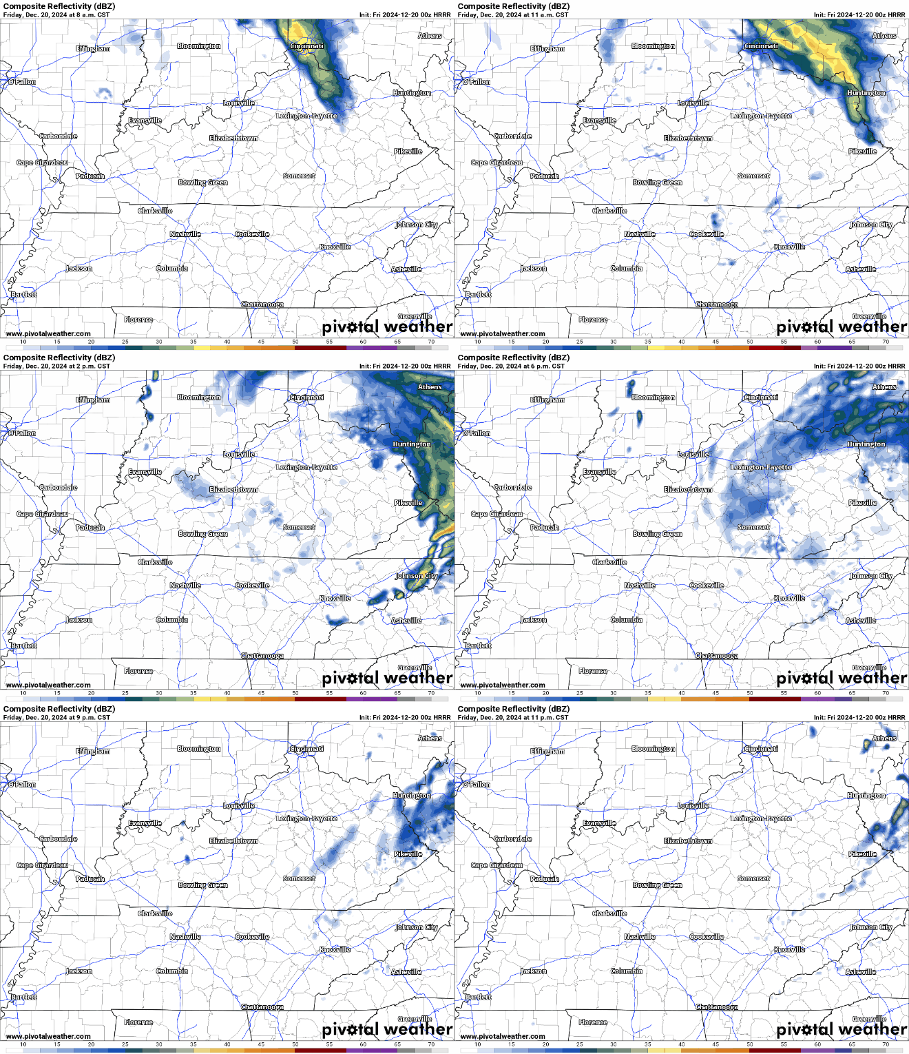
With the recent mild air and paltry snowfall rates, the likelihood is that we won’t see much accumulation, if any.
The biggest effect we’ll see from this system will likely be the colder air filtering into the area on the back of winds gusting upwards of 20-25mph.
Old Man Winter’s chill solidifies (no pun intended) overnight as lows are back in the middle 20s.
Christmas Weekend: Saturday and Sunday
Yes, it’s the weekend fight the crowds for the last of the Christmas deals with Jolly Old St. Nick’s big night to shine around the corner. The good news is that the weather shouldn’t be an issue for all you procrastinators looking for the last of the holiday deals.

High pressure builds into the region, though it’s a cold high pressure that should keep us in the upper 30s to lower 40s. Appropriate for the Winter Solstice (3:20am for those of you scoring at home.) The good news, though, is that sunshine should be plentiful during the afternoon.
And clear skies overnight will keep us appropriately chilly past dark, with lows dipping back into the lower 20s.
More of the same expected as we head into the day on Sunday. Cold high pressure remains in place, which should keep us sunny, but also predictably chilly.
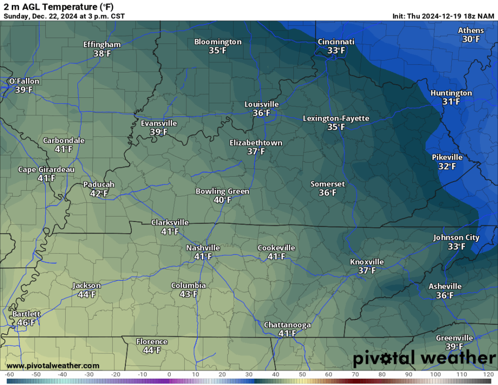
Highs will still hover around the 40º mark or so in the afternoon. So, looking good if you’re hitting the road a little early for that Christmas travel.
Overnight lows look rather chilly as we head into the overnight hours, with ratings settling back into the lower 20s.
Santa’s Final Prep: Monday and Tuesday
High pressure should start to scoot east as we head into the day on Monday, though it will still exert quite a bit of dominance over our forecast.
High pressure moving on to the east, though, should allow temperatures to try to rebound, at least working up into the upper 40s to near 50º or so. Perhaps a few more clouds try to work in as our next system starts working in. Overnight lows stay near 40º as we watch showers try to sneak in.

As Santa Claus finishes the second run-through of the ol’ List, we’ll be seeing some showers scattered about WABBLES as our weak front starts pushing into the region. Christmas Eve highs don’t look very Christmassy, with readings topping out in the lower 50s.
Santa may just need Rudolph’s nose as he enters WABBLES airspace, with plenty of scattered showers possible overnight, with lows only near 42º or so. Hopefully, the big man has a way of wiping his feet off before heading down the chimney.
Christmas morning looks to be a cool and damp affair, with low 40s to start, on our way to the lower to middle 50s for daytime highs. That milder trend looks to continue as we close out 2024.
That’s it for me for now! You can always keep up with the latest on all of our social media platforms. Have a tremendous day and a great weekend!

