This has been a decidedly milder week around the WABBLES region, even with a midweek arctic plunge that brought us a hint of Old Man Winter. However, milder air continues to settle into the Ohio Valley, bringing with it more chances for showers.
Showers Increase: Friday and Friday Night
Sunshine makes an appearance for at least part of our Friday, thanks to departing high pressure.

On the back side of the high pressure, we’ll set up return flow into the region, allowing more warmth and moisture to filter back into the region.
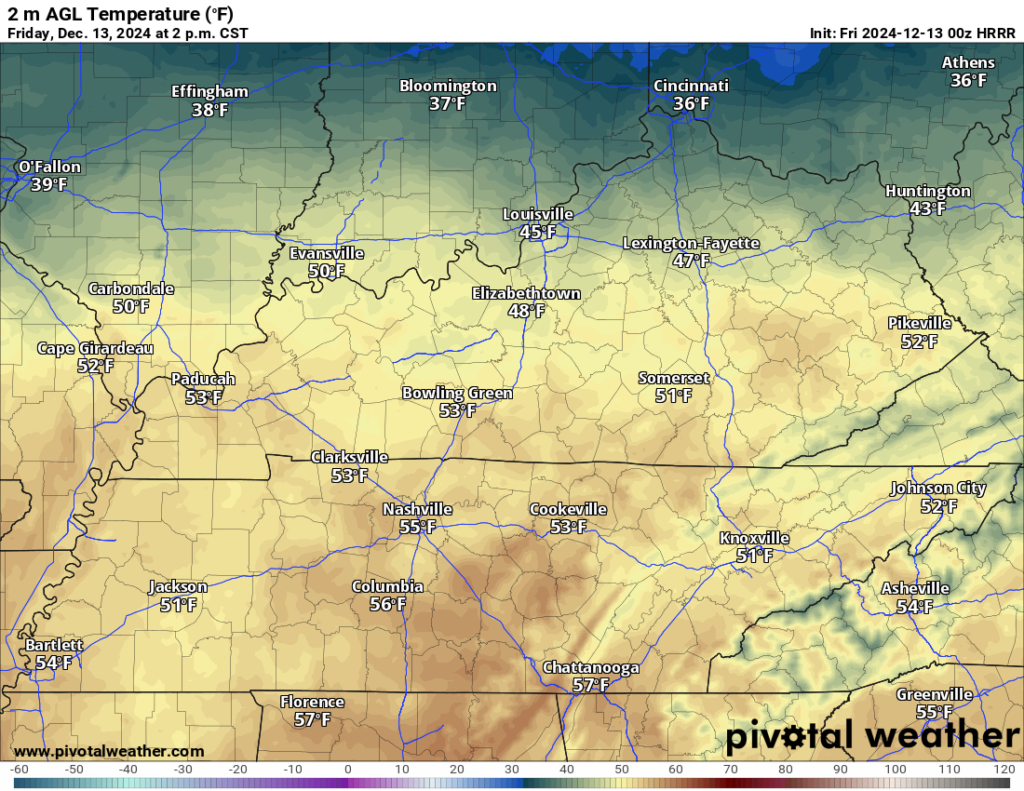
The end result for our day on Friday looks to be an increase in cloud cover as we head through the day. The sunshine we do see will join the southerly winds to bump temperatures up into the lower 50s for the afternoon hours. We’ll just gradually see more clouds than sun work in toward sunset as our next disturbance works closer to the region. Clouds will keep us mild for mid-December overnight, with lows only around 40º.
Soggy Setup: Saturday and Sunday
Our system will drag a cold front into the area as we head into the day on Saturday.

Ahead of the cold front, we’ll see temperatures and moisture continue to surge as we see highs peak in the lower to middle 50s yet again. Widespread showers look to move back into the region as we work through the afternoon hours.
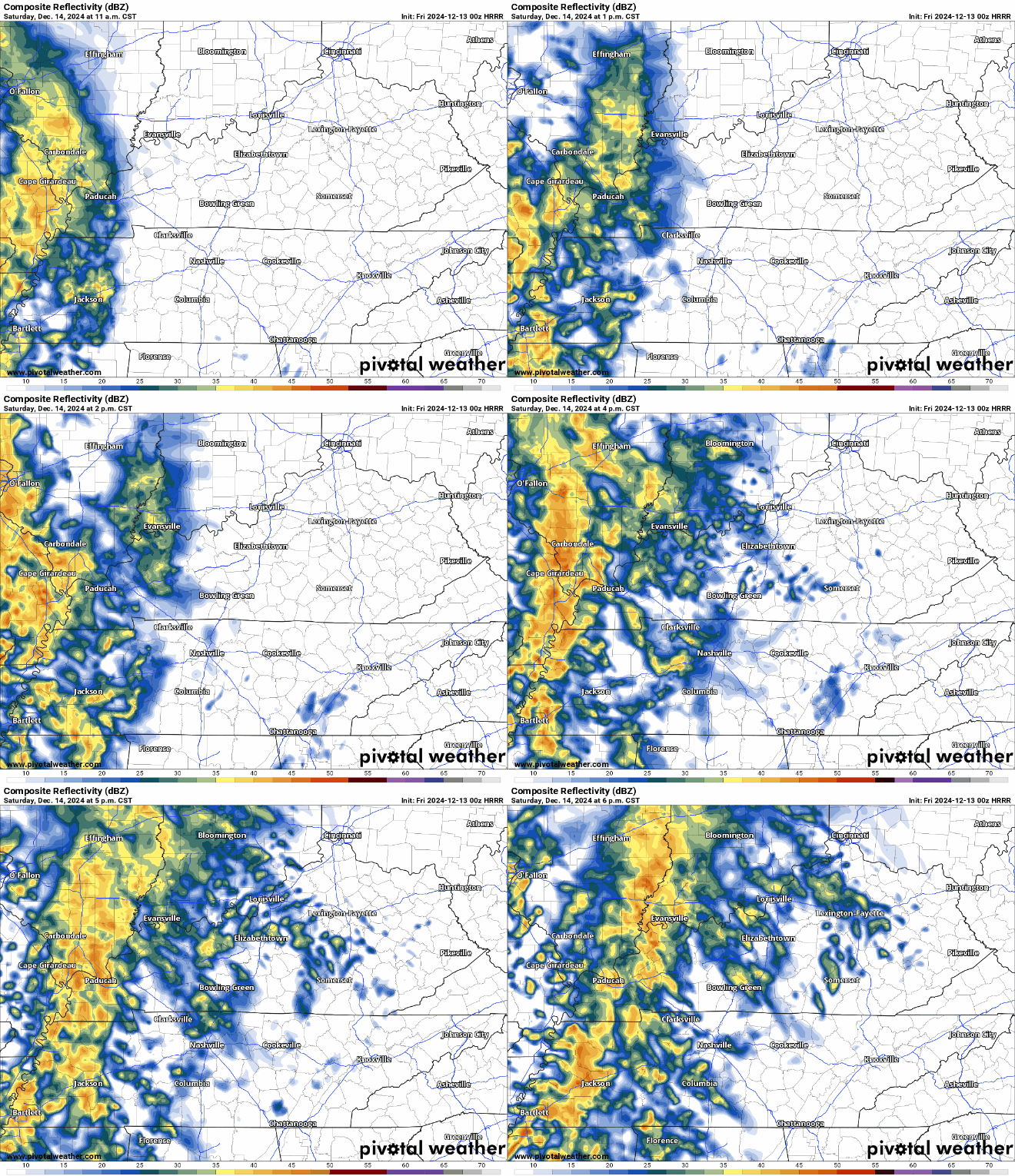
Some locally heavy amounts will be possible depending on where we run into some of these heavier bands along the front. The good news is that severe weather parameters look next to nil, so we’re just looking at another good old fashioned soaker. Definitely a day to stay inside and bake Christmas cookies.

Showers look to continue through the evening hours as the frontal boundary slowly works through the region, though they’ll begin to taper off from west to east. Things still stay comparatively mild overnight, with lows only near 45º.
Our Saturday front is just the first in a series however.

Our frontal boundary looks to get hung up into the region, which should provide us with renewed chances for showers…especially early in the day.
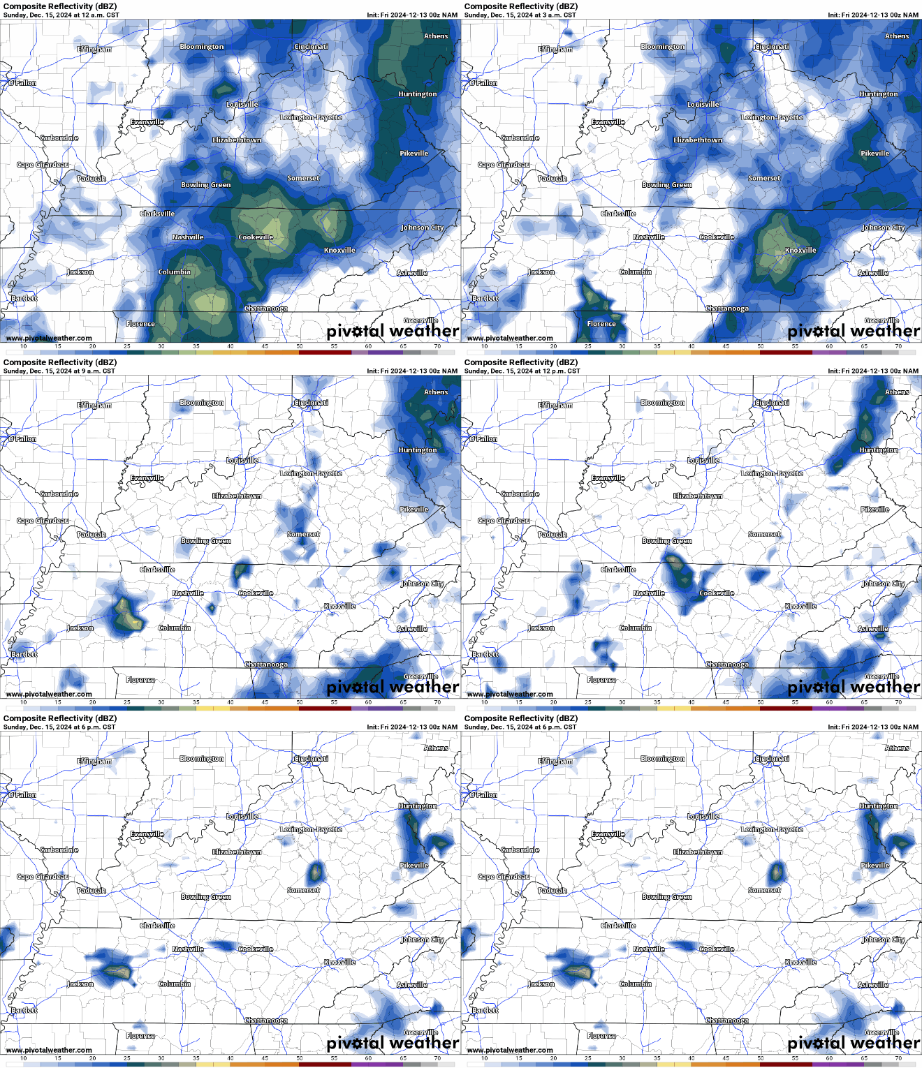
Highs are back into the middle 50s as the air behind our Saturday front doesn’t look very wintry at all. In fact, we’ll keep southerly flow in place as the upper trough continues to deepen into the eastern third of the country.
We’ll stay dry into Sunday night with lows only in the lower 40s.
Dodging more showers: Into Next Week
We’re keeping things mild and wet as we head into the week before Christmas.
We’ll watch another weather maker inch toward the region as we head into the early parts of next week. Ahead of it, we’ll continue to see warm and moist air return to the region. That will allow another disturbance to bring showers back to the region on Monday.
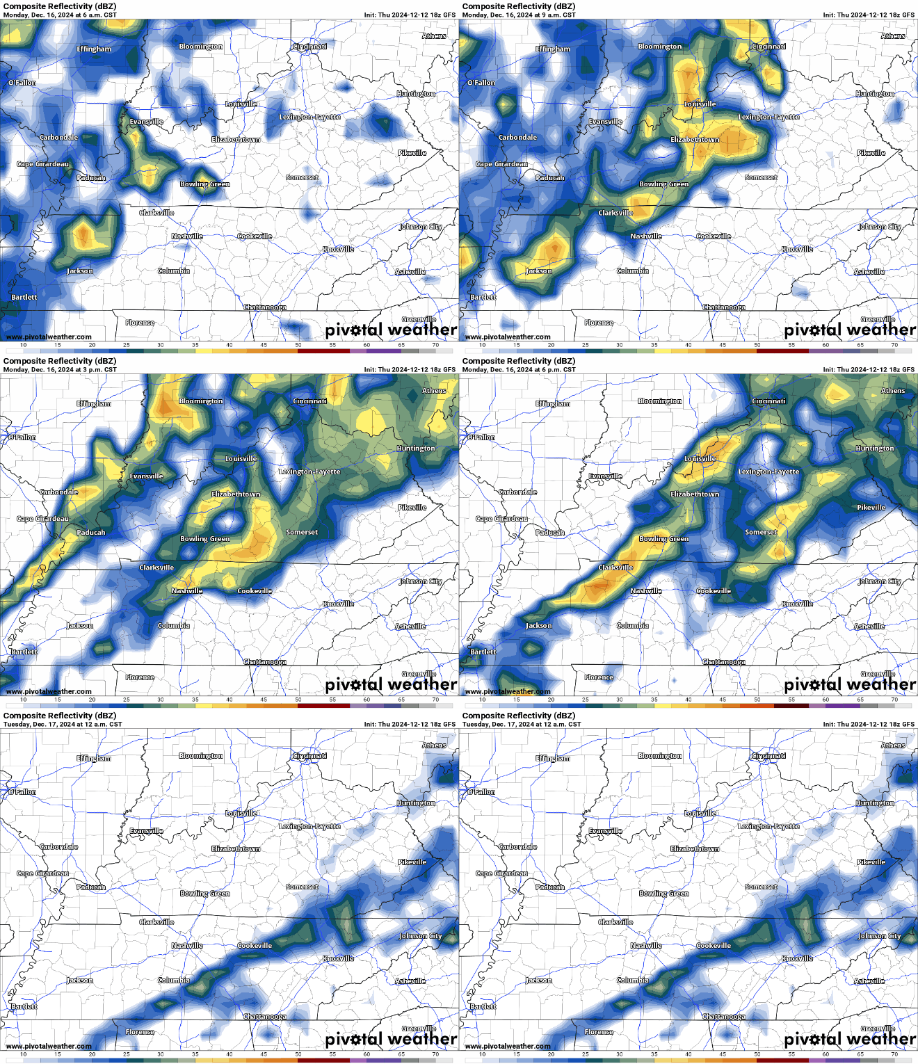
Outside of rain and rumbles of thunder, we’ll keep things mild, as highs yet again flirt with the 60º mark during the day, only falling into the lower 40s overnight.
Tuesday marks another transition day as one shot of cooler air works into the region, at least temporarily, Highs only make it into the lower 50s with a slightly drier pattern in place. It doesn’t look to last, though, as yet another front could bring us shots of rain by the middle and end of next week. We could be looking at a good soaking by the time all is said and done next week.
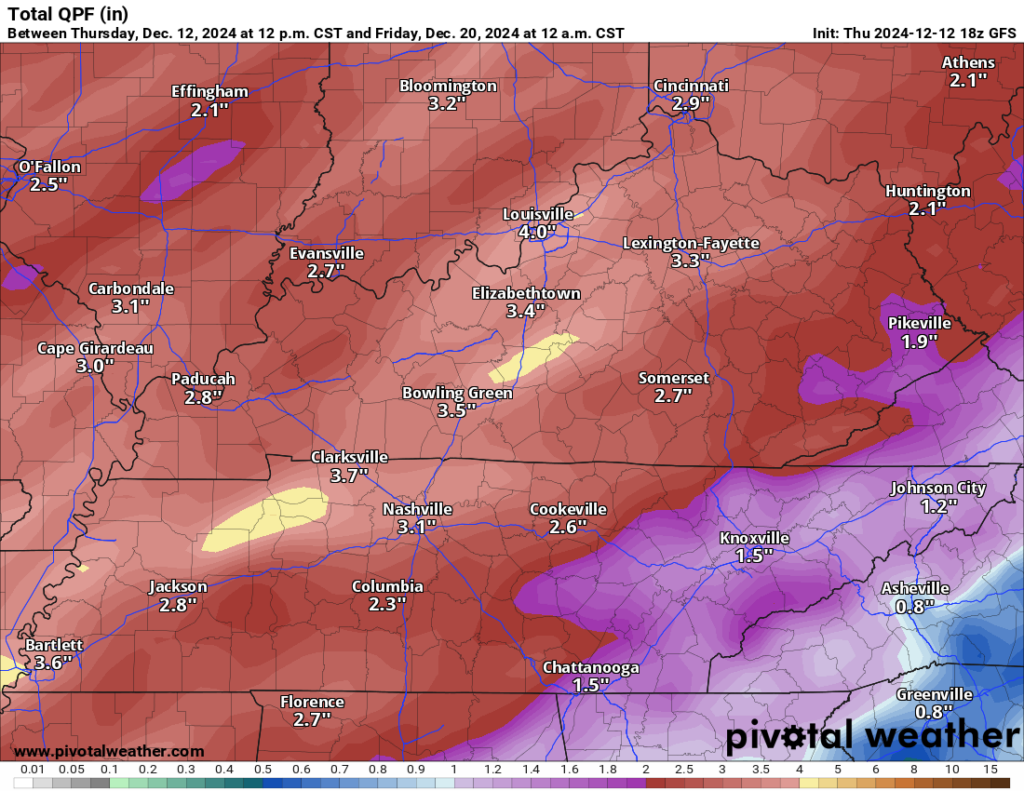
That looks to be followed by cooler than normal weather making a comeback as we head toward Christmas…yes, keep those eyes peeled!
That’s it for me for now! You can always keep up with the latest on all of our social media platforms. Have a tremendous day and a great weekend!

