It has been a cold, cold week in WABBLES. Many of us flirted with record cold lows on Thursday, the culmination of a week that featured multiple rounds of snow showers. The best news looks to be that temperatures will be going up as this weekend goes on.
Friday and Friday Night: Winter’s Chill
Winter’s chill is not quite done yet, though, with high pressure still on top of us. That will keep our modified arctic air locked in place for one more day and night.
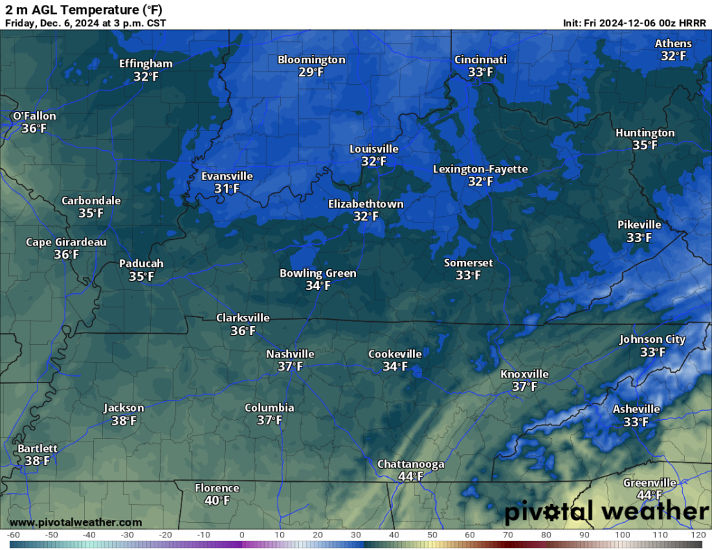
We should expect sunshine during the afternoon hours, which will make things look nice out your window. However, the heavy coat will remain a necessity, with highs only improving into the middle 30s for the afternoon…hey, at least it’s above freezing!
That was just a tease of what’s to come, though, with temperatures falling back below freezing after sunset on Friday night. Skies stay clear too, which should allow the “heat” we got from the sun during the day to escape out into space. Lows look to settle back into the lower 20s, with even upper teens possible in our especially sheltered valley locations.
Quick Moderation: Saturday and Sunday
The high pressure that settled upon the region during the back half of the work week will start to scoot off to the east as the weekend dawns upon us on Saturday. You know what this means…things will at least try to get a tad more comfortable.

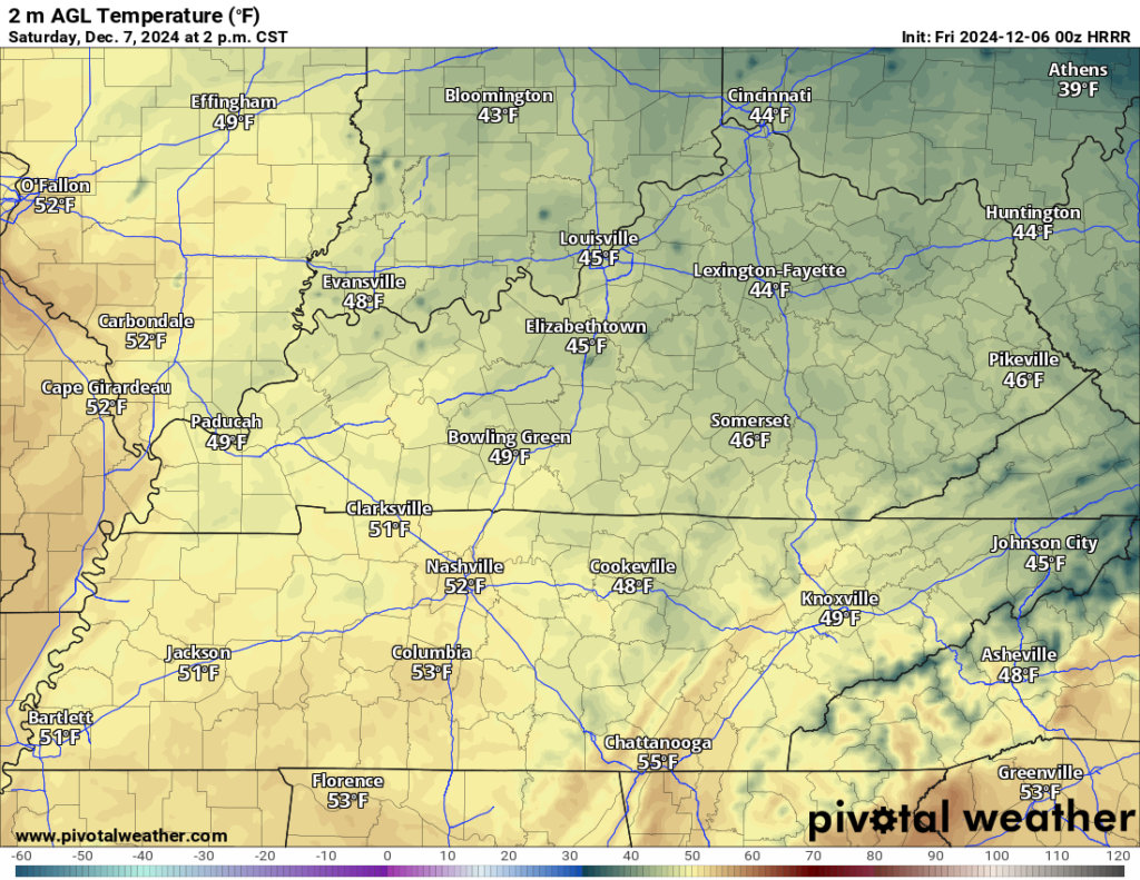
We’ll get some amount of southerly flow into the region as we work into the afternoon on Saturday. This, combined with sunshine working in, should help highs move up into the middle and upper 40s for an afternoon high. After this week, that doesn’t sound too bad, right?
We’ll likely also see another round of high clouds that could give us some nice sunsets and potentially sun dogs as we head into the evening hours. Those partly cloudy skies also mean that it’s likely that lows will be milder than we’ve seen recently, only around freezing or so.
We’ll do several degrees better as we head into Sunday!
We’re watching a piece of energy from our south attempting to merge with a piece of energy being carried by the northern jet stream. Before they do, we’ll continue to see sunshine briefly interrupted by some clouds and potentially a shower or two as we head through the afternoon.
That will keep us much milder during the heat of the day, perhaps you could call it hot to compared to where we are now. Highs look to peak in the middle 50s during the afternoon hours. Clouds will continue to increase past dark as overnight lows look to fall back into the middle 40s as clouds and showers become more widespread.
Into next week: warm and wet…for December
Sunshine looks to be a rare feature as we head into the early part of December’s second work week.
Plenty of rain showers look to be traversing the region as we head back to work and school on Monday…certainly not helping that case of the Mondays out there.
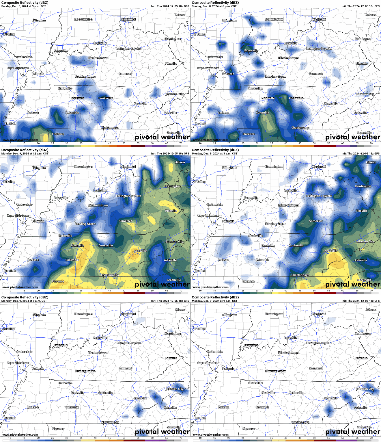
Even with the showers around, we’ve got enough warm air filtering into the region along with moisture, which should help highs make it back into the lower 60s during the afternoon.
Some showers look to continue overnight as lows only fall back into the middle and upper 40s with plenty of clouds around.
We’ll keep things slightly cooler but still mild as we head into the day on Tuesday. Highs look to make it back into the middle and upper 50s as we watch showers start to work out of the region. More cold air looks to build back in behind this particular front, however, as we head toward midweek.
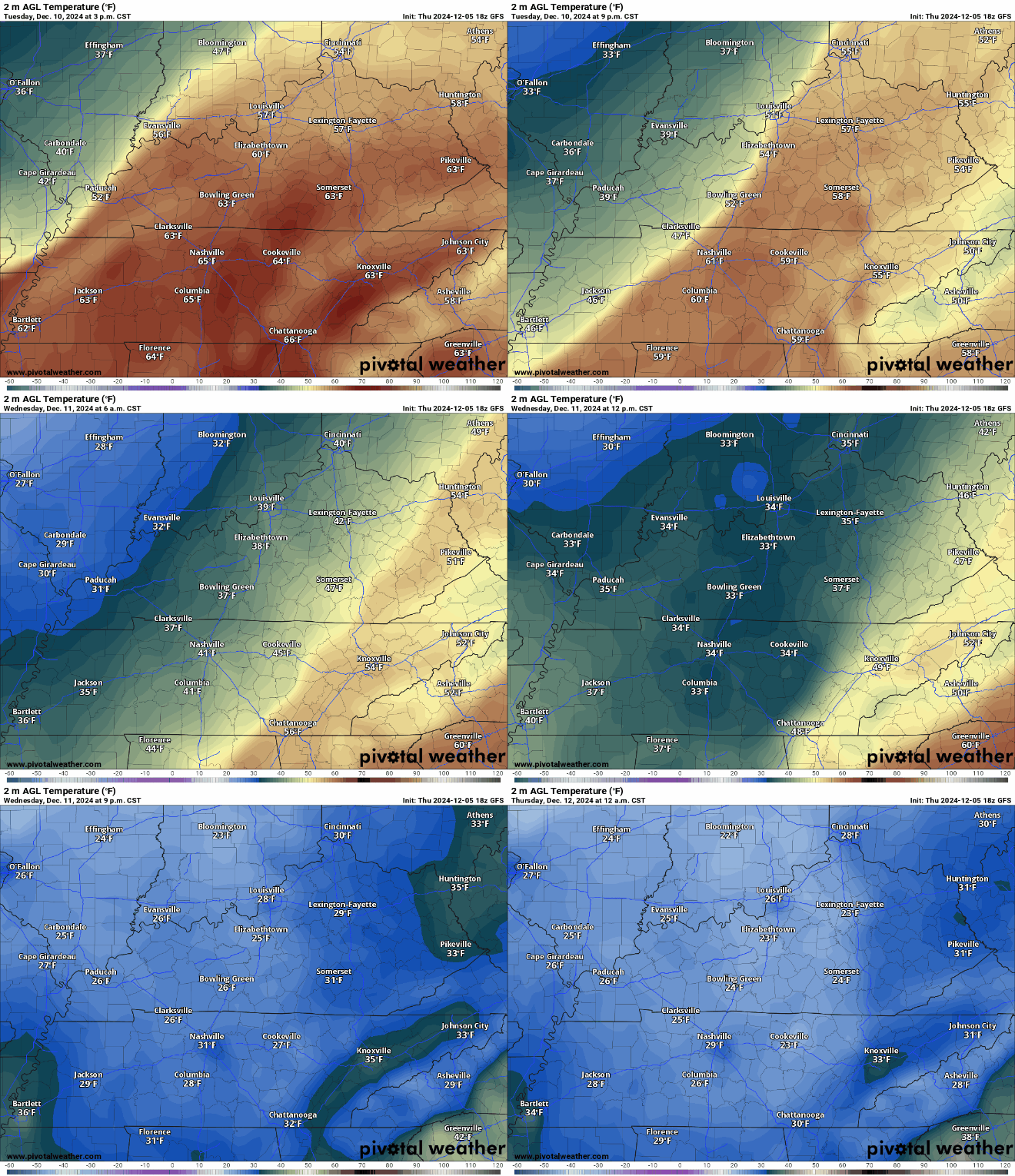
As that cold air pushes back into the region, we’ll have to see what kind of moisture is leftover for some decorative snow showers…it’s something we’ll watch.
Otherwise, the December feel looks to settle back into the region, with highs again plateauing in the 40s as sunshine attempts to return to the region
That’s it for me for now! You can always keep up with the latest on all of our social media platforms. Have a tremendous day and a great weekend!

