Welcome to November! Despite what you might think, WABBLES looks to be warming up as we begin what looks to be an active month of weather.
Pleasant Start: Friday and Friday Night
Some clouds will be with us to start our Friday as our spooky Halloween cold front scoots out of the region.
High pressure will at least briefly build into the region for a rather nice day for our Friday as sunshine builds back in. However, temperatures will be much cooler.
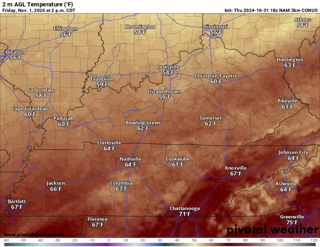
North and northwesterly winds will bring us drier and cooler air, with highs making it only into the middle to perhaps upper 60s in spots. So, we’re looking pretty good if you’re headed out to vote early on Friday afternoon.
If you’re headed out for the final week of the regular season on the high school gridiron, you will, indeed, need the outerwear. We’ll be in the upper 50s at kickoff, falling into the 40s after sunset as the dry air lets us cool off quick. We’ll settle into the lower 40s under clear skies.
Rebound: Saturday and Sunday
Sunshine continues as high pressure remains in control of our weather for Saturday and Sunday. However, we will begin to see changes in the forecast.

High pressure will start to move off to the east, allowing return flow from the south and southwest. You guessed it…that means warmer air.
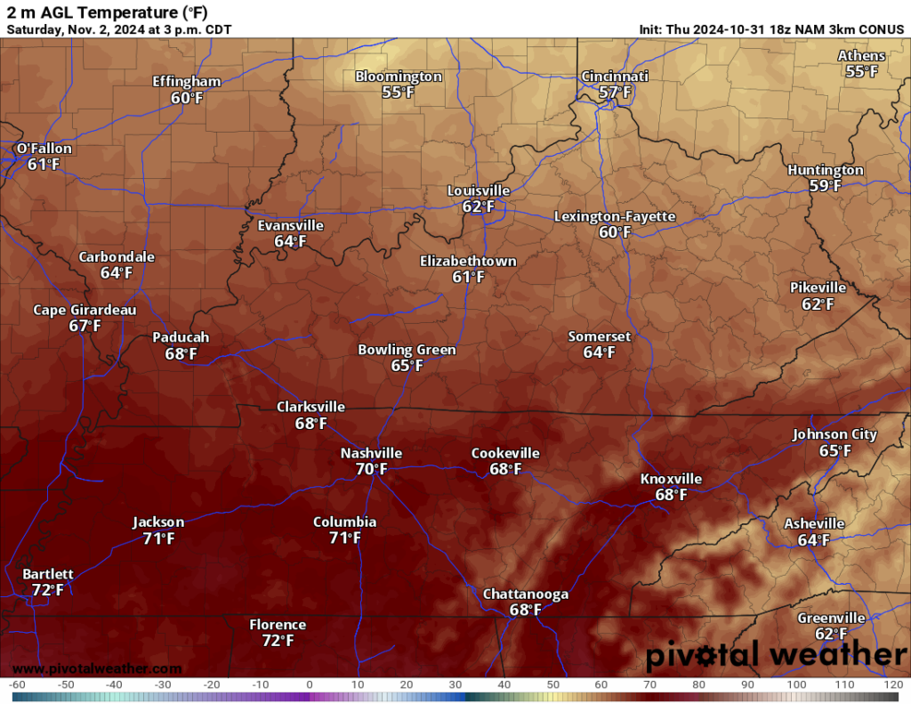
The warming will be rather modest and we won’t be uncomfortable by any means, but highs do look to make it back to about 70º under plenty of sunshine. Honestly, another beautiful afternoon expected throughout the region. Overnight lows will be milder as that milder air pushes into the region. We’ll only fall into the lower 50s during the overnight hours. Speaking of overnight hours, remember to set those clocks back an hour before you go to bed Saturday night as Daylight Saving Time comes to an end.
More changes on the way on Sunday…and I don’t just mean the clocks!
High pressure continues to scoot out of the way as our next disturbance gathers steam across the nation’s midsection.
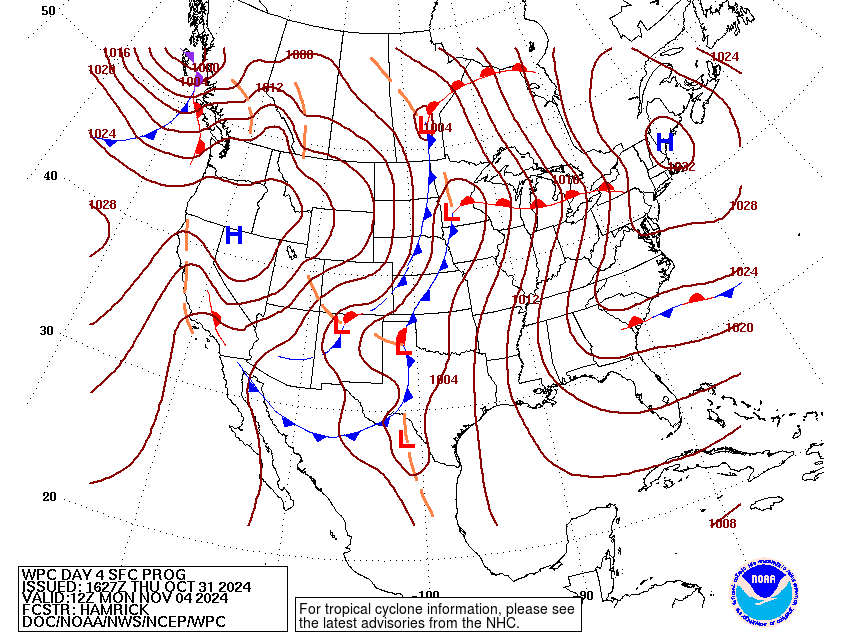
That will not only allow warmer air to push into the region, but more moisture as well. That will increase cloud cover as we work through the day on Sunday.
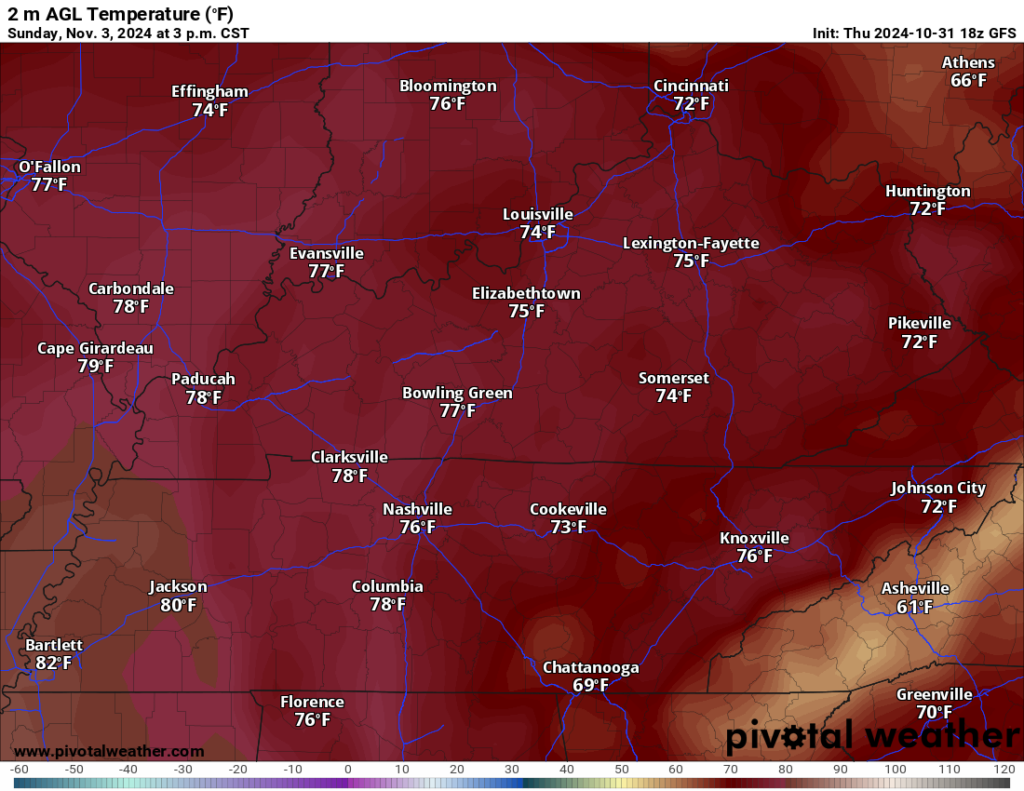
Even with the clouds, we’re still bringing warmer air back into the region as highs surge into the middle 70s into the afternoon. The later we go, the more likely it is we’ll see a widely scattered shower or two in the afternoon and evening hours. Clouds will continue to be scattered overnight as lows stay quite mild near 60º.
Even Mother Nature Can’t Make a Decision: Monday and Election Day
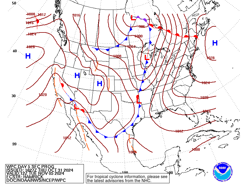
As we continue to approach Election Day, we’ll continue to see a chance for showers in the forecast as a cold front continues to push into the region.
There are still some things up in the air with this pattern, but the active weather looks to continue as highs top out again in the middle 70s by Monday afternoon. Overnight lows remain in the 60s as we wait for another surge of showers and storms on Tuesday.

We may stay dry during the day on Tuesday itself, before more showers and storms work into the region by the afternoon and evening. Highs look to stay in the middle and upper 70s again as our next system scoots in. Some of those storms could be on the strong side, but we’ve still got plenty of time before this one moves in.
That’s it for me for now! You can always keep up with the latest on all of our social media platforms. Have a tremendous day and a great weekend!

