

")

It’s been a week with fairly big temperature swings around WABBLES despite the overall lack of changes in the forecast. However, we’ll keep an eye on the potential for some showers moving back into the region for part of the weekend as temperatures tumble again.
Warm Finish to the Week: Friday and Friday Night
High pressure continues to scoot to the east as we watch a weak front push toward the region. This will mean two things. 1: we’ll be warming up, and 2: we’ll see some moisture try to return.

Filtered sunshine during the day, combined with southerly winds increasing our moisture content, should allow highs to get up into the lower to perhaps middle 80s throughout the region.
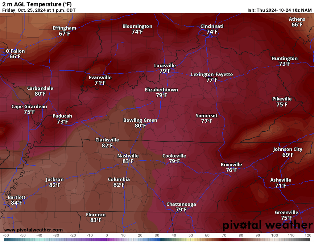
While return flow ahead of the front will allow moisture to return to the region, there’s still plenty of dry air in place in the lower levels of the atmosphere. So, while we’ll see the potential for some high clouds increasing, I think showers will still be hard to come by late Friday night into early Saturday.
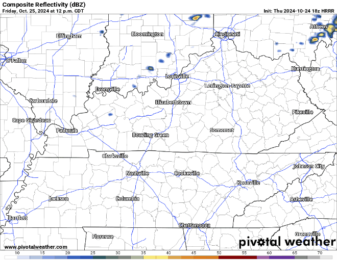
However, that front will swing on through and the whatever showers we manage to squeeze out won’t be around long because things are looking much nicer as we head into the weekend. Overnight lows are back into the upper 50s.
Rollercoaster takes a dip: Saturday and Sunday
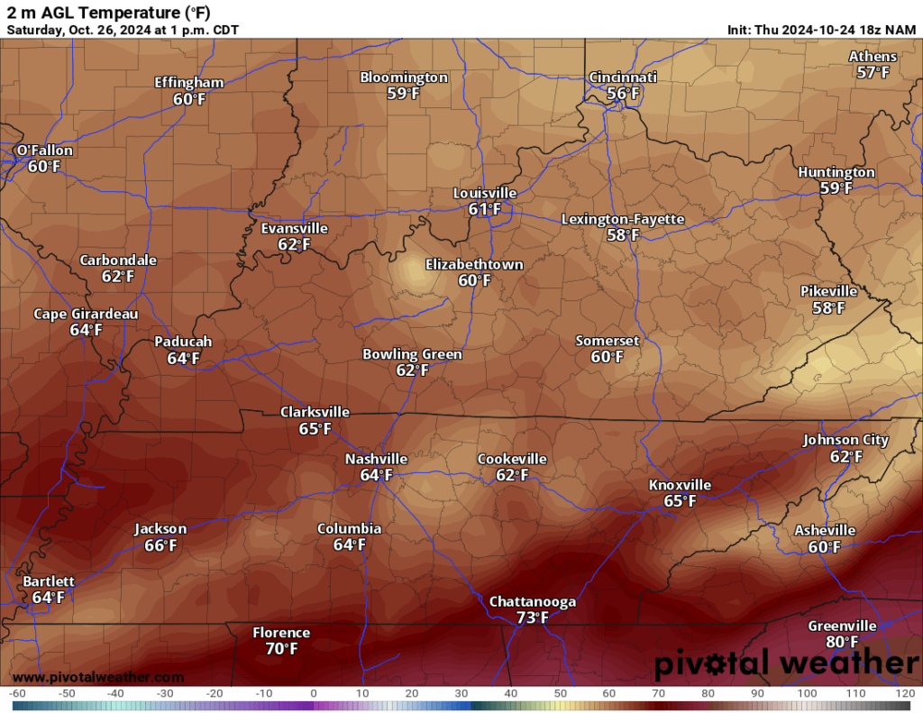
Some clouds may linger into the early hours of our Saturday as we watch our front continue to depart, which will bring cooler and drier air behind it.

However, the clouds won’t hang around too long as we’ll expect to see more sunshine breakout as high pressure settles back in during the afternoon. That will keep us on the cooler side as highs only make it into the lower to maybe middle 60s.
However, even with the mild air sticking around a bit, that warm air remains dry, which should help our lows get a bit chilly again, with partly cloudy skies allowing lows to fall back into the middle 40s.
Our current fall pattern looks to peak as we head into the end of the weekend on Sunday, with the high pressure on top of us…which should allow plenty of sunshine.

That means not quite as many clouds out there and mild, dry air in place. We should peak in the lower 70s for daytime highs on Sunday afternoon. However, hints of what’s to come start to work in even Sunday night, with lows only making it into the upper 40s.
An Actual Pattern Change? Into Next Week
Halloween week is finally upon us and things may even look a little spooky as we head into the middle and end of the week.

Though, not at the start. High pressure scoots off to the east, allowing milder air to work into the region yet again under plentiful sunshine. That should allow Monday highs to soar back into the middle 70s during the afternoon. More of the same expected on Tuesday, though we may start to see a few more clouds sneak in as highs make it to near 80º.
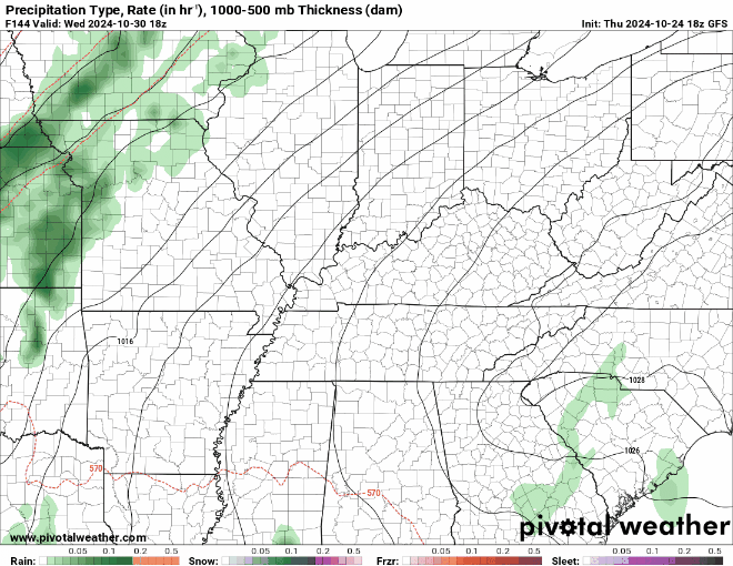
We’ll be keeping an eye on a disturbance that models continue to indicate may move in as we head toward the middle and back half of the work week. This could not only bring us the potential for the first substantial chance of rain in nearly a month (I’m not kidding, heading into Friday, Bowling Green has seen 0.00” of rain in October), but could also bring us the opportunity for a strong storm or two.
Still a little early to go into specifics, but it’s not uncommon to see strong storms this time of year as we enter our “second season” of severe weather. Generally, things don’t get as raucous, but it’s something we’ll continue to watch.
Some models have this holding off until closer to Election Day, if that’s the case, we’ll keep things mild and dry toward Halloween. Stay tuned for the latest updates!
That’s it for me for now! You can always keep up with the latest on all of our social media platforms. Have a tremendous day and a great weekend!