

")

There’s been little in the way of big issues for WABBLES this week as we continue to be stuck in a rather pleasant pattern. We did, however, get yet another opportunity of a lifetime to see the northern lights above WABBLES last night. An utterly incredible and awe-inspiring display!
Pleasant for Football: Friday and Friday Night
We’re keeping things oh so nice as high pressure remains in place over the region this afternoon.

With that dome of Canadian high pressure overhead, we’ll experience somewhere in the neighborhood of our 10th consecutive beautiful day around here as highs peak in the middle 70s yet again under full sunshine. However, you might need the jacket if you have any Friday night plans, because we’ll be cooling through the 60s and into the middle 50s by the time you head in.
Warming on Up: Saturday and Sunday
Intense summer heat looks to be over with, but warm air is still going to work in ahead of a late weekend cold front. Before that, though, things are looking rather nice.

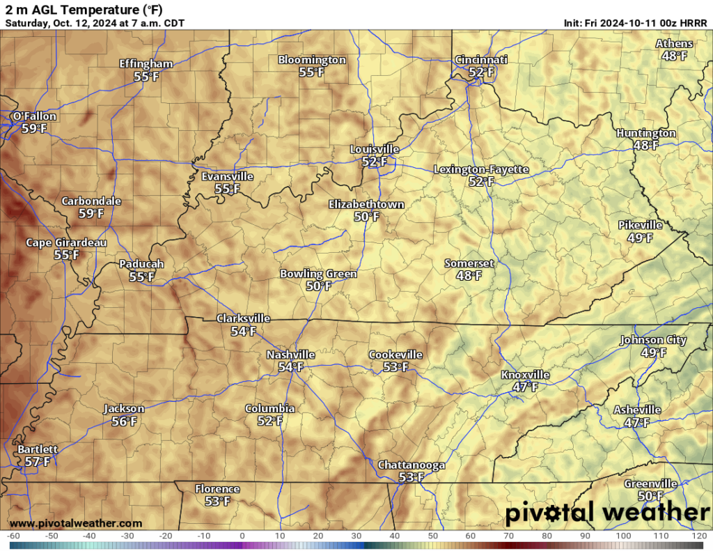
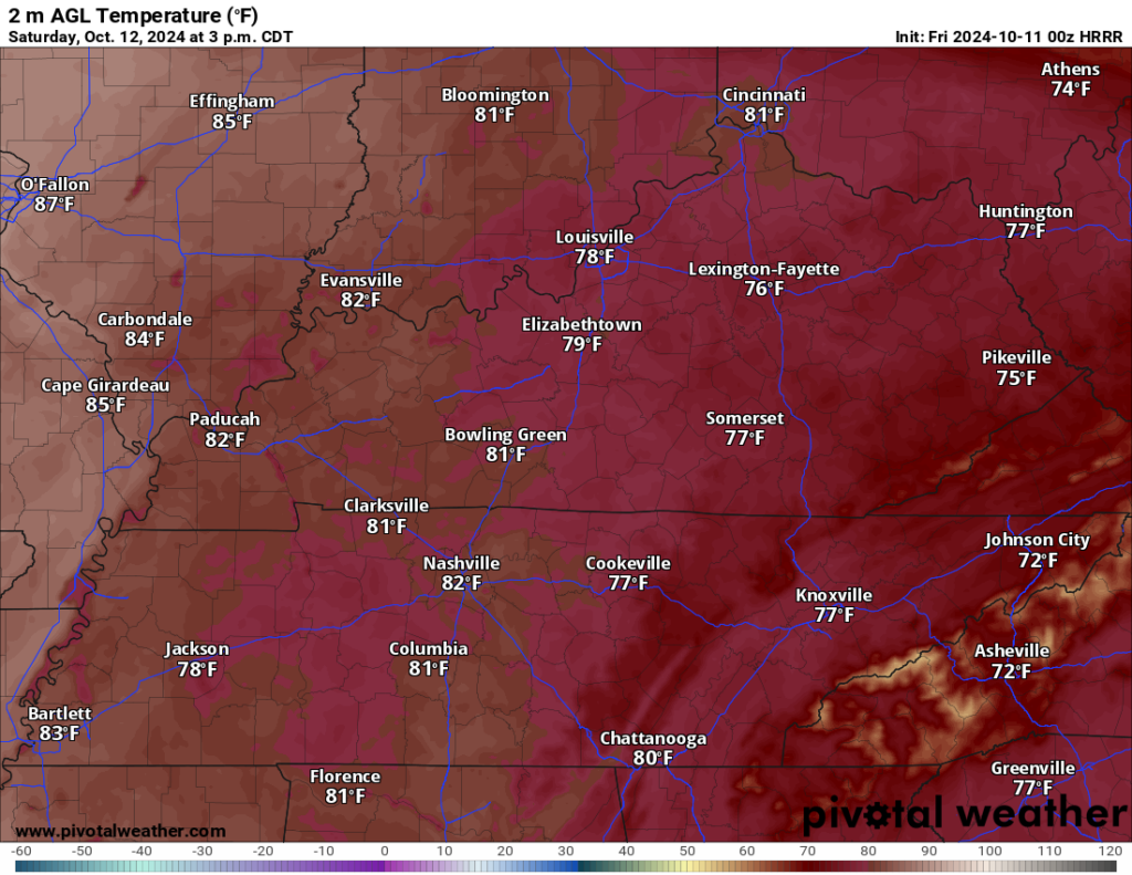
Sunshine continues as winds turn southerly ahead of the front on Saturday. That will help warm us up in the afternoon. We’ll be lucky to see a cloud or two as temperatures take a leap back into the upper 70s and lower 80s.
The good news here is that the air looks to remain rather dry, so we’re not dealing with the humidity that often comes with temperatures in the 80s. That also means that we should continue to see cooler weather overnight…though slightly milder than previous days with lows down into upper 50s or so.
Sunday looks to be the peak of the current warming trend as we are continuing to bring warm air into the region. But here’s the deal…our moisture levels remain quite low as the front arrives.
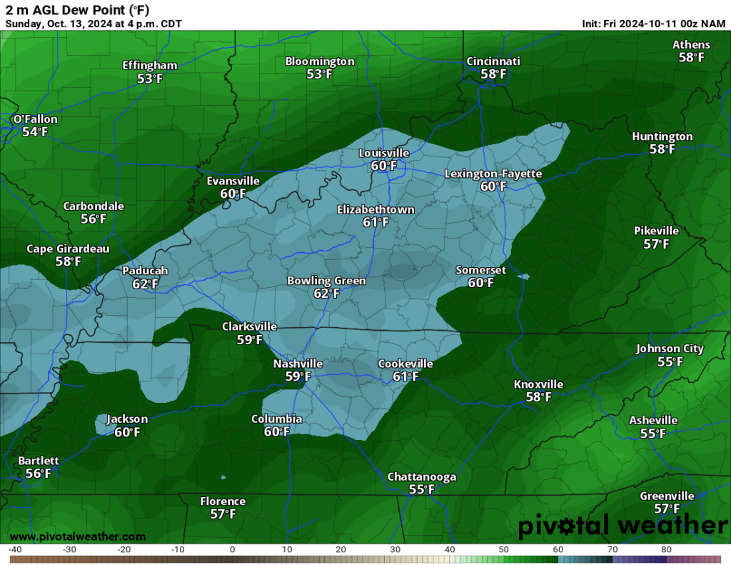
This simply means that, after highs get into the 80s, the most we’re going to get out of this front will be a wind shift! It will cool us down…and that’s about it!

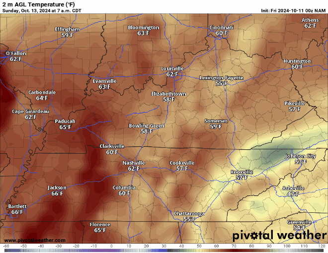
As the winds shift out of the north and northwest Sunday evening into Sunday night, we’ll see cooler and even drier air filter into the region…I’m talking highs back in the upper 40s overnight!
Fantastic Fall Feel: Into Next Week
The front finally finishes its progression through the region by early Monday, bathing the region in that sweet, sweet Canadian air.

While wafting maple syrup scents may not make it this far south, the autumn air sure will. High pressure begins to dominate the pattern in the region, causing temperatures to struggle to make it out of the middle 60s for daytime highs. Seriously!
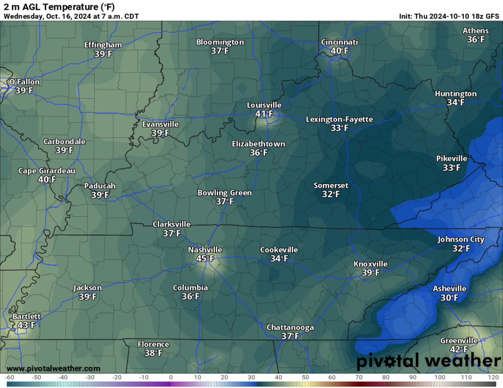
High pressure stays firmly in place as we head through the middle of the week. This will keep highs in the lower to middle 60s through at least Wednesday, with overnight lows falling into the lower 40s…perhaps the upper 30s in some of our sheltered locations. Yep…we’re going to have to keep an eye on some frost around the region as we head through next week!
Ahead of that, some milder air may try to make a come back by mid-month…stay tuned!
That’s it for me for now! You can always keep up with the latest on all of our social media platforms. Have a tremendous day and a great weekend!