

")

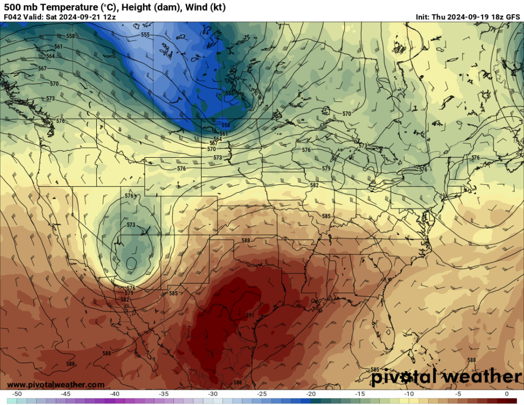
The dry pattern in WABBLES has not changed much in the past week or so, even with two rounds of tropical remnants in the vicinity. However, the potential is there for a few showers to try to sneak in as we finish out the weekend.
Sunshine and Warm Air: Friday and Friday Night
Our pattern has remained remarkably similar as we’ve gone through the past week or so. Broad troughing across the upper midwest will continue to try to dig into the region. However, the heat dome will continue to dominate the forecast as we head through the afternoon hours.
That will lead to continued baking sunshine during the afternoon hours, which should bump highs back up into the lower 90s. Thankfully, we won’t also be dealing with tropical moisture in the region, so head indices shouldn’t be too off the charts…but it will be warm.
Things shouldn’t be too bad when it comes to high school football time, though, as temperatures settle into the 80s at kickoff with temperatures falling through the 70s…so no big issues as the boys hit the ballfields on Friday night.
Autumnal Equinox? Where? Saturday and Sunday
High pressure continues to influence the weather pattern as we head through the day on Saturday. We’ll continue to see sunshine during the day with high pressure trying to scoot on out. However, as it does, we’ll likely see more moisture move in…which means more clouds.
Even with more clouds, we’ll continue to see toasty temperatures peaking into the lower 90s yet again, but we’ll feel slightly muggier in the afternoon. We’ll be warm and muggy as the Tops kickoff against Toledo as well, with temperatures in the middle 80s falling through the upper 70s during the game…that will be on our way into the middle 60s overnight.
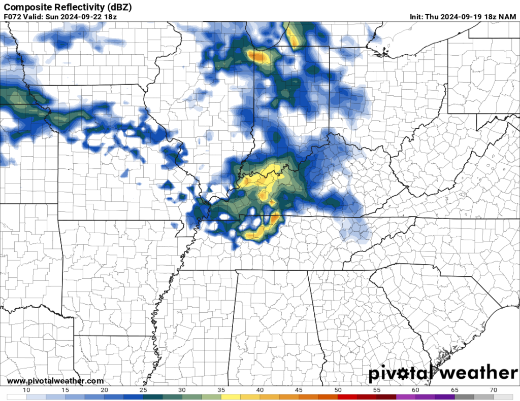
We continue to watch one of these troughs trying to build into the region as we head into the day on Sunday. However, we’re continuing to struggle to bring moisture back into the region for showers and storms. Looks like the first day of fall on Sunday looks to remain mostly dry and quite warm, with highs in the lower 90s. However, we’re going to be watching one of these disturbances try to make its way in. Some models have this, and some don’t…so you’ll want to check back on social media frequently on Sunday and keep the radar handy.
The humidity won’t be all the way back in the afternoon, but it is possible we’ll be slightly muggier than we have been. Lows fall back into the middle 60s.
Similar Pattern Next Week
Our pattern gets a little stagnant again as we head into the early parts of next week thanks to the blocking pattern developing across the country.

For us, we’ll continue to see some sunshine as we start the day on Monday as our disturbance continues to hover around the region. Highs look to be back in the upper 80s to near 90º or so as showers and storms pop-up in the afternoon with the little moisture we have around.
Things look to change as we head toward later in the week as another disturbance tries to dive down into the region from the upper midwest. This may, just may, bring us another chance for some showers as we head toward the middle and later part of the week. Not only that, but we may see some fall-like temperatures head our way. Nothing is set in stone, but man, we could use some relief.
That’s it for me for now! You can always keep up with the latest on all of our social media platforms. Have a tremendous day and a great weekend!