

")

Meteorological fall technically began back last Sunday on September 1, but as we head into the first full weekend of September, things are looking quite a bit more fall-like around WABBLES!
Into the Weekend: Friday and Friday Night
Things don’t look to be totally dry as we head into the final day of the work week, however. We’re watching a weak cold front diving in from the north as a shortwave swings toward the region. We’ll see highs warm up into the middle and upper 80s in the afternoon before showers pop up into the evening and overnight hours. I can’t rule out thunder and lightning but we’re not expecting much in the way of heavy rain, let alone strong storms. Either way, the rain gear looks like a safe pack if you’re headed out to high school football.

Some of those showers could linger into the overnight hours, but their coverage should continue to wane as they move east of the region by daybreak on Saturday. Low overnight start their descent into the autumnal, falling to around 60º.
Such a Pleasant Weekend: Saturday and Sunday
Say hello to Canadian high pressure.

As the high pressure swoops down from the upper midwest and into the Great Lakes, it will give us a wonderful fall feel for the day on Saturday. Some clouds hanging around early in the day, but overall we’ll see a sunny pattern take over as we head into the afternoon hours. Things look exceedingly comfortable as well. Highs look to make it only into the middle 70s. Yes, middle 70s!
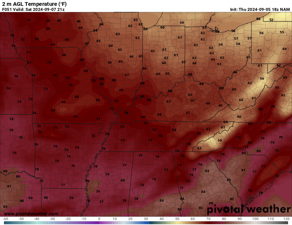
Dew points will be a non-factor, down into the 40s as we see that dry Canadian air filter in. This means we’ll likely be seeing much cooler nights for the first time in awhile. With the dry air, radiative cooling should have lows hovering around 50º or so. Yes, that means you might need the sweatshirt or coat for early Sunday services!
More of the same expected on our Sunday, with the sole exception of seeing more sunshine early in the day. Highs once again look to top out in the vicinity of 75º or so. That low humidity remains as well, for an absolutely beautiful day throughout WABBLES. I mean, cannot be beat. Another day where the overnight looks chilly. Clear skies should let us fall into the upper 40s for overnight lows!

Through Next Week: Slowly Warming
Thankfully, the nice weather looks to continue as long as high pressure wants to hang around the Ohio Valley. This means another beautiful day on Monday.

Highs yet again look to stay around the upper 70s to near 80º or so with the dry and comfortable air in place. We’ll just have to watch for a few clouds moving in overnight as lows are back to near 50º or so.
This trend continues as we head through at least early next week, but highs will slowly increase up into the middle 80s as we head toward the middle and end of next week. We’ll be keeping a close eye on it as well to see if we can expect any rain to head our way.
That’s it for me for now! You can always keep up with the latest on all of our social media platforms. Have a tremendous day and a great weekend!